Questions to ask before buying land in France.

Before you sign for a plot,
look at the land.

Nine free checks: outline, planning, flooding, ground, Natura 2000, heritage, road access, networks, land prices. Official sources, no account.

Sample report

Report: €29 incl. VAT in one language · €39 incl. VAT in bothor click on the map
F 2746,390 m²Brailly-Cornehotte, Somme
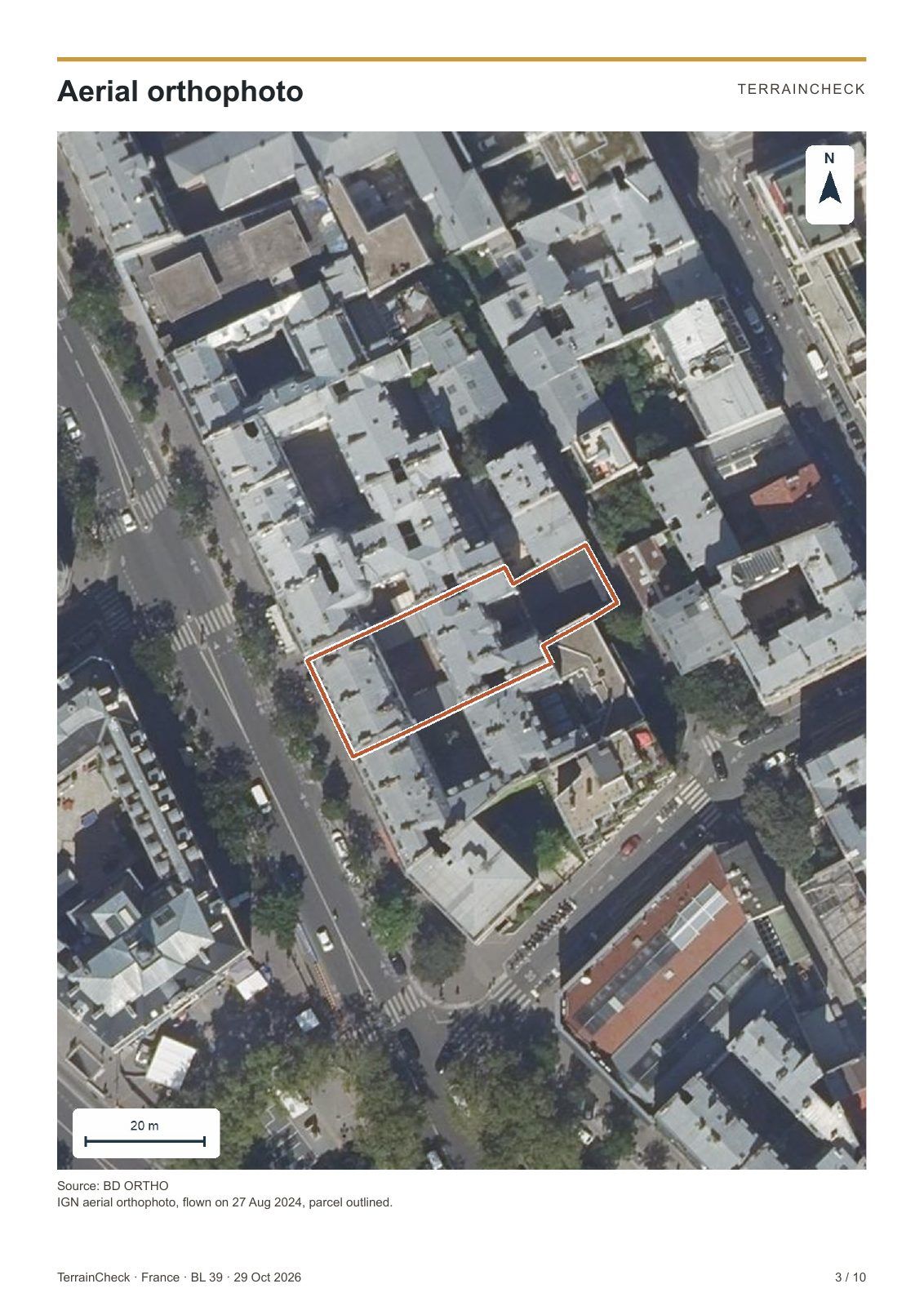
Photo: IGN BD ORTHO
No account or email neededAlerts are freeEvery finding cites its source

Your starting point

We check the whole parcel, rather than a single point.

Find the land on the map, then confirm its outline to see the findings.

Photo: IGN BD ORTHO

F 274 · Brailly-Cornehotte, Somme

3 points to clarify

  • Outline and areaOfficial outline
  • PlanningWorth noting
  • FloodingNothing found
  • GroundWorth noting
  • Natura 2000Nothing found
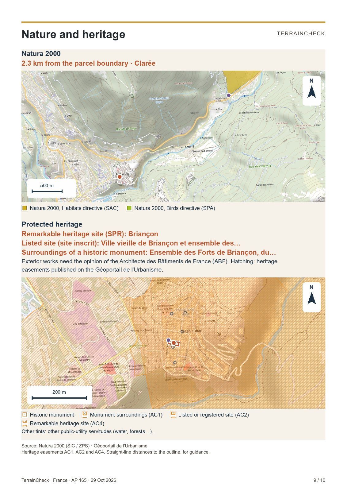
  • HeritageWorth noting

Read the first findings for free, then explore the details in the report.

The free check0 €

What you learn for free

  • The cadastral outline and area
  • The planning zone and identified restrictions
  • Mapped hazards and protections
  • Sources, dates and what remains unknown

A detected alert is always visible. Missing data stays grey.

Start with the free check
Two reports

A free report to get a first idea, a full report to prepare the purchase.

Start with the free one: an e-mail address is all it takes. If the land interests you, the full report goes through every point in detail.

Free

Free report

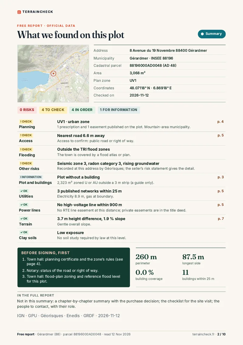
10 pages · PDF by e-mail · no payment

A summary in maps and facts, to see whether the land is worth a closer look.

  • A summary of the plot, with the points to check first
  • The plan with dimensions and buildings
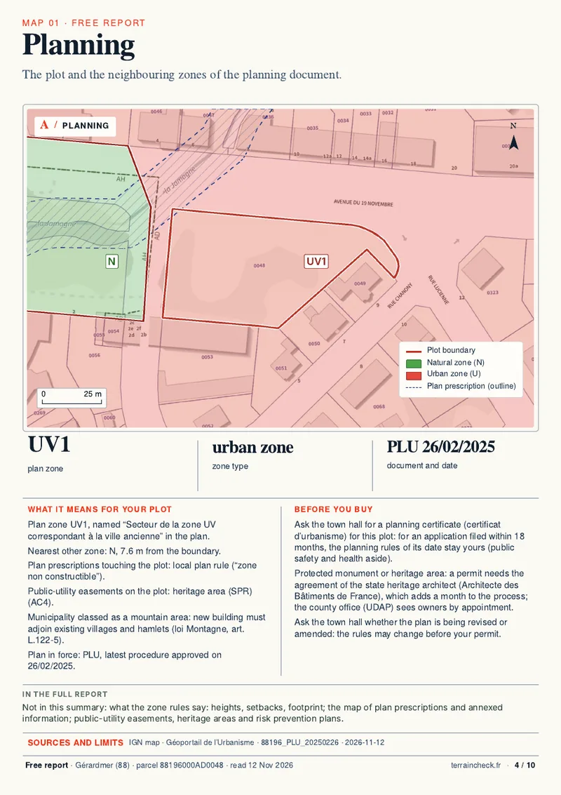
  • Planning, utilities and road access on a map
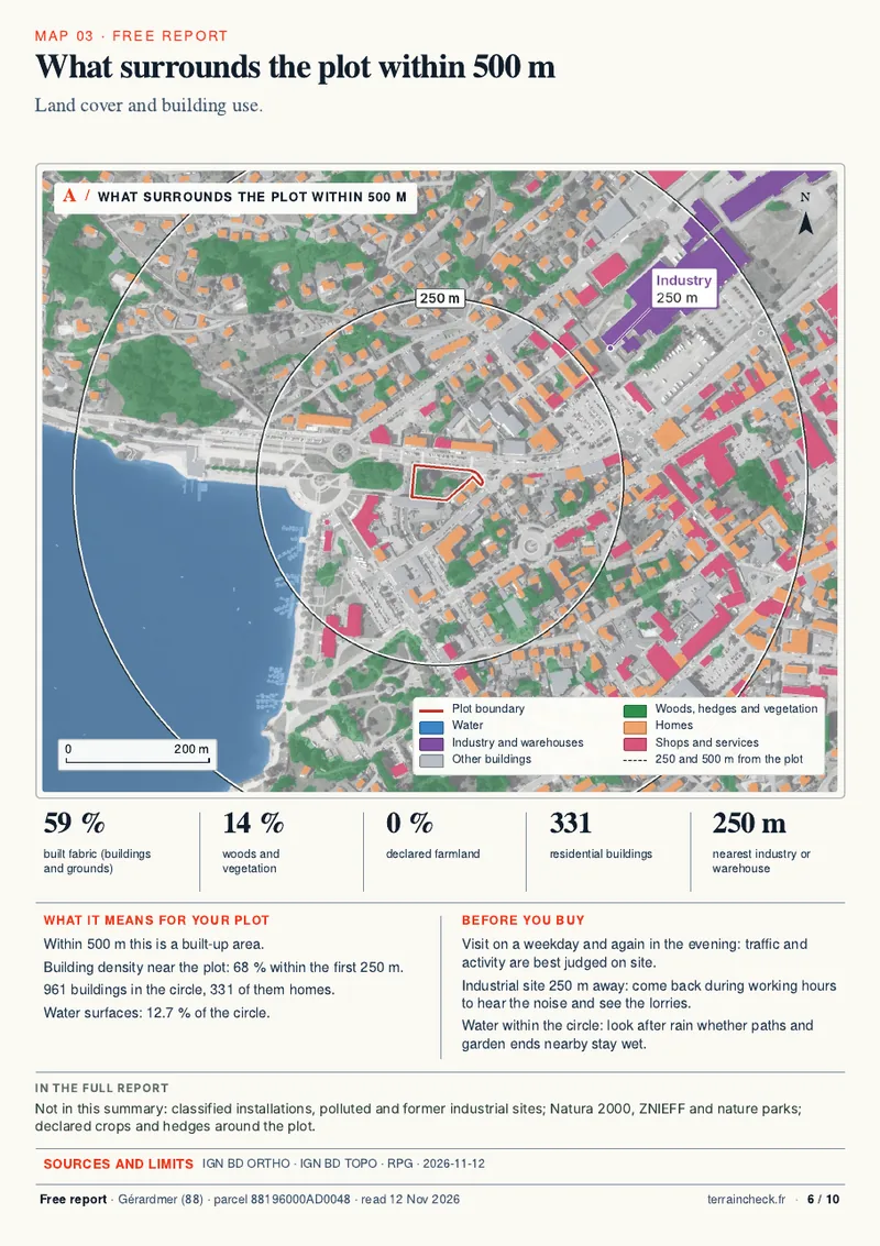
  • The terrain and what surrounds the land within 500 m
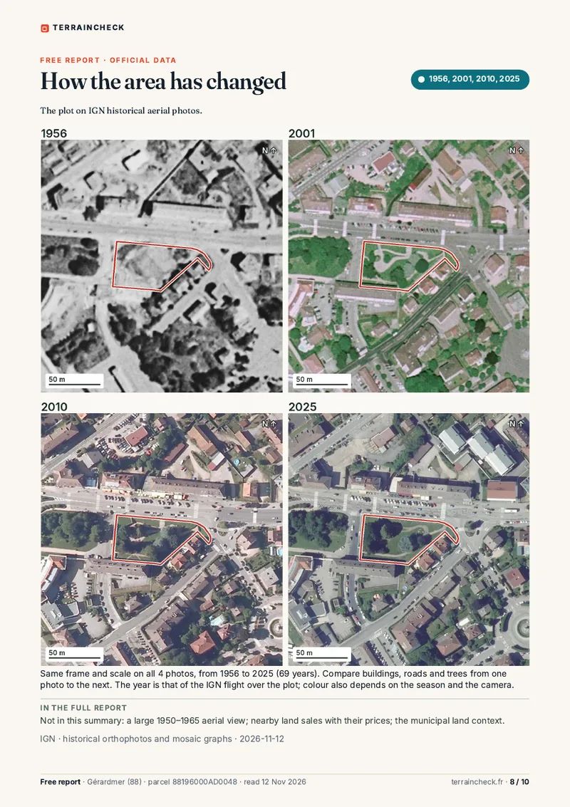
  • Aerial photos then and now

It comes by e-mail, usually within a few minutes.

Summary of the plotPlanningWhat surrounds the plotAerial photos then and now

Extract: plot AD 48 in Gérardmer (Vosges). Open the sample PDF

Get the free report
from €29

Full report

100 pages · 55 maps · PDF by e-mail within 45 minutes

The file to read before you sign for a plot: every point of the free report in detail, and what it does not show.

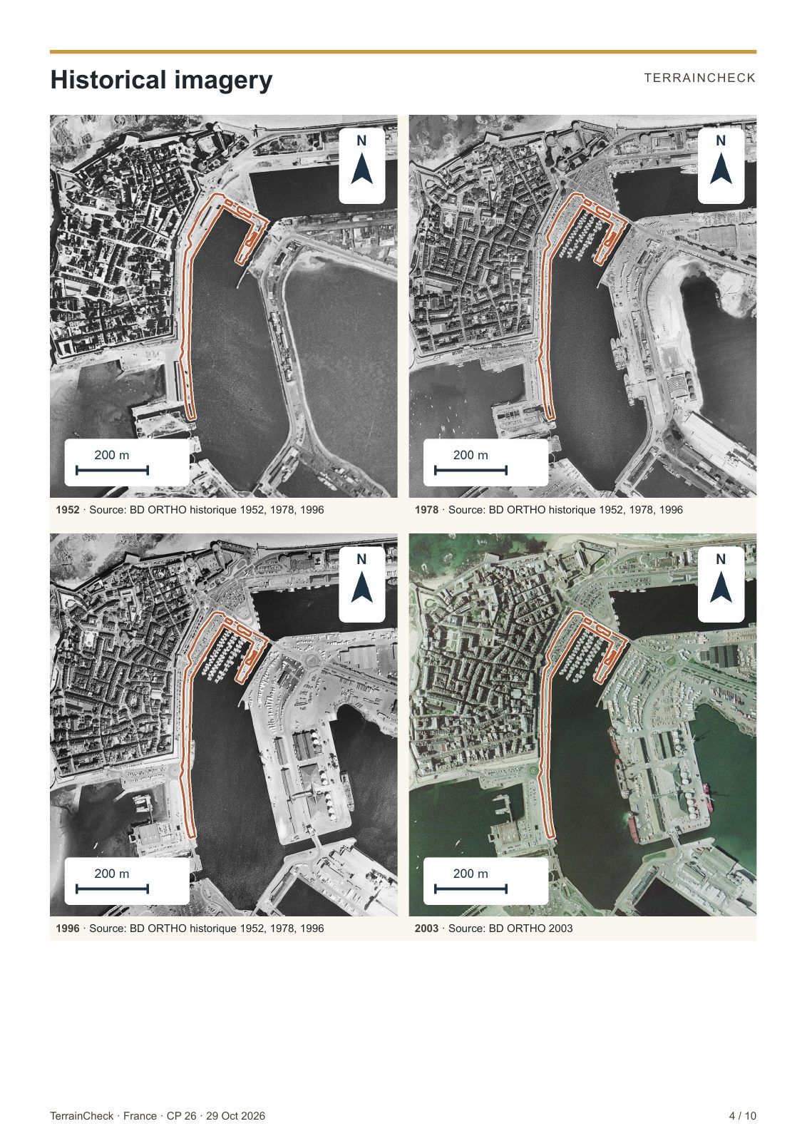
  • Historical aerial photographs from the IGN archives
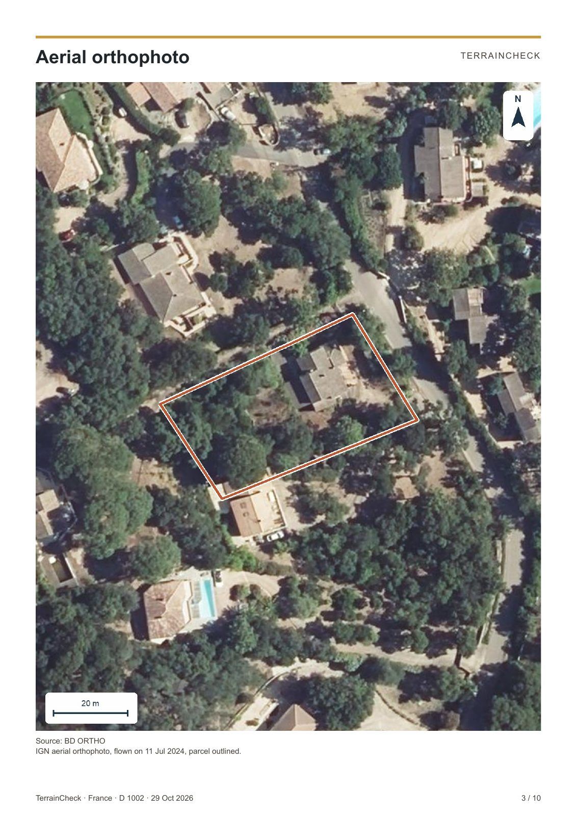
  • Orthophoto, dimensions and neighbouring parcels
  • Local planning rules and risk prevention plans (PPR)
  • ‘Checks before the preliminary sale agreement’

€29 in one language · €39 in French and English

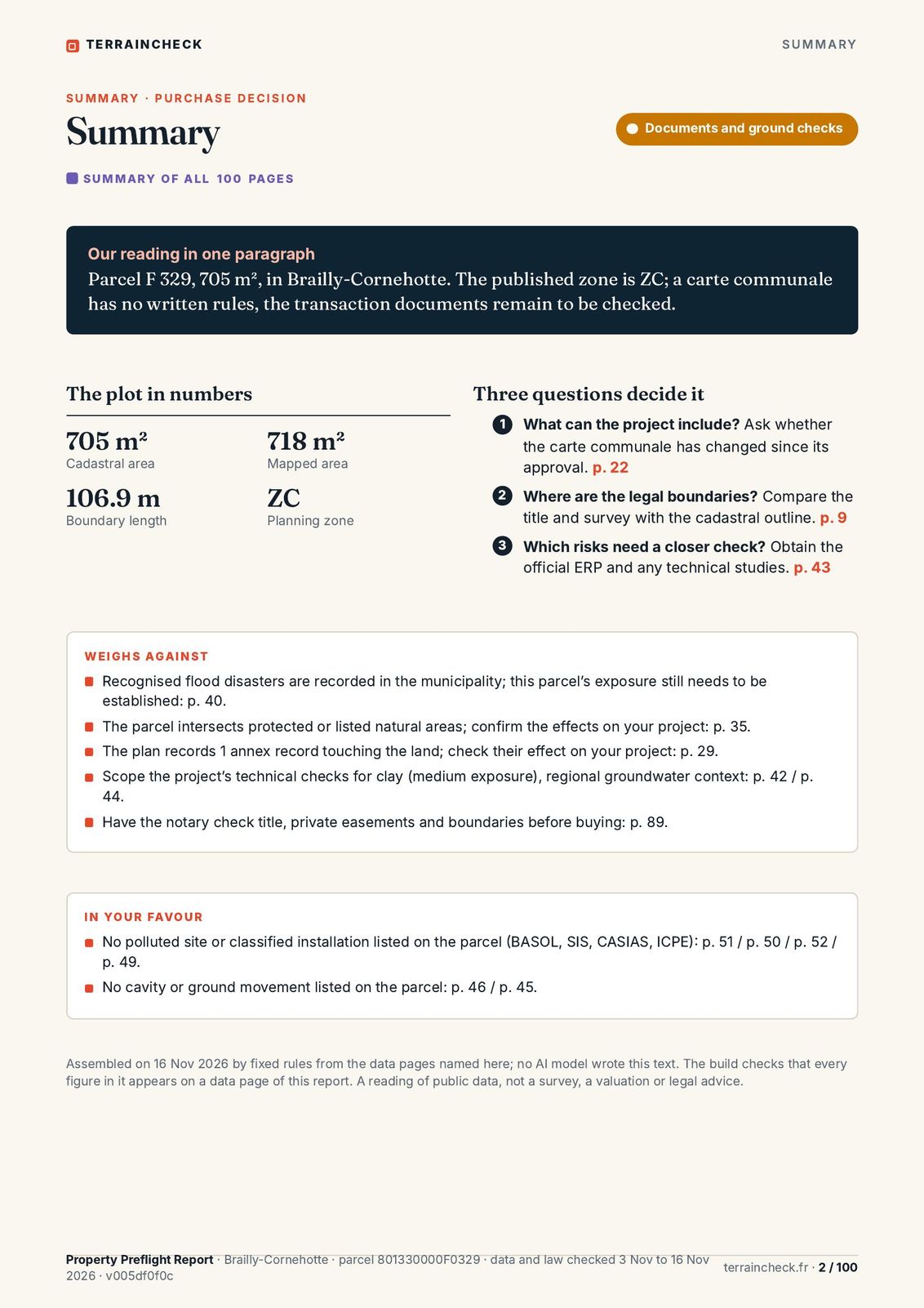
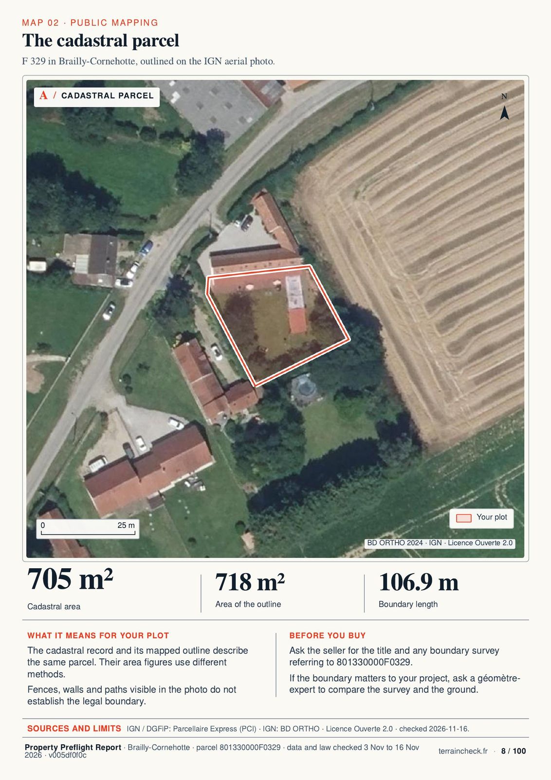
Summary: the purchase decisionThe cadastral parcelPlanning zones around the parcel

Browse a sample of the full report

Order the full report

Read before you decide

Browse a real report

The sample has 100 pages and 55 maps: the outline, past and present views of the land, planning, hazards, nature, roads and nearby sales, with their sources. The length depends on what the sources publish about the parcel.

Read the land documents to prepare questions for your next viewing.

  • Summary and contents
  • Location and current images
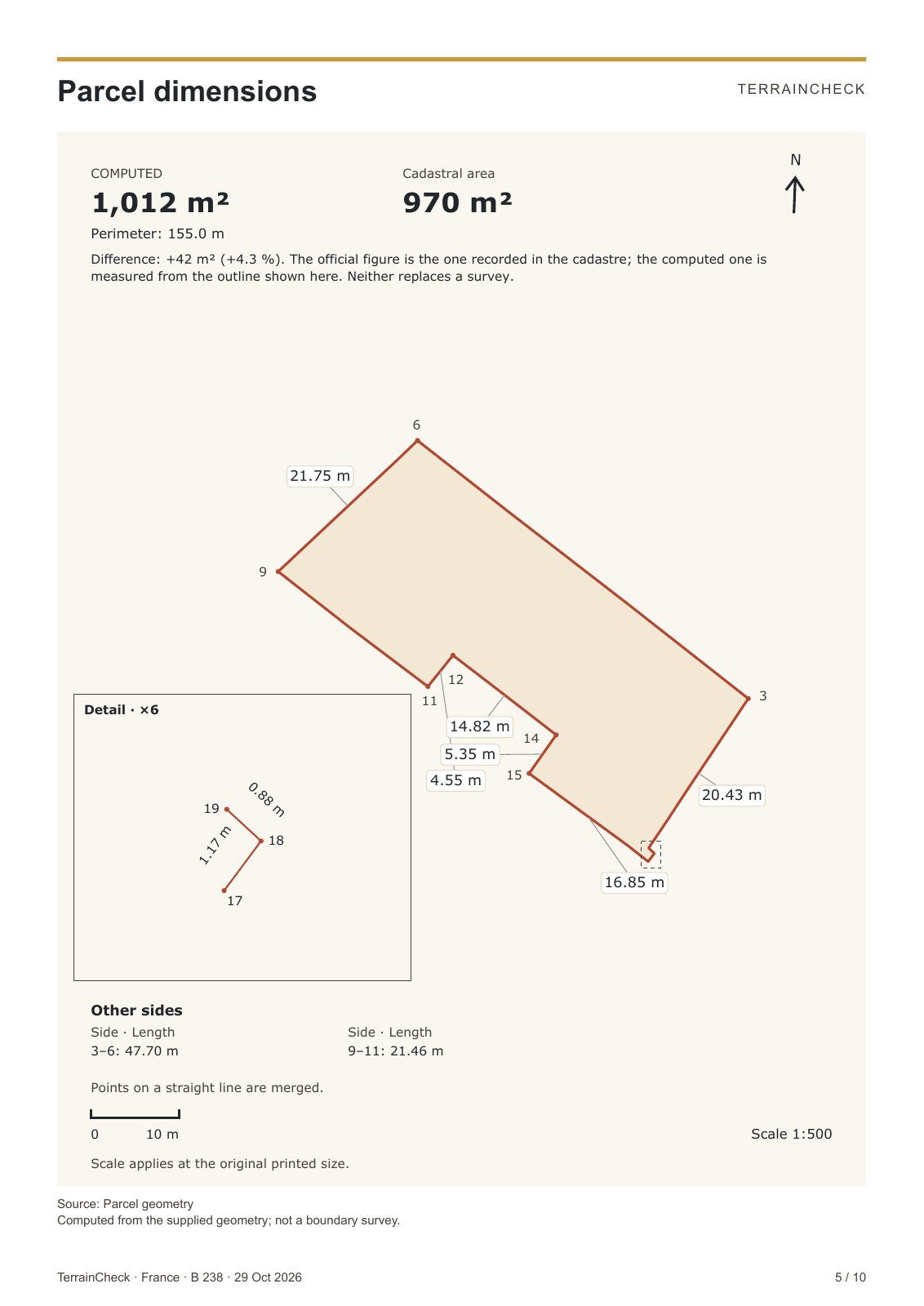
  • The plot: outline, dimensions, relief, neighbours
  • Historical images
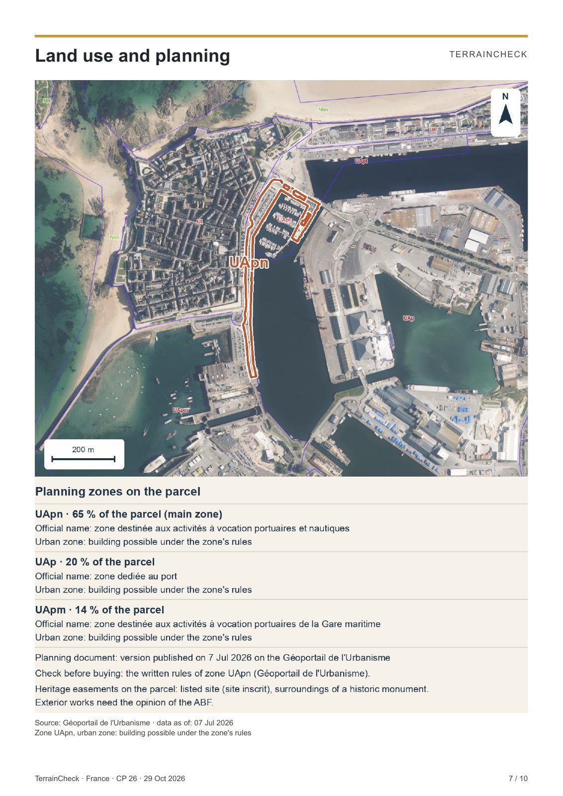
  • Planning and documents
  • Nature and heritage
  • Flooding
  • Natural hazards and ground
  • Roads and networks
  • Land sales
  • Checks, contacts and sources
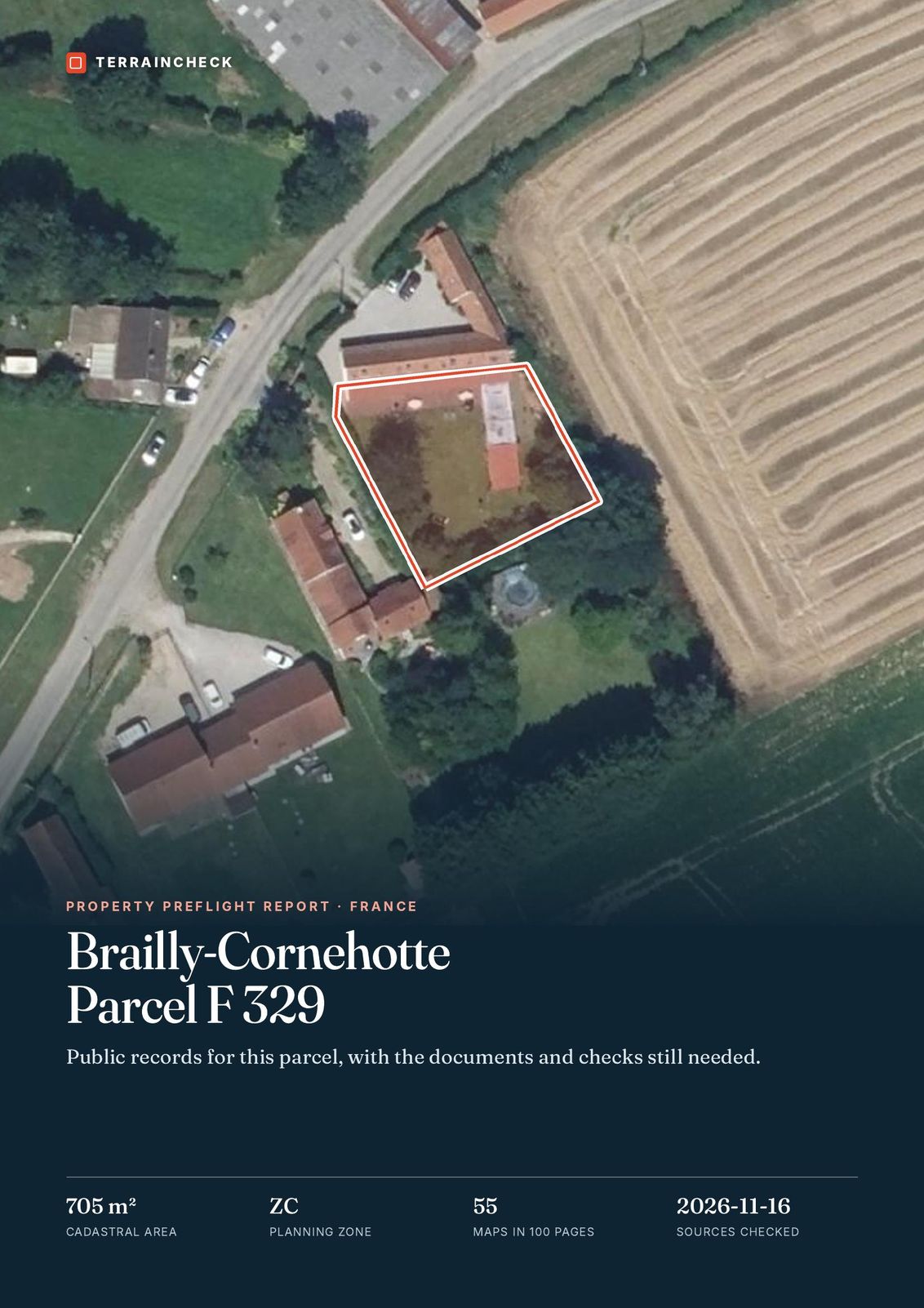
Cover · F 329, Brailly-Cornehotte
Cover · F 329, Brailly-Cornehotte1
Summary: the purchase decision
Summary: the purchase decision2
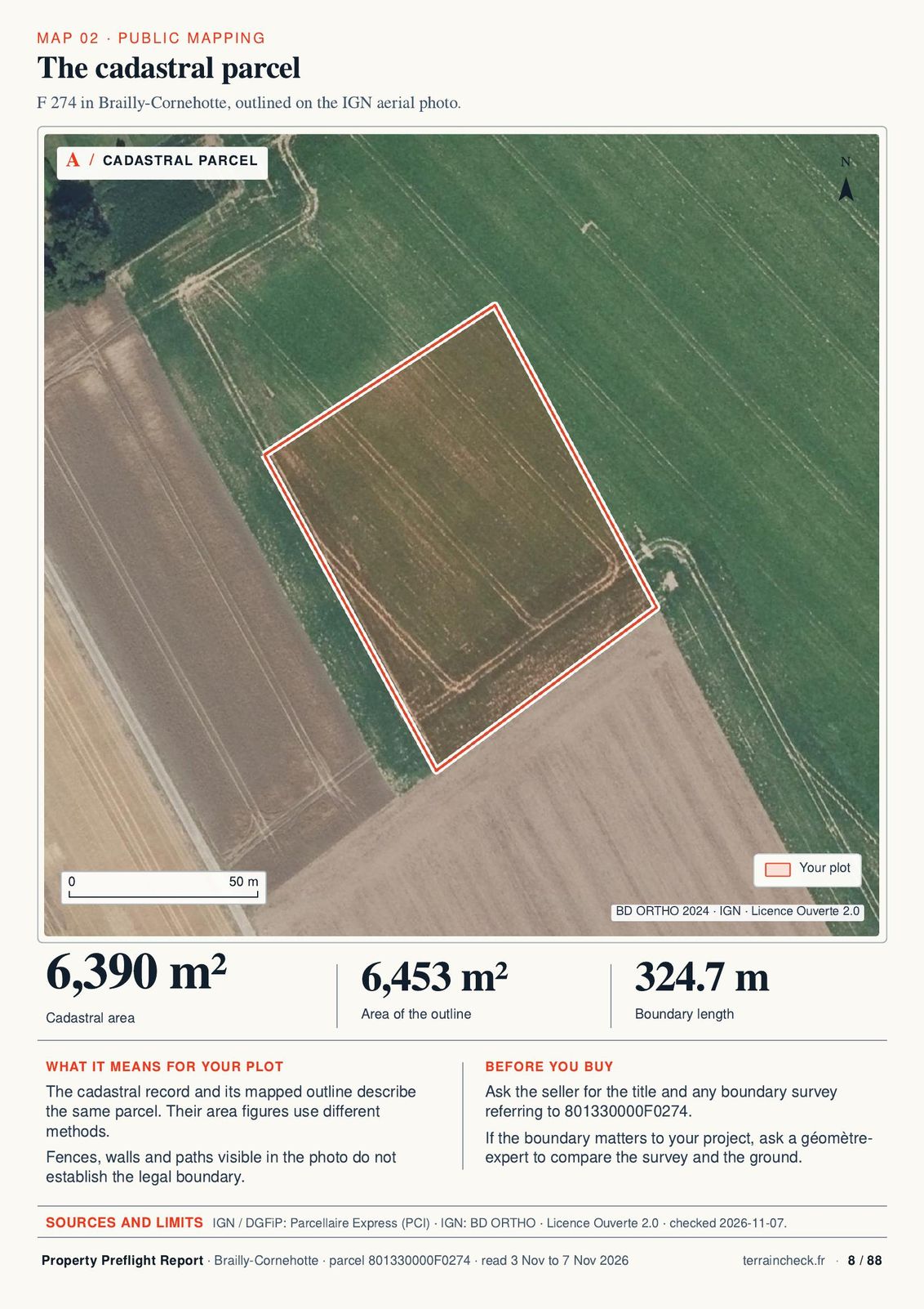
The cadastral parcel
The cadastral parcel8
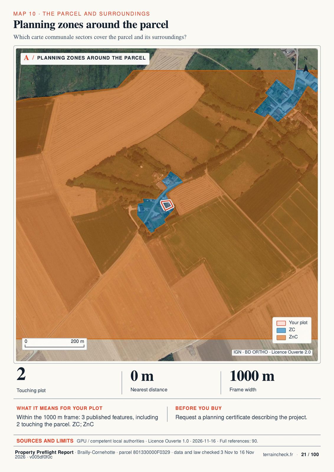
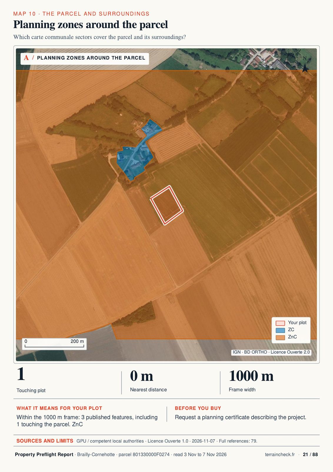
Planning zones around the parcel
Planning zones around the parcel21
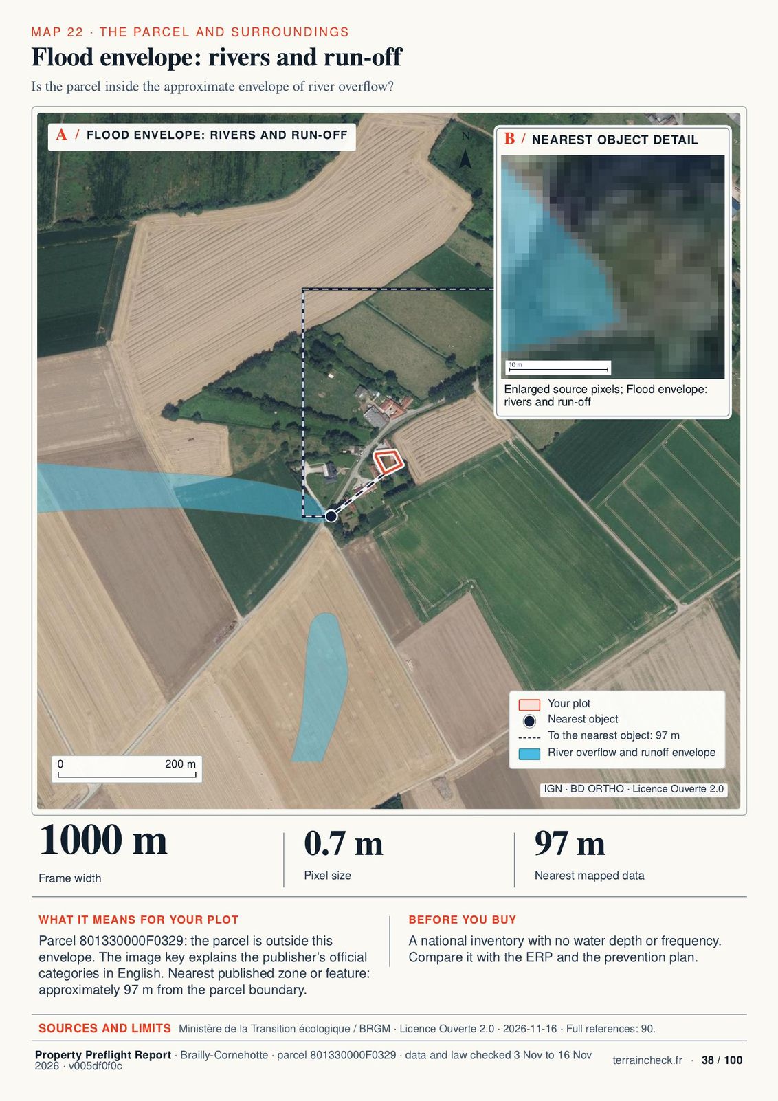
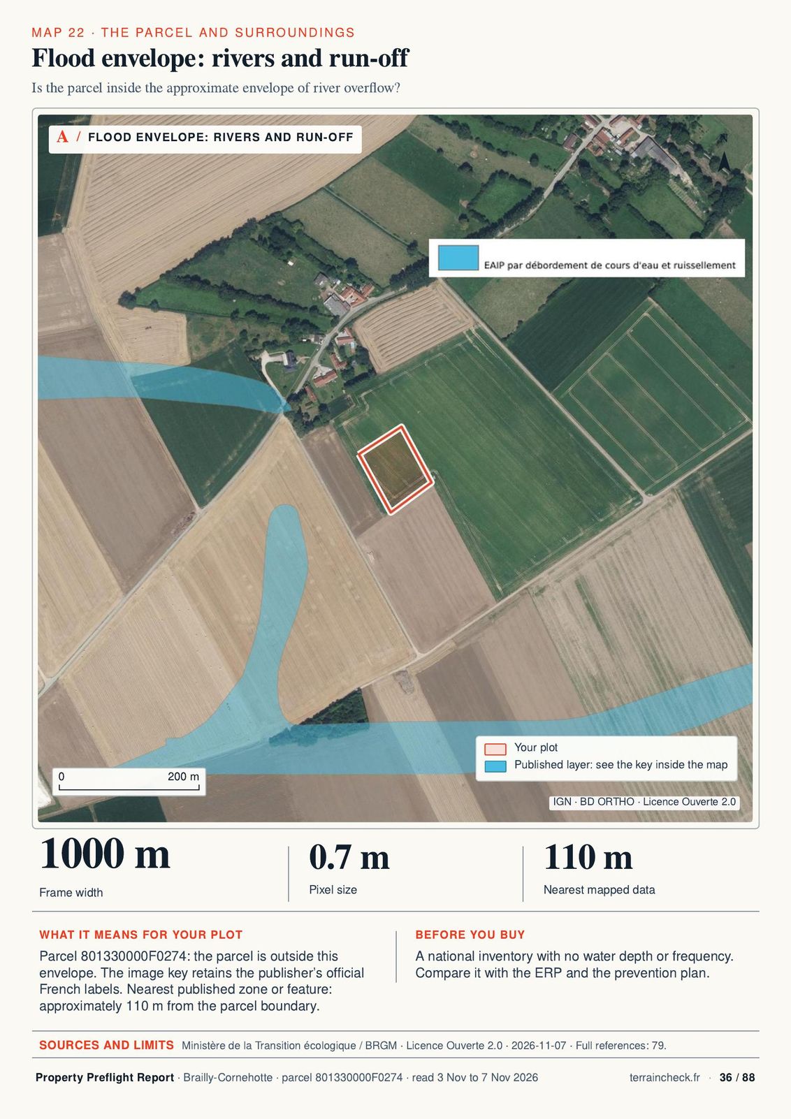
Flood envelope: rivers and run-off
Flood envelope: rivers and run-off38
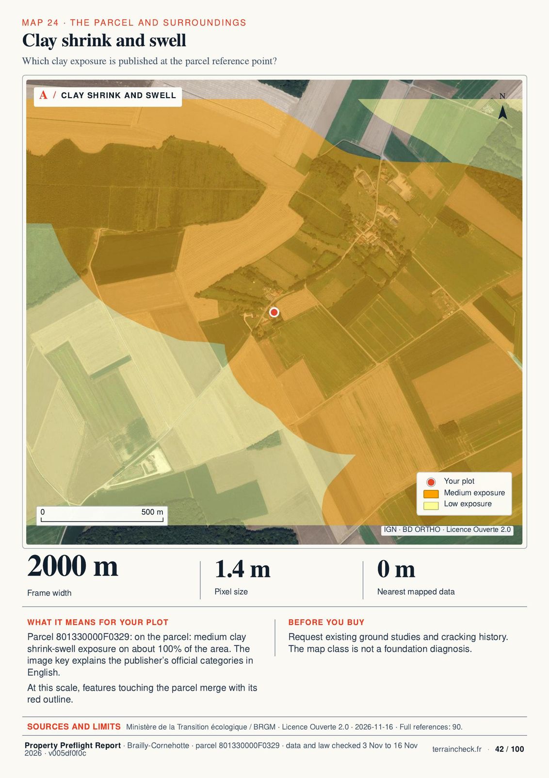
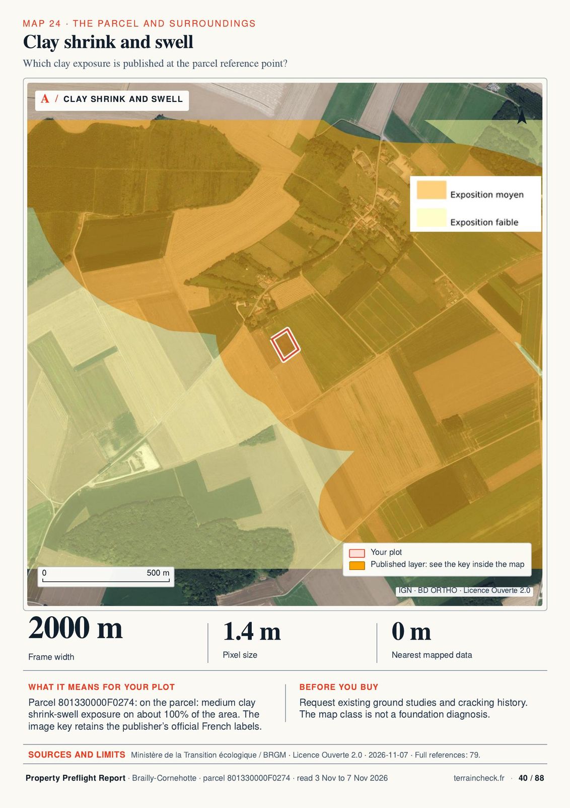
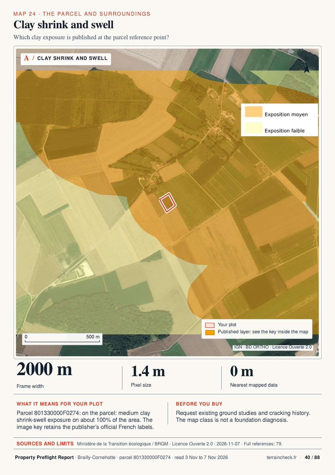
Clay shrink and swell
Clay shrink and swell42
Actual extracts · parcel F 329, Brailly-Cornehotte (Somme) · report dated 16 November 2026Read the whole sample report

Parcel F 274 map: IGN BD ORTHO 2024; IGN / DGFiP Parcellaire Express (PCI), data accessed on 7 November 2026. PCI service: edition dated 1 June 2026 in metadata checked on 11 November 2026. Image cropped and outline added. IGN WFS · Licence Ouverte 2.0

From an address to the report.

How it works
  1. 1

    Start with the free PDF

    Find your plot on the map and request a free 10-page PDF by email. No purchase is required.

  2. 2

    Check the parcel

    The cadastral outline appears with its area, then the free check goes through 9 topics.
  3. 3

    Pick the language

    French or English for €29, both for €39. An email address is enough, no account.

  4. 4

    Get the PDF

    The PDF report arrives by email within 45 minutes.

Before you sign

5 questions to ask before you buy

Even beautiful land can hide problems. These are worth asking early.

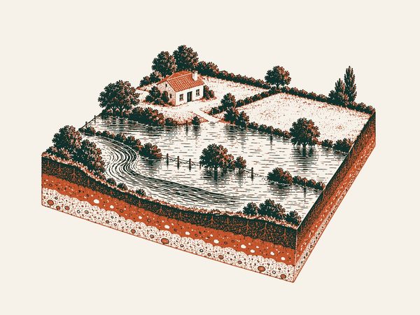
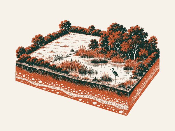
Could water rise here?
illustration

Could water rise here?

Look at the flood zones and request the applicable prevention documents.

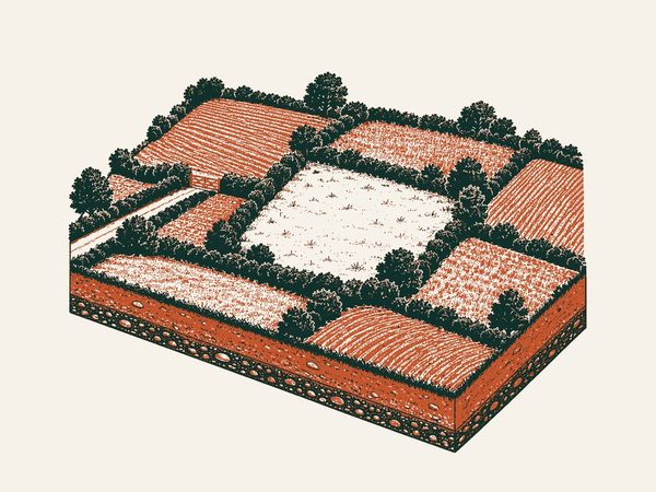
How do you get there?
illustration

How do you get there?

A visible track does not prove a right of way. Have the deeds checked.

What does the plan allow?
illustration

What does the plan allow?

Agricultural and natural zones restrict projects. The zone letter (A, N, U…) does not tell you everything.

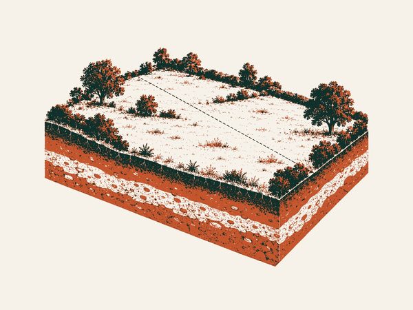
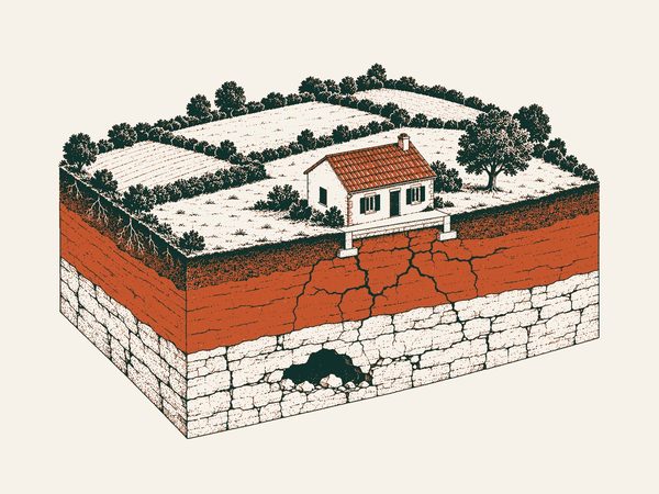
What is known about the ground?
illustration

What is known about the ground?

Maps show known ground hazards; a soil study is still needed to design the foundations.

What is protected?
illustration

What is protected?

Nature and heritage can affect your project, even without a listed building on the land.

What we do, and where we stop.

The free check and report help you prepare your project with the relevant professionals.

Your approachOn your ownSurveyor or architectFree checkReport
TimeDepends on your researchDepends on the briefA first lookA PDF to read
CostFree public sourcesBy quotationFree, no account29 € / 39 € · 1 language / FR + EN
What you getDocuments to gather and cross-checkExpertise suited to the land and your projectFindings, alerts and their sourcesMaps, history and rules brought together
LimitsYou check dates and coverageA scope defined in the quotationOnly the checked layersNo site visit, boundary survey or permission

Report

Time
A PDF to read
Cost
29 € / 39 € · 1 language / FR + EN
What you get
Maps, history and rules brought together
Limits
No site visit, boundary survey or permission

Free check

Time
A first look
Cost
Free, no account
What you get
Findings, alerts and their sources
Limits
Only the checked layers

Surveyor or architect

Cost: By quotation

Details
Time
Depends on the brief
What you get
Expertise suited to the land and your project
Limits
A scope defined in the quotation

On your own

Cost: Free public sources

Details
Time
Depends on your research
What you get
Documents to gather and cross-check
Limits
You check dates and coverage

In the documents

Three findings on this parcel

Three findings from the sample report dated 7 November 2026, parcel F 274 in Brailly-Cornehotte (Somme). No personal data.

Planning to check

A sector closed to building

The parcel lies in sector ZnC of the carte communale, where new buildings are not allowed. A carte communale has no written rules: ask the town hall whether it has changed and what your project would be allowed.

Géoportail de l’Urbanisme · see page 21 ↗
Ground to examine

Medium clay exposure

The whole parcel has medium clay shrink-swell exposure. Ask for any existing soil studies; the map is not a foundation survey.

Géorisques · see page 40 ↗
Nothing found

Outside the flood envelope

The parcel lies outside the approximate envelope of river overflow; the nearest mapped area is about 110 m away. Compare this with the official risk statement and the prevention plan.

Géorisques · see page 36 ↗

Where the data comes from and what it cannot tell you

Each layer has its coverage and date. ‘Not detected’ means only in the checked layer.

IGN · Cadastre & photographs

Cadastral outline, orthophotographs and historical views.

Historical photographs: 16 July 1959, 19 June 1979 and 2004.

Géoportail de l’urbanisme

Zoning, local planning rules and heritage restrictions.

Checked for the report dated 29 Oct 2026.

Géorisques

Flooding, clay, ground movement and cavities.

Checked for the report dated 29 Oct 2026.

INPN · Natura 2000

Protected site boundaries and distance to the outline.

Checked for the report dated 29 Oct 2026.

The report date is not the data date: the Sources pages give, layer by layer, the date read and the period described when the source publishes it.

One report, one payment.

Choose French or English. No subscription. Both editions cover the same parcel.

Add the second language later: +10 €.

29 € incl. VAT

29 € in English · 39 € in French + English

Order the report

Common questions

Before your first search.

Is the check really free?

Yes. Findings and alerts are visible without an account or email. The report adds maps, rules and history: 29 € for one language or 39 € for French and English.

Will I know whether I can build?

Zoning is a starting point, not permission. Your project must meet the applicable rules and be confirmed with the town hall, particularly through a planning certificate.

What does a green light mean?

Nothing was detected in the checked layer. This does not guarantee an absence of risk on the land. Unavailable or unchecked layers are shown in grey.

Why are some dates missing?

The files in this sample do not give every data date. We mark an unknown date as unknown rather than replace it with the report date.

Can I add the other language after buying?

Yes, the second language costs 10 € extra. Both editions together cost 39 €. The content covers the same parcel.

How long does the report take?

45 minutes at most, by email.

Can I order yet?

Yes. The free check works without an account. You order the report online and it arrives by email.

All frequently asked questions
The PDF report 29 € incl. VATOrder

Browse a sample report

Cover · F 329, Brailly-Cornehotte
Summary: the purchase decision
Contents
The cadastral parcel
Parcel dimensions
Aerial photographs, 1950–1965
Planning zones around the parcel
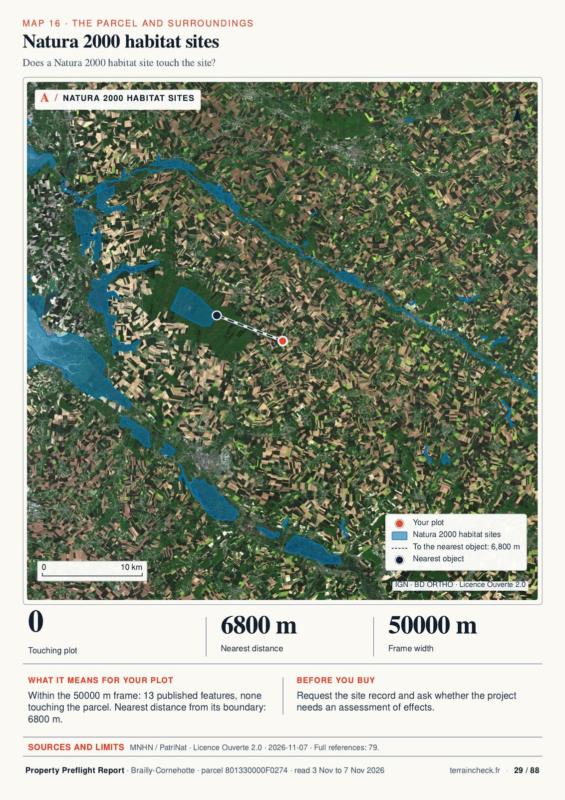
Natura 2000 habitat sites
Flood envelope: rivers and run-off
Clay shrink and swell
Overhead power lines
Recorded land sales nearby
What we could not read
Sources and dates