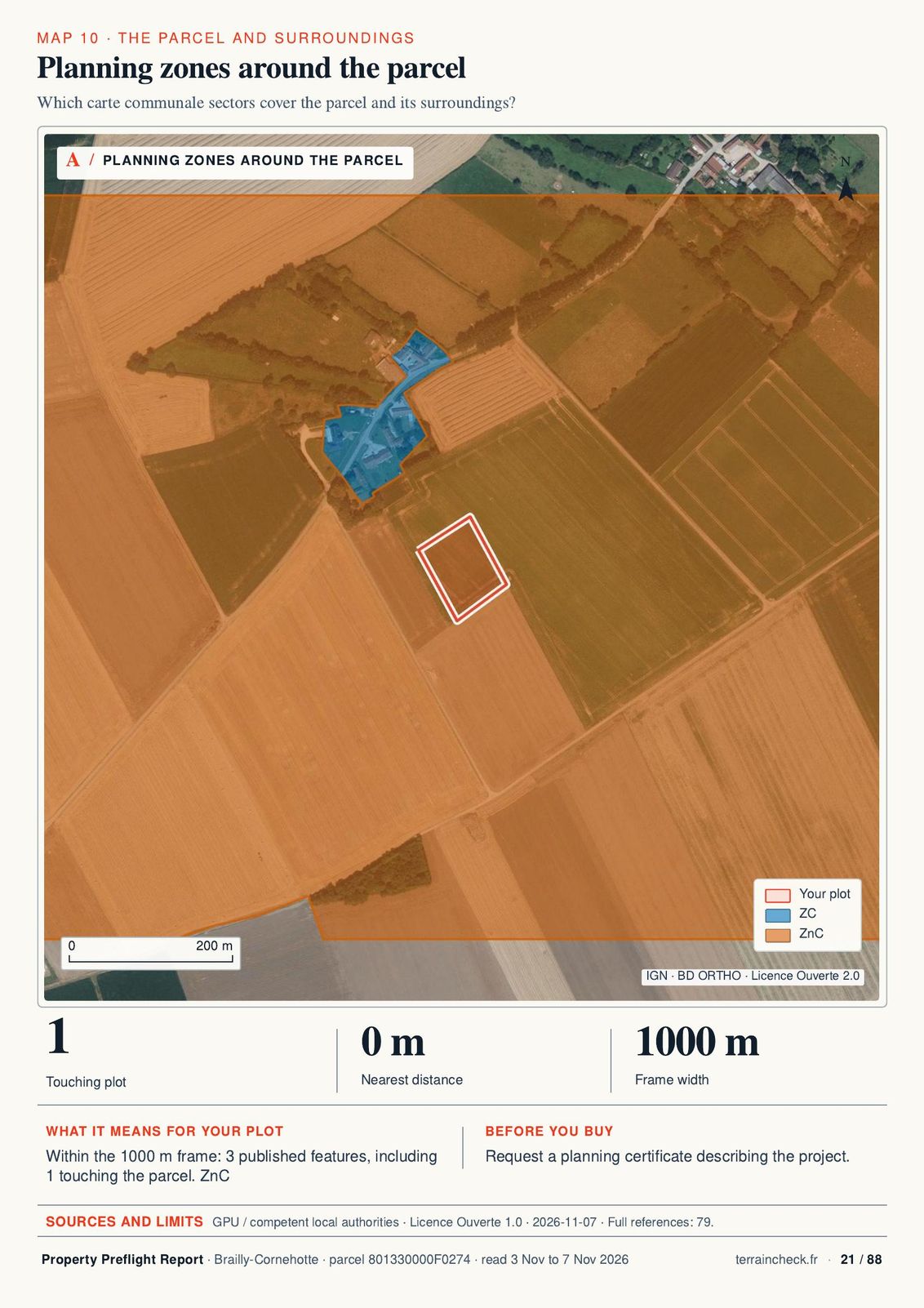
a sector of the local planning map where buildings are not allowed.
Ask the town hall Which rules and exceptions apply to your project?
See page 21 ↗How it works
You pick the parcel on the map. We read the cadastre, the local plan, the hazard maps and the protected sites. You get a PDF report with the questions to ask the seller, the notary and the town hall.
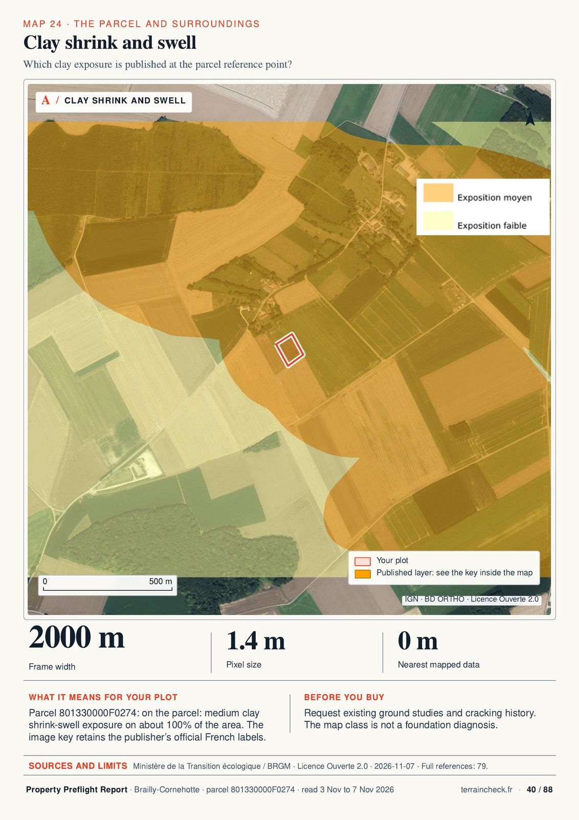 Brailly-Cornehotte · clay soils (Géorisques) · report page 40
Find your plot on the map and request a free 10-page PDF by email. No purchase is required.
The cadastral outline appears with its area, then the free check goes through 9 topics.
French or English for €29, both for €39. An email address is enough, no account.
The PDF report arrives by email within 45 minutes.
What the report finds
Each tile comes from a real report. Open one to see the whole page.
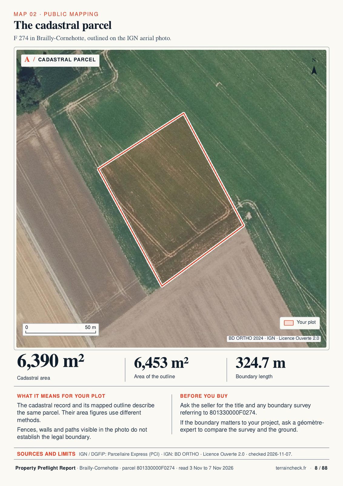
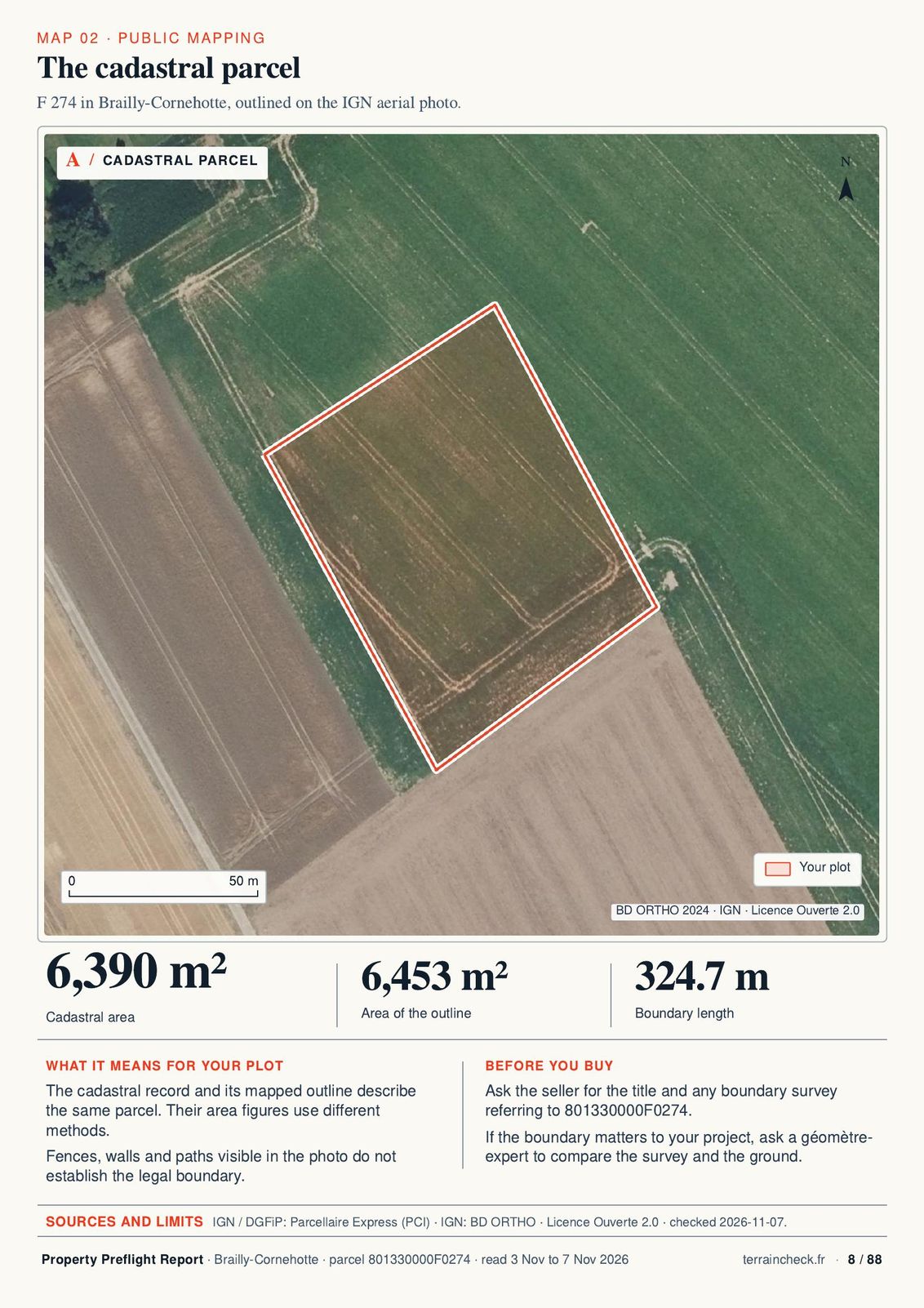
The cadastral outline on the aerial photograph and the recorded area.
Report page 8 · Brailly-Cornehotte ↗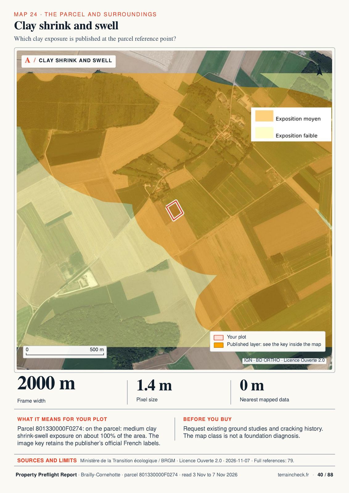
Parcel F 274 has medium clay shrink-swell exposure.
Report page 40 · Brailly-Cornehotte ↗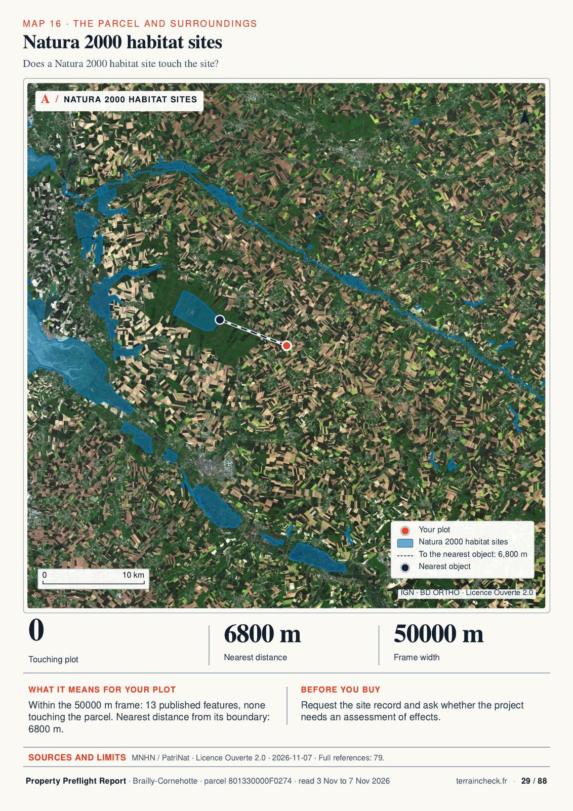
The report gives the distance to protected sites around the parcel.
Report page 29 · Brailly-Cornehotte ↗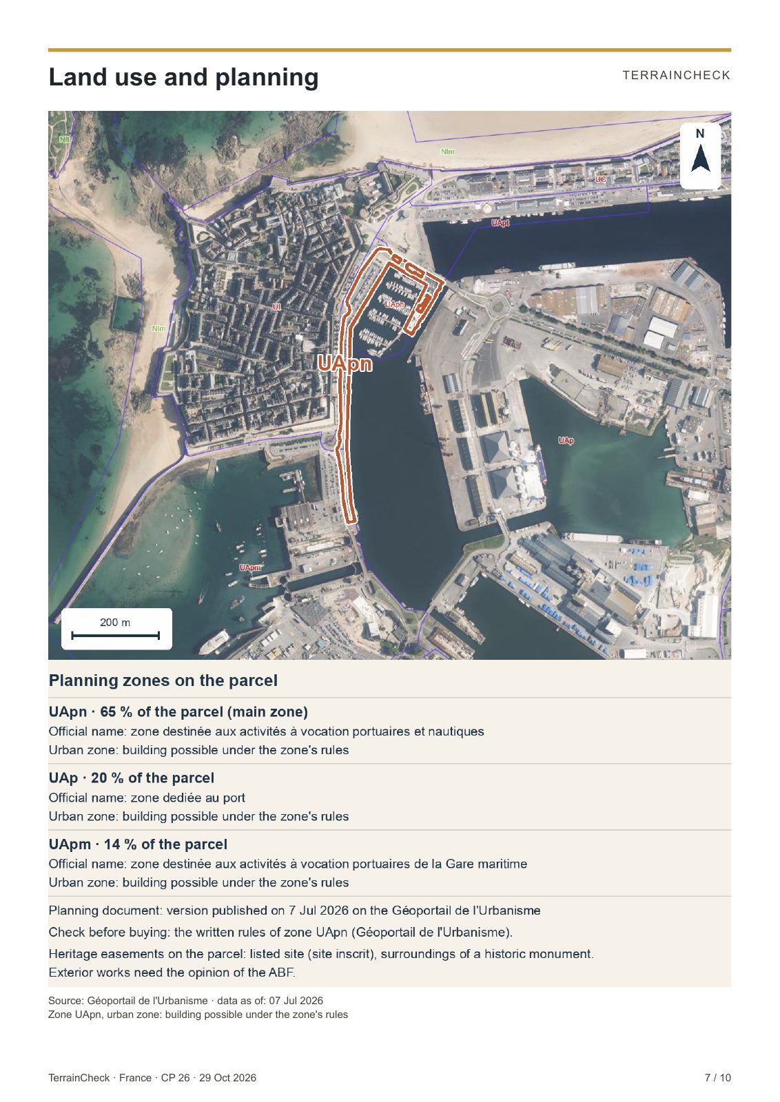
In an A or N zone, building is tightly limited. The report gives the zone, its share of the parcel and its official label.
Report page 7 · Saint-Malo ↗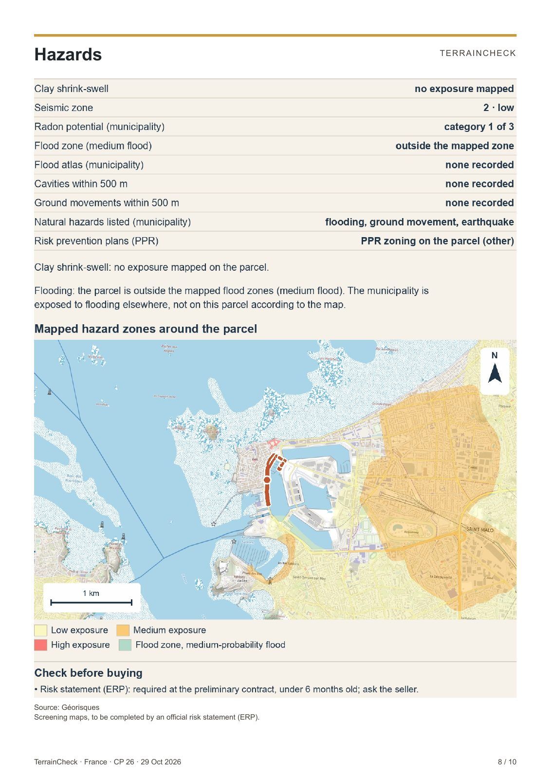
A flood or clay zone changes insurance, permits and price. The parcel is placed on the Géorisques map.
Report page 8 · Saint-Malo ↗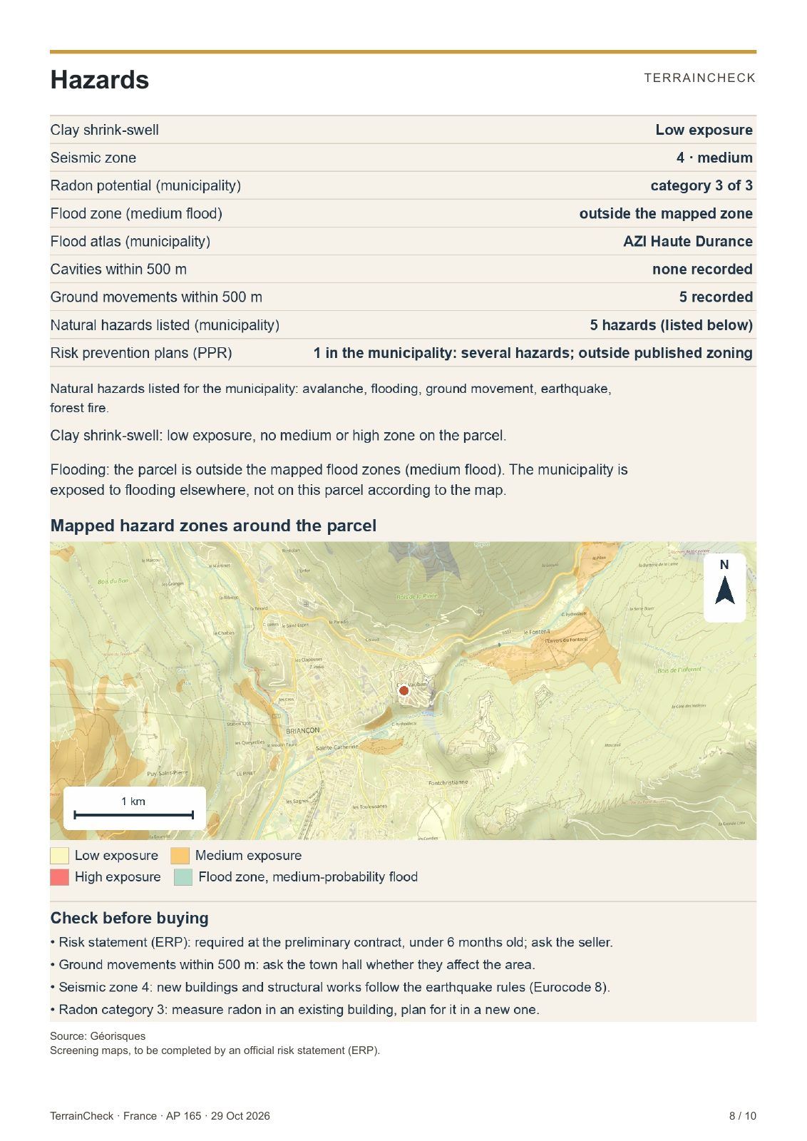
In Briançon, seismic zone 4 and radon category 3: building rules to follow and a radon test to plan.
Report page 8 · Briançon ↗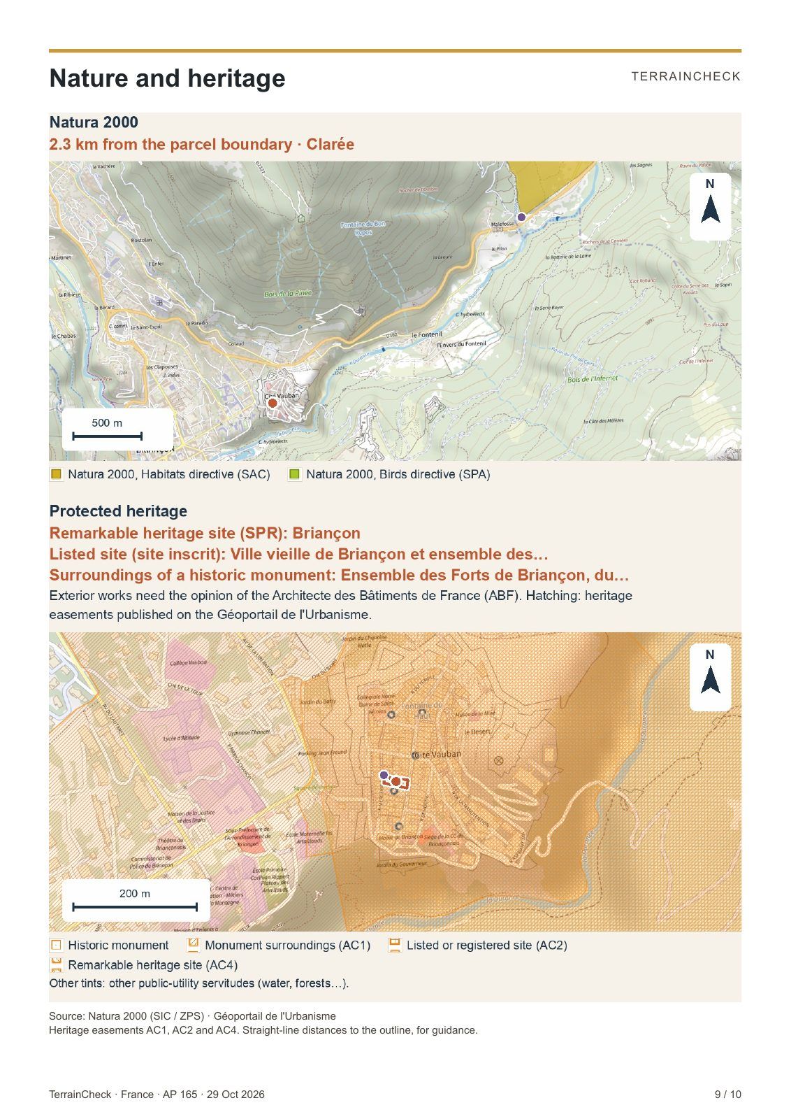
Near a monument or in a listed site, the ABF heritage architect gives an opinion on exterior works.
Report page 9 · Briançon ↗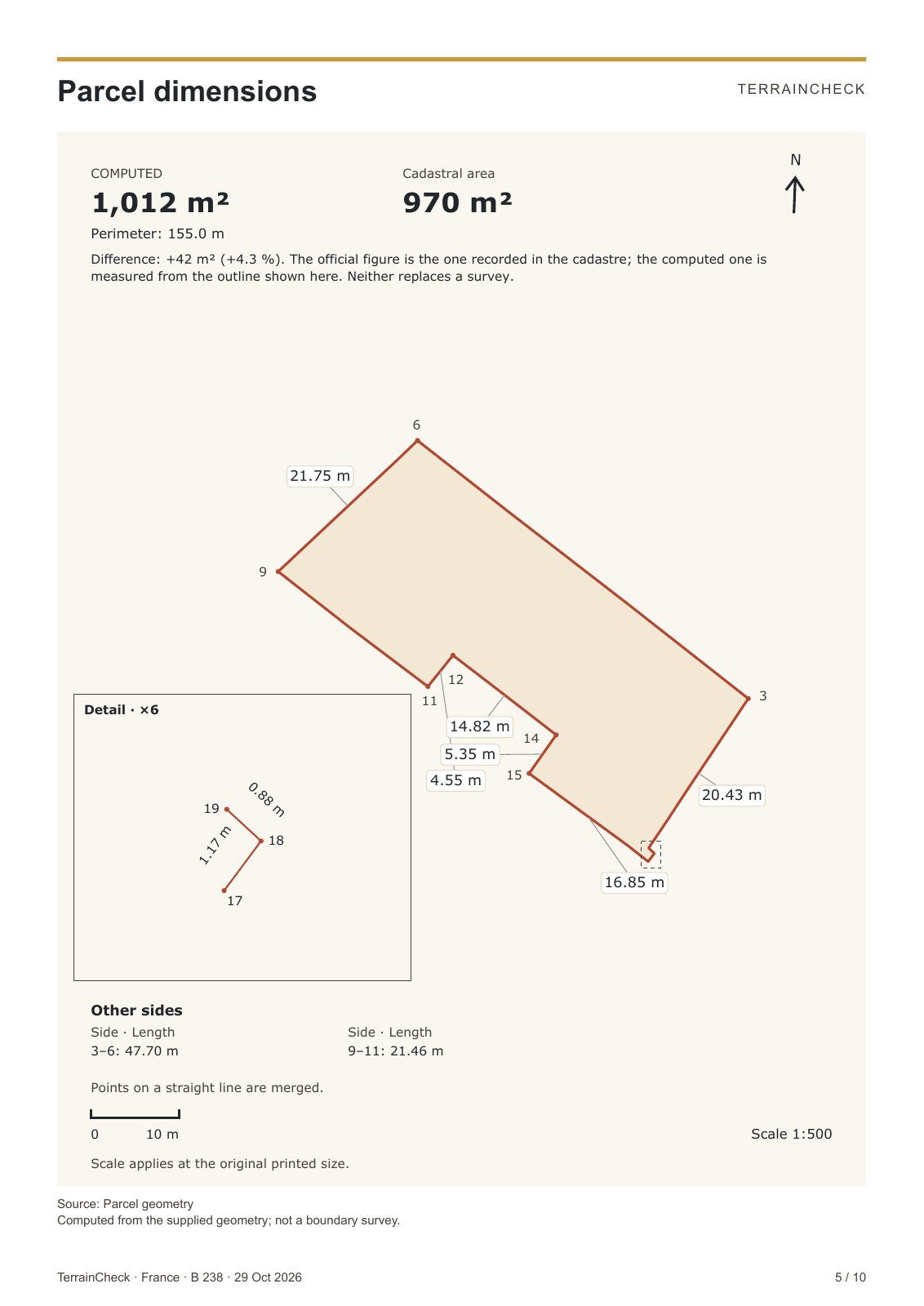
If the measured area differs from the cadastre, have a surveyor mark the boundaries.
Report page 5 · Puisseguin ↗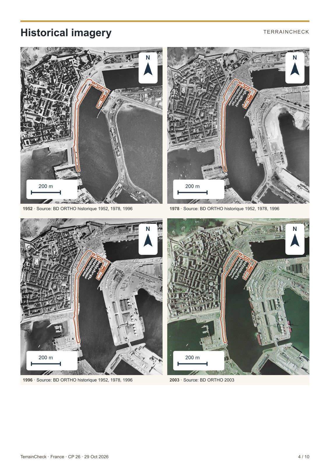
Photos since 1952 can show fill, a former activity or a demolished building.
Report page 4 · Saint-Malo ↗A real example
Four findings from the report of 7 November 2026, and the questions they raise.
a sector of the local planning map where buildings are not allowed.
Ask the town hall Which rules and exceptions apply to your project?
See page 21 ↗clay shrink-swell exposure across the parcel.
Ask the seller Is there a soil study for this land?
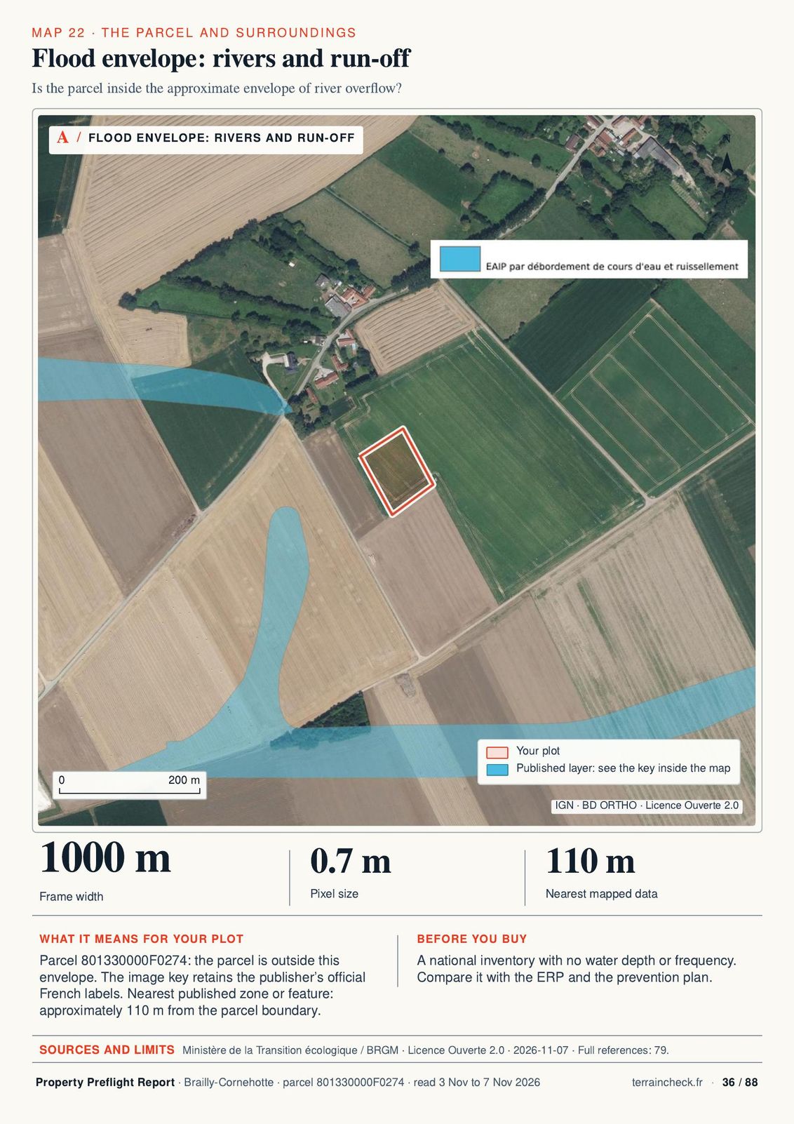
See page 40 ↗approximately to the mapped envelope of river overflow.
Ask the seller What does the official risk statement say about this land?
See page 36 ↗of cadastral area; the cadastre does not establish property boundaries.
Ask a surveyor Has the boundary been surveyed?
See page 8 ↗The data comes from French public services, under the Etalab Open Licence 2.0. Each report page names them with the date we checked.
It prepares your questions. The official answers come from these four people.
Common questions
Within 45 minutes. If an official public source is slow, up to 90 minutes.
We wait for the source for up to 90 minutes. If it still does not answer, you get the report with that topic marked as pending and the complete report within 24 hours. We do not replace missing data with an estimate.
French or English for €29, both for €39. You can add the second language later for €10.
If the error is ours, we correct the report and send it to you within 24 hours. If you chose the wrong parcel, write to us within 7 days and we will prepare one report for the correct parcel free of charge. The details are in the terms of sale.
Géorisques shows hazards only. The report puts the measured cadastre, the local plan, hazards, heritage, Natura 2000, access, networks and nearby land sales in a PDF, with the questions to ask the seller, the notary and the town hall.
The check is free. The report costs €29 (€39 in both languages) and arrives within 45 minutes.
With consent: Google Ads cookies measure ads and purchases. Privacy