Buying building land in France: the PLU, the certificat d’urbanisme, boundaries and the soil study before the compromis
On this page
This guide follows the order in which to gather documents before signing a compromis or promesse de vente (the French preliminary contracts) for building land: what each document proves, what it does not, and what to write into the preliminary contract.
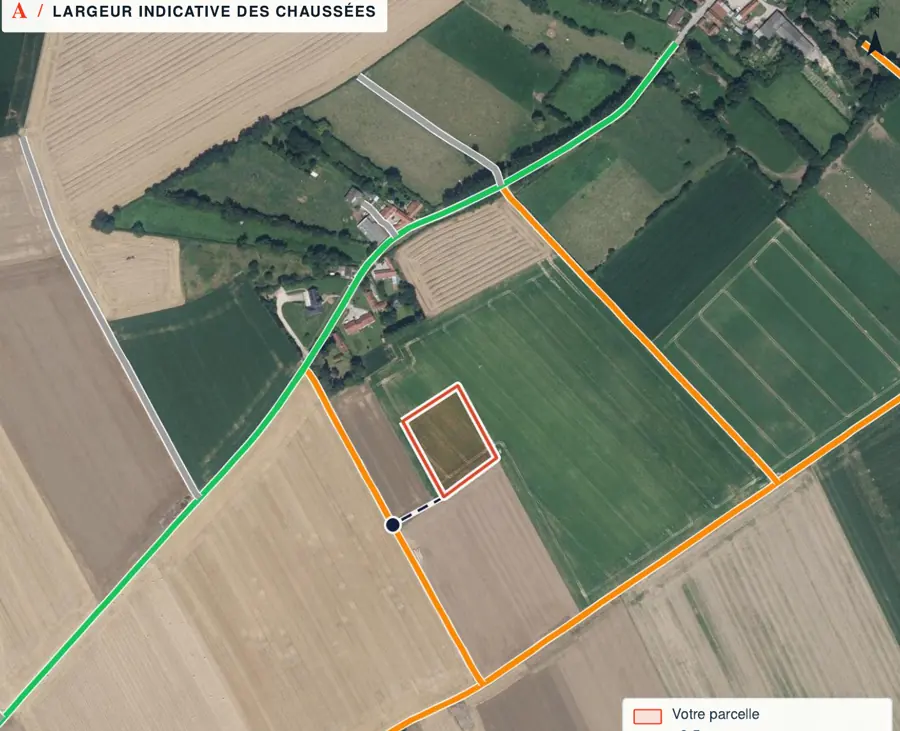
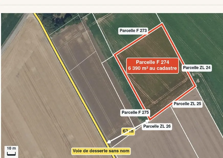
Have a parcel in mind? The report runs these checks on it, with the source and date of every figure: €29 in one language, €39 in French and English, by email within 45 minutes. Pick the parcel on the map →
What the documents say, and what they do not
A listing describes land with three words: an area, “constructible” (buildable) and “viabilisé” (serviced). None of them is a document. Before you sign, each claim should point to a dated document that carries the cadastral reference of the plot you visited.
| Document | What it states | What it does not prove | First step |
|---|---|---|---|
| Cadastral plan | The position, number and an indicative area of the parcel. | The exact line with the neighbours: only a boundary survey (bornage) fixes it. | Ask whether a bornage exists. |
| PLU zone | The general rule for the area: U, AU, A or N. | That your house is allowed: height, setback, access and footprint are in the written rules. | Read the rules of the zone. |
| Certificat d’urbanisme (information) | The planning rules, administrative limits and taxes that apply. | That your project can be built. | Ask for a certificat opérationnel. |
| Certificat d’urbanisme opérationnel | Whether the plot can take the project described, and the state of roads and networks. | A building permit. | File the permit within its 18 months. |
| Risk statement (ERP) | The hazards and prevention plans that cover the land. | What the ground is like under the future house. | Check its date and the parcel named. |
| Preliminary geotechnical study | A first identification of ground risks, including clay. | Your house’s foundations: that is the design study’s job. | Ask the seller for it in a medium or high clay zone. |
| Bornage | The boundaries agreed with the neighbours by a géomètre-expert. | What you may build. | Ask for the survey report and plan. |
Each document answers a different question; the listing replaces none of them. Sources: Service-public.fr: certificat d’urbanisme (Planning Code, art. L410-1); Service-public.fr: precautions before buying building land outside a lotissement; Service-public.fr: risk statement (Environment Code, art. L125-5); Géorisques: geotechnical study, rules (Building Code, art. L132-4 to L132-9); Service-public.fr: boundary surveys (Civil Code, art. 646). Accessed 29 October 2026.
Cadastre and boundary survey: where the lines really run
The French cadastral plan exists to locate parcels and to assess property tax. Its area and lines are an indication, not a guaranteed boundary. On building land the gap matters: a few metres less can make the setback required by the PLU impossible, or move the access.
A bornage fixes the line between two neighbouring properties. Any owner can require the neighbour to agree a bornage of adjoining land (Civil Code, art. 646). The line is set by a géomètre-expert (chartered surveyor), who writes a report and places the markers; the costs are usually shared. The Order of géomètres-experts describes the profession as the only one allowed to fix property boundaries.
Boundary survey: what the law asks, by type of plot
- Stand-alone plot, outside a lotissementA bornage is not compulsory to sell. The promesse states whether one exists.
- Plot in a lotissement (approved subdivision)The promesse must give the plot’s boundaries resulting from a bornage (Planning Code, art. L115-4).
- Disputed or vague boundaryAsk for a bornage before the deed and set out in the preliminary contract who orders and pays for it.
The PLU: reading zone U, AU, A or N
The plan local d’urbanisme (PLU, the local plan) divides the municipality into zones. The letter sets the frame; the written rules of the zone decide your project: use, height, siting, appearance, parking.
The four families of PLU zones
- U · urban zoneAreas already built up, or where existing or planned public networks have enough capacity for new buildings (art. R151-18).
- AU · zone to be developedAreas meant to be opened to development. Read the rules: they say when and on what conditions (art. R151-20).
- A · agricultural zoneAreas, serviced or not, protected for the farming, biological or economic potential of the land; in principle not buildable (art. R151-22).
- N · natural and forest zoneAreas, serviced or not, protected in particular for the quality of sites and landscapes or for forestry (art. R151-24).
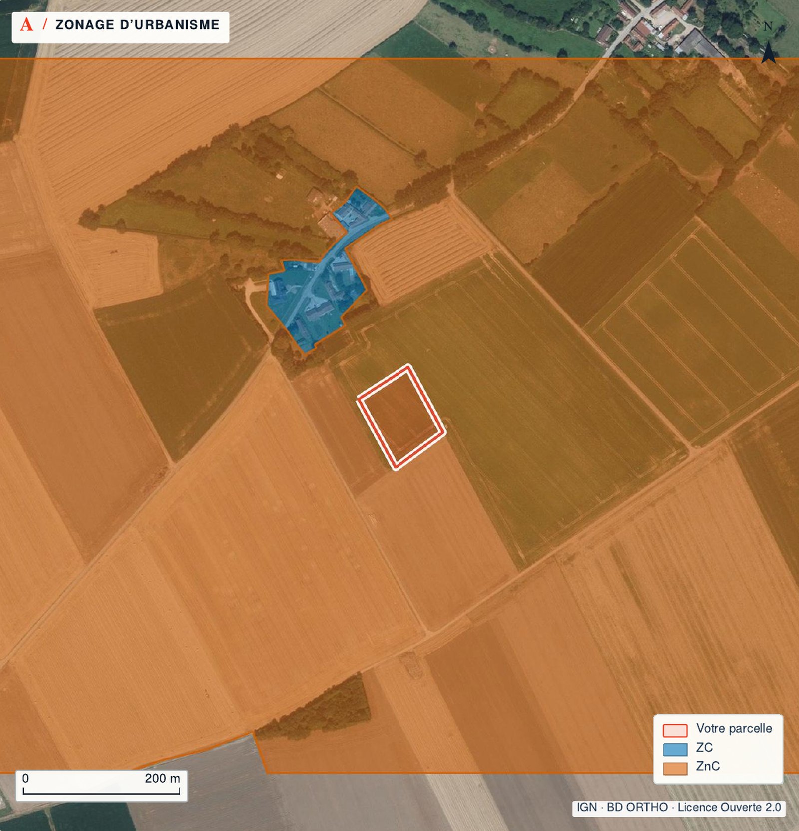
Where there is neither a PLU nor a carte communale, the national planning rules (RNU) apply to the land. The PLU can be read at the town hall and on the Géoportail de l’Urbanisme, which lets anyone locate a plot, query its zoning and see the public-interest easements. Note the date of the version shown: an amendment may be under way.
The planning certificate
Ask the mairie for an operational certificate for your project. Our planning certificate guide compares both types and the application. See also flood risk checks.
Public-interest easements and the surroundings of monuments
Public-interest easements (servitudes d’utilité publique) come on top of the zoning and are annexed to the PLU (Planning Code, art. L151-43). Since 1 January 2020 an easement can also take legal effect through publication on the Géoportail de l’Urbanisme. The zone rules are therefore not enough: read the list of easements as well.
Two common easements on building land
- AC1 · surroundings of a historic monumentWithout a defined perimeter, protection covers buildings within sight of the monument and less than 500 m from it. Works there need consent from the Architecte des Bâtiments de France.
- Risk prevention plan (PPR)An approved PPR is a public-interest easement annexed to the PLU (Environment Code, art. L562-4). It can ban building or impose design requirements.
The risk statement (ERP)
The état des risques (ERP) is compulsory when selling any building or any plot, buildable or not, in a listed zone (Environment Code, art. L125-5). The seller hands it over at the first viewing, if there is one. It must be less than 6 months old and be attached to the promesse or the deed. The listing must refer to the Géorisques website.
If it is missing, the buyer can ask the court to cancel the sale or to reduce the price. Read it with a map: it says whether the land is in a hazard zone; it says nothing about how the ground will behave under the future house.
Clay soil: the preliminary geotechnical study
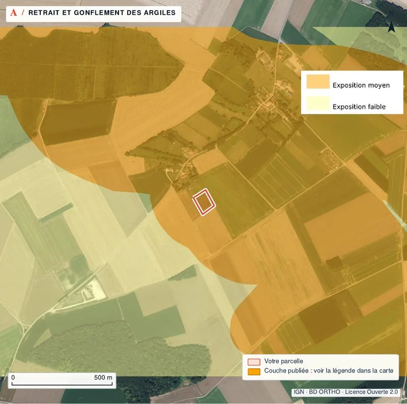
Clay swells when it takes up water and shrinks as it dries. The national map ranks exposure in three levels: low, medium or high. The map at the top of this page shows parcel F 274 in Brailly-Cornehotte in medium exposure.
Since the ELAN law, the sale of buildable bare land in a medium or high exposure zone comes with a preliminary geotechnical study (étude géotechnique préalable) supplied by the seller. It is attached to the promesse, or to the deed when there is no promesse, and stays valid for 30 years (Building and Housing Code, art. L132-4 to L132-9). A G1 study under standard NF P 94-500 is presumed to comply.
What the exposure level changes at the sale
- Low exposureNo study required of the seller. A soil study is still useful to design the foundations.
- Medium exposureThe seller supplies the preliminary geotechnical study, attached to the promesse or the deed.
- High exposureSame duty. Check that the study covers the right parcel and the land as it is sold.
The preliminary study is not the design study. The design study takes the house’s siting and characteristics into account and sets the construction requirements; it comes with the project, after the purchase.
Natura 2000: a nearby site does not ban everything
A Natura 2000 site protects habitats and species. Being inside a site, or next to one, does not make land unbuildable. Plans, programmes and projects likely to affect the site significantly, alone or together with others, must however go through an assessment of their effects (Environment Code, art. L414-4).
Ask the town hall or the departmental planning office (DDT) whether your project is on a list that requires this assessment. Keep the site’s name and code: you will need them in every exchange.
Services: access, water, electricity, drainage
“Viabilisé” is listing language: none of the official sources read for this guide defines it. Ask network by network where the pipe or line runs, how far from the boundary, and who pays for the connection. The certificat opérationnel already states the existing or planned public roads and networks.
Questions to ask, network by network
- AccessDoes the plot touch a public road, or do you have to cross the neighbour’s land? A right of way is written in the title deeds.
- Water and electricityAsk the water service and the electricity network operator for the nearest connection point and a quote.
- Mains drainageConnecting to the public sewer can trigger the sewerage contribution (PFAC); ask the town hall for the amount.
- No mains drainageThe building permit file must include the SPANC certificate approving the private sewage system; the owner pays the costs.
Building also triggers the taxe d’aménagement (development tax), at the rate in force when the permit is granted (Planning Code, art. L331-1 ff.). The certificat d’urbanisme lists the taxes that apply to the land.
Pre-emption: the municipality and the SAFER
Two priority buyers can take your place: the municipality, where it has set up an urban pre-emption right, and the SAFER for agricultural property. The notaire asks them before the deed; the compromis must cover the case.
| Question | Urban pre-emption right (DPU) | SAFER |
|---|---|---|
| Who | The municipality, if it has set up the right by council decision. | The regional rural land agency (société d’aménagement foncier et d’établissement rural). |
| How it is told | Notice of intention to sell (DIA) sent to the town hall. | Notice of the planned sale from the notaire. |
| Time to answer | 2 months from receipt of the DIA. | 2 months from receipt of the notice. |
| Silence | Counts as waiving the right; the deed cannot be signed before the waiver. | The sale can be signed once the period is over. |
The notaire checks whether SAFER must be notified of the sale. Sources: Service-public.fr: selling in a pre-emption zone (Planning Code, art. L211-1, L213-2); National Assembly: minister’s answer on the SAFER pre-emption period, Journal officiel 3 May 2022; Ministry of Agriculture: CGAAER report no. 26024 on the SAFER, April 2026 (Rural Code, art. L143-1). Accessed 29 October 2026.
When to hold back your signature
Four levels before you pay anything
- StopZone A or N and a house unrelated to farming or forestry; or the seller refuses the risk statement or the geotechnical study that is due.
- PauseNo certificate or an expired one, an AU zone whose opening is not settled, networks far away: get the documents before signing.
- ConditionThe project depends on a permit, a loan or a soil study: write it as a condition precedent, with dates.
- Go onZone U, a recent certificat opérationnel for your project, boundaries surveyed or scheduled, an ERP under 6 months, the clay study supplied if due.
Three hypothetical examples
These cases are invented to show the method. They do not describe any real parcel.
Hypothetical example
A “buildable” plot in an AU zone
The listing calls the plot buildable. The PLU puts it in AU, and the rules make opening the zone depend on the networks arriving. The seller only has an information certificate. The buyer applies for a certificat opérationnel for the house and signs with a building-permit condition that carries a date.
Hypothetical example
A high-exposure parcel without a study
The land is in high clay exposure and the seller has no study. The notaire points out that the seller must supply it and attach it to the promesse. The buyer waits for the study before signing, then passes it to the builder.
Hypothetical example
A farm garden sold as building land
A parcel in zone A adjoins a house. The rules allow no new dwelling unrelated to farming there, and the notaire notifies the SAFER. The buyer rethinks the plan: this is a garden, not a building plot, and the price is negotiated accordingly.
What to write into the compromis
A condition precedent (condition suspensive) makes the sale depend on a future, uncertain event (Civil Code, art. 1304 ff.). For building land, the promesse states among other things the buildable floor area, whether a bornage exists, the easements, how the purchase is financed and the deadline for each condition.
- Building permit: a permit for the project described (floor area, use), free of third-party appeal, with deadlines to file and to obtain it.
- Loan: amount, term and maximum rate. If the loan is refused, the sale does not go ahead and the buyer owes the seller nothing; the period allowed to obtain it cannot be shorter than one month.
- Ground: the preliminary geotechnical study attached where it is due; otherwise a condition tied to a soil study compatible with the project.
- Boundaries: a bornage done before the deed, naming who orders and pays for it.
- Pre-emption: sale subject to the municipality, and in a farming zone the SAFER, waiving their rights.
- Networks: connection possible at a cost you set, based on quotes.
A privately signed unilateral promise (promesse unilatérale) must be registered with the tax office within 10 working days (€125); an immobilisation payment is compulsory when an individual signs a promise lasting more than 18 months.
The costs to budget
| Item | Amount | Who pays | Worth knowing |
|---|---|---|---|
| Certificat d’urbanisme | Free | The applicant | 1 month (information) or 2 months (opérationnel) to answer. |
| Registering a privately signed promesse unilatérale | €125 | Seller or buyer | Within 10 working days, at the tax office. |
| Preliminary geotechnical study | By quote | Supplied by the seller | Due in medium or high clay exposure. |
| Bornage | The surveyor’s fees | Often shared between neighbours | No official scale; ask for a written quote. |
| Notary costs (frais de notaire) | 7–8% of the price for existing property, 2–3% for new-build, per the notaries (2020) | The buyer | The figure dates from 2020; for land, ask the notaire for a written estimate. |
| Private sewage system | Depends on the system | The owner | SPANC certificate attached to the permit. |
| Taxe d’aménagement | Depends on floor area and local rates | The permit holder | Rate in force when the permit is granted. |
Fixed amounts come from the official texts; everything else is priced by quote, before you sign. Sources: Service-public.fr: certificat d’urbanisme (Planning Code, art. L410-1); Service-public.fr: promesse de vente for a stand-alone building plot; Géorisques: geotechnical study, rules (Building Code, art. L132-4 to L132-9); Service-public.fr: boundary surveys (Civil Code, art. 646); Notaires de France: notary costs, article of 8 December 2020; Service-public.fr: domestic wastewater; Service-public.fr: taxe d’aménagement (Planning Code, art. L331-1 ff.). Accessed 29 October 2026.
The steps before the deposit
- Get the exact cadastral reference, the title deed and the seller’s plan.
- Read the PLU zone and rules, then the list of easements, on the Géoportail de l’Urbanisme.
- Apply for a certificat opérationnel for your project, or check the seller’s.
- Ask for the risk statement under 6 months old and, in a medium or high clay zone, the preliminary geotechnical study.
- Have the boundaries confirmed: an existing bornage, or one to be done before the deed.
- Get connection points and quotes for water, electricity and drainage.
- Ask the notaire whether a pre-emption right applies, municipal or SAFER.
- Have the conditions precedent drafted with dates, and only then pay the deposit (dépôt de garantie).
Questions to send before you pay
- What is the full cadastral reference, and does the area sold come from a bornage?
- Which PLU zone applies, and when was the version consulted published?
- Do you hold a certificat d’urbanisme? Which kind, what date, for what project?
- Which public-interest easements affect the land?
- Can you send me the risk statement less than 6 months old?
- Is the land in medium or high clay exposure, and do you have the preliminary geotechnical study?
- Where are the water, electricity and sewer networks, and do you have connection quotes?
- Does the plot have direct access to a public road, or a right of way?
- Can the municipality or the SAFER pre-empt?
- What happens to the deposit if a condition is not met by its date?
Common questions
Is a plot in zone U always buildable?
No. Zone U sets the frame; the written rules fix height, setback, access and footprint, and easements can add limits. A certificat d’urbanisme opérationnel answers for your project.
Does the certificat d’urbanisme cost anything?
No, applying is free. The town hall answers within 1 month for an information certificate and 2 months for an opérationnel one.
Must the seller have the boundaries surveyed?
Not for a stand-alone plot outside a lotissement. In a lotissement, the promesse must give the boundaries resulting from a bornage. You can always make one a condition of the compromis.
Who pays for the soil study in a clay zone?
In medium or high exposure, the preliminary geotechnical study is supplied by the seller and attached to the promesse or the deed. The design study for your house comes later, with your project.
Do I have 10 days to withdraw?
Not for building land outside a lotissement. The period applies to a plot in a lotissement whose seller holds a permis d’aménager.
What if the loan is refused?
If the compromis says the purchase is financed by a loan and the loan is refused, the sale does not go ahead and you owe the seller nothing. The period to obtain the loan cannot be shorter than one month.
Can the SAFER buy in my place?
On agricultural property, yes: it has a pre-emption right and 2 months from the notaire’s notice. If it does not answer within that time, the sale can be signed.
What does the TerrainCheck report show for €29?
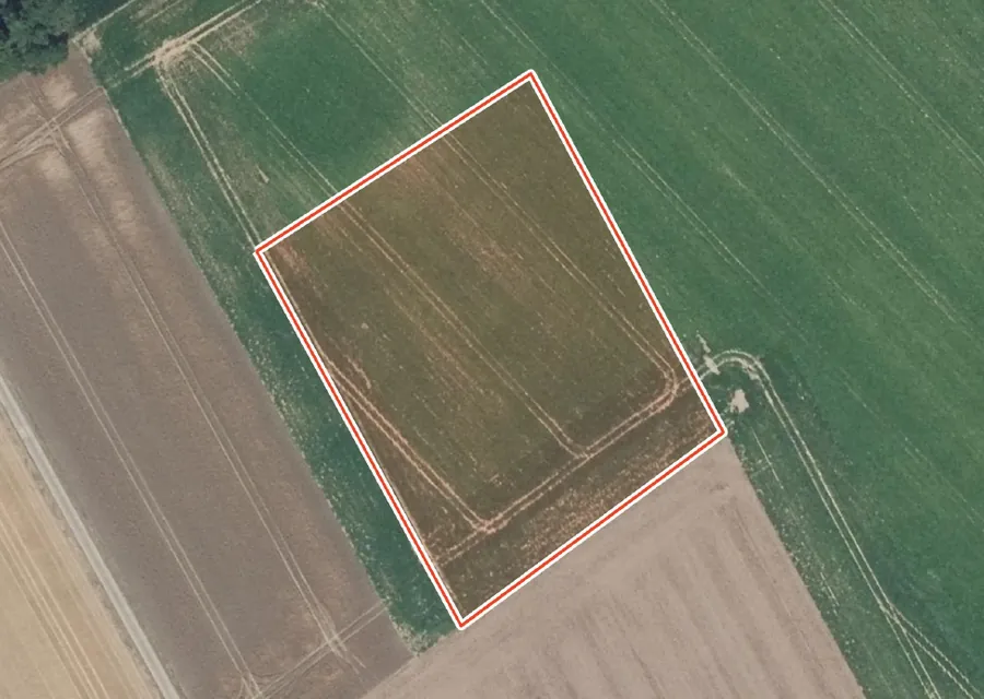
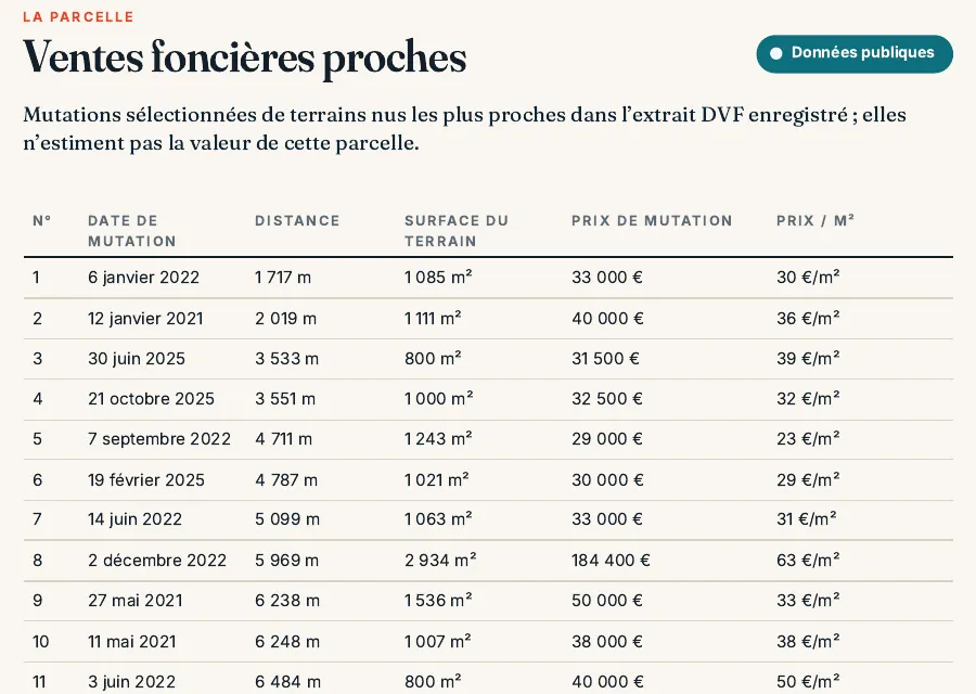
A PDF on your parcel, mostly maps: current and old aerial photos, dimensions, cadastre and neighbours, planning, flooding, clay and other hazards, Natura 2000 and heritage, roads and networks, nearby land sales, with the source and date of every figure. The published sample has 88 pages and 51 maps; the length depends on what the sources publish about the parcel. It does not replace the certificat d’urbanisme, the risk statement or a bornage.
Keep reading
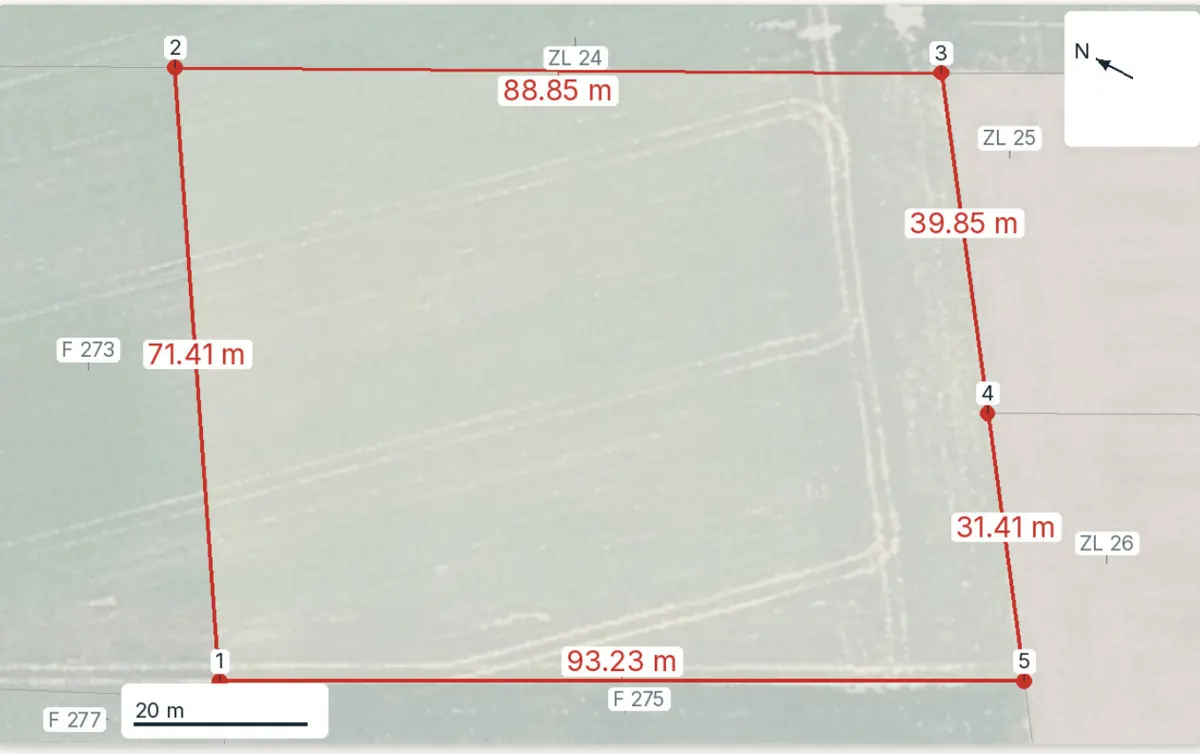
French cadastral reference: how to find a parcel number and read it correctly
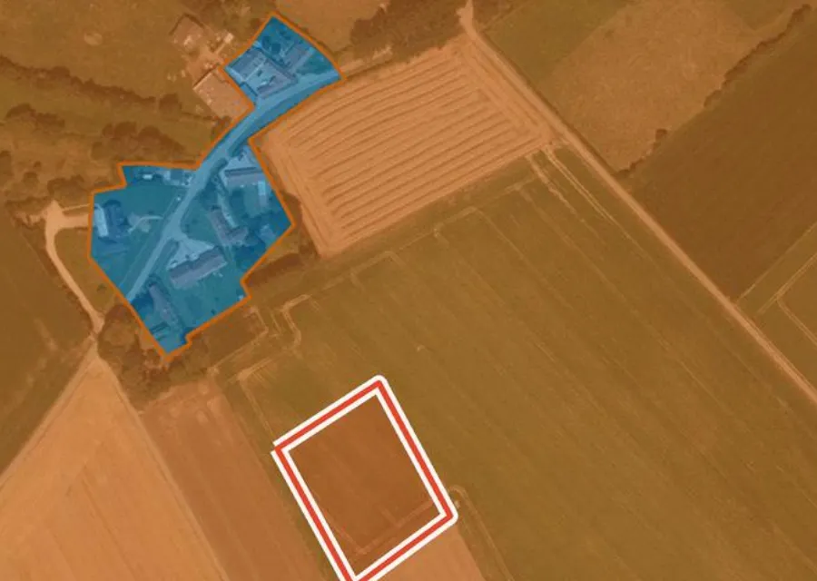
Is a plot buildable in France? How to check the zone, utilities, easements and the official answer
Connecting land to utilities in France: costs, steps and timescales
Non-buildable land in France: price, permitted uses and pitfalls
Compromis de vente for land in France: the clauses to check before you sign
Notary fees when buying land in France: 2026 rates by département, the fee scale and worked examples
Check these points on your parcel
Pick the parcel on the map: outline, PLU zone, hazards, clay, Natura 2000 and heritage are read for it, with source and date. Free check, PDF report for €29 (€39 in French and English).
