Pillar: Buying building land in France
Cadastral area vs real area of a plot in France: why the figures differ and what the law says
The cadastral area of a French plot (the contenance) is not a measurement: the map is a tax document. Across 781 parcels in one commune of the Somme, the median gap with the drawn outline is about 0.8%, but it reaches 5% or more for 75 of them. The exact area comes from a survey by a géomètre-expert (chartered land surveyor).
In brief
- The cadastral area (the contenance) is not a measurement of the land: the French cadastral map is a tax document and does not fix boundaries. The exact area comes from a measurement on site; a bornage by a géomètre-expert (chartered surveyor), often attached to the deed, is what secures it.
- In one commune (municipality) in the Somme whose 781 parcels we analysed, the median gap between the drawn outline and the recorded area is about 0.8%, but 75 parcels reach 5% or more.
- In that commune, smaller parcels show larger relative gaps between the recorded area and the outline: a median of about 2.6% under 1,000 m², about 0.54% above.
- The French Civil Code (articles 1616 to 1623) allows a price reduction or increase when the stated area is wrong. Unless the land was sold “at so much per measure”, the gap must reach one twentieth, judged on the value of the whole, and the contract can exclude the rule; claims must be brought within a year of the contract.
On this page
Three figures, three origins
For one parcel you will often meet two figures online and a third at the surveyor’s. The contenance is the area recorded for the parcel in the cadastre, published in the open data files as the “contenance” field. The outline area is computed from the drawing on the map, by a website or by you with a measuring tool.
Neither of the first two is binding. Service-Public, the official French government information site, states that the cadastral map is a tax document and does not fix property boundaries. The data.gouv.fr cadastre guide calls parcel outlines an imprecise drawing made before aerial photography became common, and adds that only deeds of sale have legal force.
How far apart the figures are
To give an order of magnitude, we took the 781 parcels of Brailly-Cornehotte, a rural commune in the Somme, from the open cadastral data (release of 1 September 2026). For each one we computed the area of the published outline and compared it with the “contenance” field in the same file. This is not a measurement on the ground: the chart compares two cadastral figures with each other.
The drawn outline is larger than the recorded area for 429 parcels and smaller for 352, so the gap runs both ways. It matters more on small parcels, where a few metres of line are a bigger share of the area. Under 1,000 m², 65 of 238 parcels have a gap of 5% or more; above that size, 10 of 543.
For parcel F 274 in the sample, the recorded area is 6,390 m². The outline gives 6,454.53 m² in this calculation, which rounds to 6,455 m², and 6,453.47 m² in the report, which prints 6,453 m². That one square metre comes from the method, not from the ground: our commune-wide calculation measures the area on the Earth’s ellipsoid, from the Etalab file of 1 September 2026; the report measures it flat, in the map projection for that part of France (RGF93 CC50), from the outline published by IGN, the national mapping agency. Either way the outline exceeds the recorded area by about 1%, or about 64 m², which a survey by a géomètre-expert can settle.
What the Civil Code says
Articles 1616 to 1623 of the French Civil Code deal with the area stated in a sale. The seller must deliver the area written in the contract, but the effect of a gap depends on how the sale is worded. The table sets out the rules as written; whether they apply to a given sale is a question for the notaire (the public notary who handles French property sales) or a lawyer.
| Article | Situation | What the text provides |
|---|---|---|
| 1617 | Sale stating the area “at so much per measure” | The buyer can demand the stated quantity; failing that, the seller must accept a proportional price reduction. |
| 1618 | Same case, area larger than stated | The buyer may pay the extra price or withdraw from the contract, if the excess is one twentieth above the stated area. |
| 1619 | All other cases, including the sale of a defined, bounded plot (corps certain et limité) | No increase or reduction unless the difference reaches one twentieth either way, judged on the value of the whole, and unless the contract provides otherwise. |
| 1620 | Price increase due under article 1619 | The buyer chooses between withdrawing and paying the extra, with interest if they have kept the property. |
| 1622 | All of these claims | They must be brought within one year of the contract, or the right is lost. |
Articles 1617 to 1622 of the French Civil Code, version in force consulted on 12 November 2026. Sources: French Civil Code, articles 1616 to 1623 (delivery of the stated area). Accessed 12 November 2026.
Two limits follow from the wording itself. The one-twentieth in article 1619 is judged on the value of everything sold, not on square metres alone, and the contract can rule it out. The one-year period runs “from the day of the contract”, not from the day you find the gap; ask the notaire which date counts when there is both a compromis and a final deed.
Checking the area before you sign
- Note the recorded area and where it comes from. Listing, cadastral extract or draft compromis (the preliminary sale contract): write down the figure and the parcel reference. Cost: nothing. Time: a few minutes. To find the parcel, see searching for a parcel on cadastre.gouv.fr.
- Measure the outline yourself. On cartes.gouv.fr, the “Mesurer une surface” tool shows in real time the area of a shape you draw on the map. Cost: nothing. Time: ten minutes. The result is still a measurement of a drawing.
- Ask whether a bornage exists. For a building plot outside a subdivision, Service-Public says the sale agreement sets out, among other things, the cadastral references and whether a boundary survey has been done. Where one exists, it fixes the limits officially. Cost: nothing; ask the seller or the notaire.
- Have it measured if the area matters. Price per square metre, building near a boundary, a division: a géomètre-expert measures and, if needed, marks the boundaries. Cost and time: see boundary surveys (bornage).
Sources: cartes.gouv.fr: measuring tools; Service-Public: sale agreement for a stand-alone building plot; Service-Public: buying building land outside a subdivision; Service-Public: boundary survey (bornage); Planning Code, art. L115-4 (boundary survey and the sale of building land). Accessed 12 November 2026.
In the report: the parcel’s dimensions
Before the compromis
- Recorded area noted, with the parcel reference and the date.
- Outline measured on cartes.gouv.fr and the gap worked out as a percentage.
- Question asked: is there a bornage, and from when?
- Area clause in the compromis read with the notaire (overall price or per square metre, any clause excluding the rule).
- Géomètre-expert consulted if the price or the project depends on the area or a boundary.
Read next: the order of checks before the compromis.
Keep reading
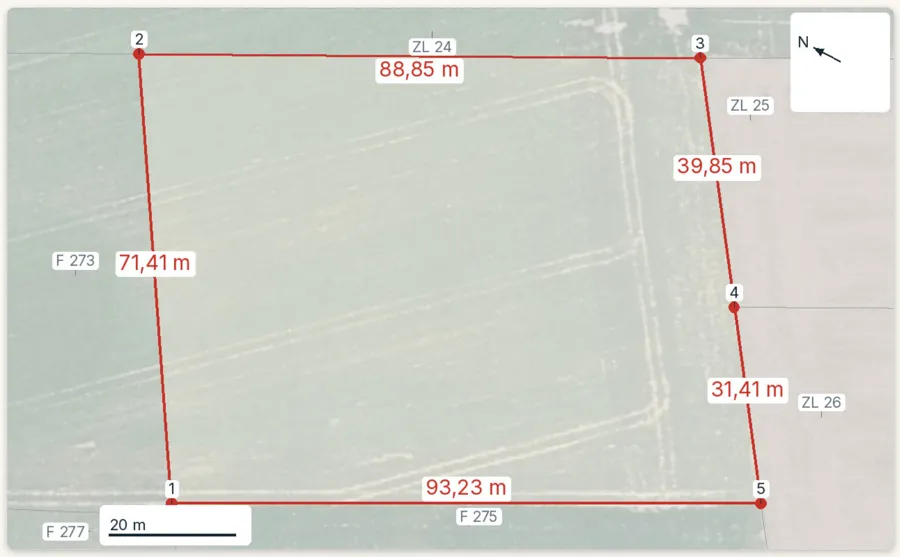
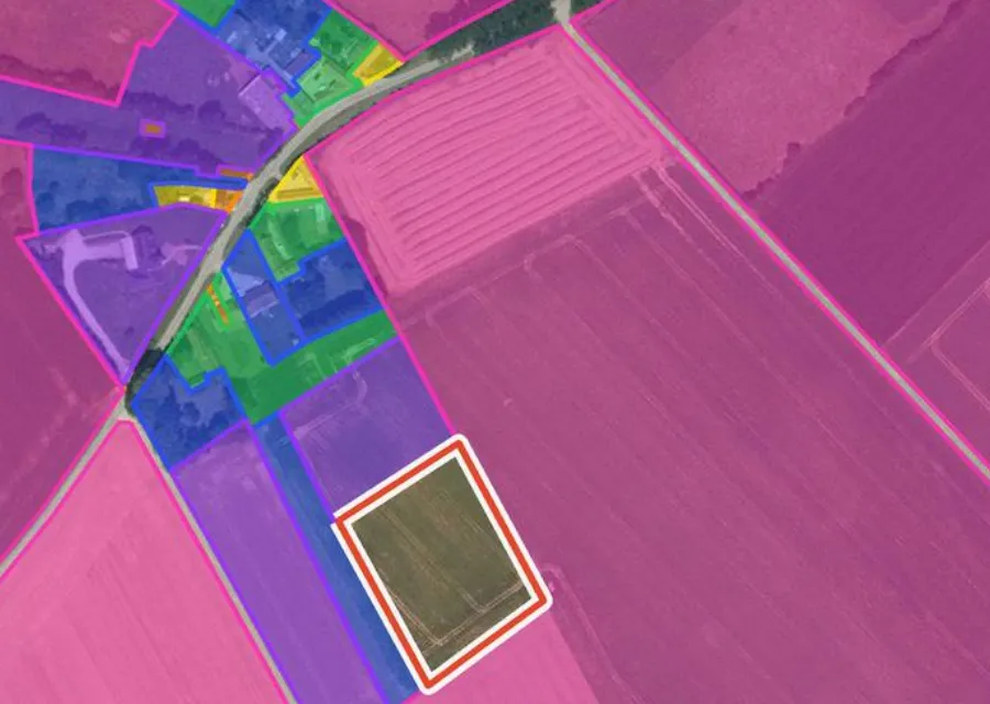
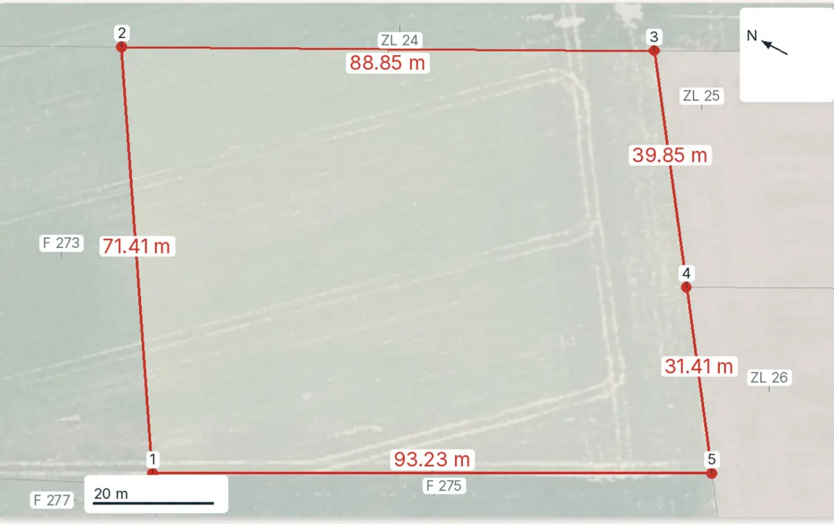
A parcel’s area and sides
Pick the parcel on the map: the report gives its recorded area, the area of its outline, its dimensions and the length of each side, with its planning zone and hazards, in English. Free preview, PDF report for €29 (€39 in French and English).
