Pillar: Buying building land in France
Setbacks from side boundaries and roads: understanding the PLU siting rule in France
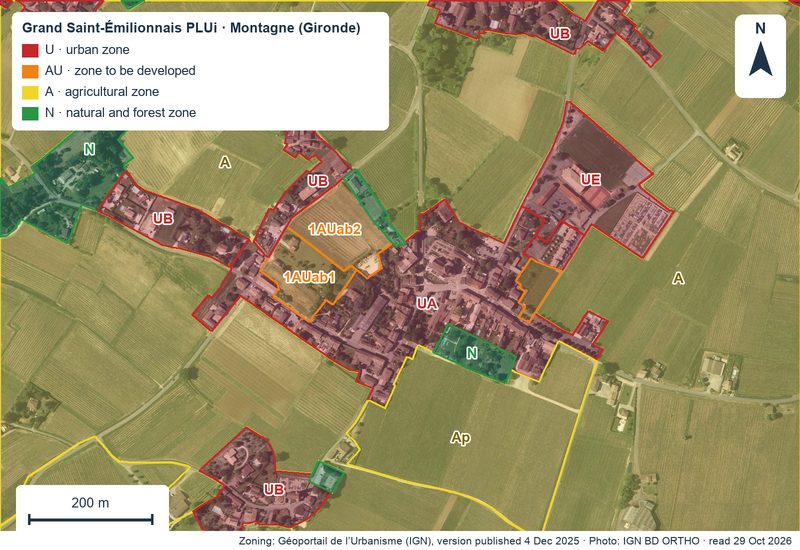
In mainland France, the distance between a building and the neighbour’s boundary or the road is set by the rules of the zone in the PLU, the local land-use plan. With no PLU or equivalent document, the national planning rules require, towards the neighbour, at least half the difference in height with a minimum of 3 m, unless the building stands on the boundary or an exemption is granted. Along a public road, they measure the distance to the road line on the opposite side, which must be at least the full difference in height, save for the special cases in article R111-16. First step: download the zone’s rules from the Géoportail de l’urbanisme, no registration needed.
In brief
- Where the commune (municipality) has a PLU, its local land-use plan, the national formula does not apply: the distance to the neighbour and to the road is whatever the rules of the zone say. In PLUs still governed by former article R123-9, look for the rules matching its items 6° (roads) and 7° (side boundaries).
- With no PLU or equivalent document, the national planning rules (RNU) require every point of a building to be at least half the difference in height away from the boundary, with a minimum of 3 m, unless the building stands on the boundary or an exemption is granted.
- Under the national planning glossary, a boundary with a road or public space is not a side boundary, and a private road open to traffic counts as a road. Your PLU may refine these definitions.
- Departures from the rule (minor adjustment, external insulation up to 30 cm, an exemption for housing) are decided case by case, when the permit or prior declaration is examined.
On this page
Side boundary, road line, setback: the vocabulary
The national planning glossary, a ministry technical sheet dated 27 June 2017, defines limites séparatives (side boundaries) as the lines between the building plot and the adjoining plots. It separates lateral boundaries from the rear boundary, which a PLU may treat differently. Boundaries with a road or a public space are excluded.
On the street side, the key word is alignement, the road line: “the determination by the administrative authority of the limit of the public highway in front of the adjoining properties” (Highways Code, art. L112-1). The code itself uses retrait (setback) for both the road line and side boundaries, so read the whole sentence, not one word.
Pending a ministerial order (arrêté), the ministry recommends these definitions to the authors of PLUs, who may refine them (art. R151-15 and R151-16). So open the definitions page at the front of the rules first.
| Term | Meaning (national glossary) | Effect on measuring |
|---|---|---|
| Side boundary | The line with the adjoining plot or plots | Basis of the side and rear setback rules |
| Road (voie) | Space open to public traffic, with pedestrian space, cycle routes, ditches and banks | Public or private status makes no difference |
| Public space (emprise publique) | Space open to the public that is neither a road nor a facility: square, public garden, railway, canal | Follows the “roads and public spaces” rule |
| Height | From the ridge or top of the parapet down to the lowest point vertically below it, from ground level before works; technical installations excluded | Used for PLU height rules; the RNU H/2 formula instead compares each point of the building with the nearest point of the boundary |
| Outbuilding, extension | Smaller secondary building, detached or attached; adjoining enlargement | The PLU may set separate rules |
Definitions to check before measuring. The PLU may refine them without changing their meaning, for instance how height is measured on sloping ground. Sources: Planning ministry (DHUP), technical sheet 13: national planning glossary, 27 June 2017 (copy from the Doubs prefecture); Planning Code, art. R151-15 and R151-16 (use of the national glossary). Accessed 13 November 2026.
H/2, 3 metres, on the boundary: reading the formula
The national formula is in article R111-17 of the Planning Code: unless the building adjoins the boundary, the horizontal distance from any point of the building to the nearest point of the boundary must be at least half the difference in altitude between those two points, and never less than three metres.
It does not apply where a PLU is in force (art. R111-1) and is checked point by point. On flat ground (TerrainCheck calculation), a 5 m wall needs 2.5 m, raised to the 3 m minimum; an 8 m ridge needs 4 m. A house 8 m wide placed 3 m from the boundary has its ridge 7 m away, so it complies.
A PLU does not have to copy this formula. Its rules “may define” how buildings are sited (art. L151-17 and L151-18), in relation to roads and public spaces, side boundaries and other buildings on the same property (art. R151-39).
Depending on the zone you will meet a fixed distance, a height-based formula, a requirement to build on the boundary or a choice between the two, sometimes with alternative rules linked to adjoining buildings (art. R151-41 and R151-13). A PLU whose procedure began before 1 January 2016, or which has since only been amended, brought into line or given a simplified revision, generally remains governed by former article R123-9 (decree of 28 December 2015, art. 12 VI): look there for the rules under items 6° and 7°.
Private roads and public spaces
For the national glossary, a public road is “the space open to public traffic”; roads “cover all types of roads, whatever their status (public or private)”, provided they are open to traffic.
So the side along a private drive open to traffic may fall under the road rule, not the side-boundary rule. Your PLU may refine this point.
With no PLU, article R111-16 applies along a public road: the horizontal distance from any point of the building to the nearest point of the road line on the opposite side must be at least the difference in altitude between them. For a private road, its actual width stands in for the regulation width. Building on the road line, or in line with existing buildings, may be required. To know exactly where the road line runs, see the certificate of alignment.
Outbuildings, extensions, insulation: what can depart from the rule
The glossary separates an outbuilding (annexe: a smaller secondary building, attached or not) from an extension (an adjoining enlargement of the house). A PLU may set separate rules for them: look for a line on garages and sheds.
- Minor adjustment: possible where the nature of the soil, the shape of the plots or the character of neighbouring buildings makes it necessary (art. L152-3).
- External insulation or projecting sun protection: up to 30 cm beyond the PLU siting rules (art. R152-6); for insulation, the building must have been completed more than two years earlier (art. R152-5). Excluded: historic monuments, their surroundings, protected heritage areas and buildings protected by the PLU (art. L152-5).
- Housing: to further social mix, an exemption from minimum distances to side boundaries is possible for a building mainly used as housing, if it blends in with its surroundings (art. L152-6, 5°), but not below the R111-17 formula (art. R152-4).
- Commune under the RNU: exemptions by reasoned decision, after the mayor’s opinion where the mayor does not issue the permit (art. R111-19). A non-compliant existing building may only receive works that improve compliance or leave its siting and volume unchanged (art. R111-18).
Measuring correctly on the plan
- Find the zone and the rules on the Géoportail de l’urbanisme, the national planning portal (French only): the public site works without registration and lets you download the rules as a PDF. Time: 15 to 30 minutes (TerrainCheck estimate). Failing that, ask the mairie (town hall).
- Read the zone’s siting rule, its cross-references and the definitions: where to measure from, overhangs, which height counts. Cost: none. Time: about an hour (TerrainCheck estimate).
- Plot the distances on the cadastral map: A3 and A4 extracts are free. The map does not fix boundaries: only a bornage (boundary survey) by a géomètre-expert (chartered surveyor) fixes the line. Time: about an hour (TerrainCheck estimate).
- Have the applicable rules confirmed with an information planning certificate (certificat d’urbanisme): free application, one month to process from receipt at the town hall. A permit application filed within 18 months of its issue keeps those rules, except those that protect public safety or health.
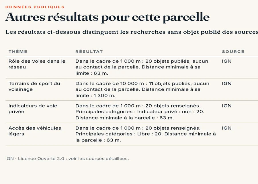
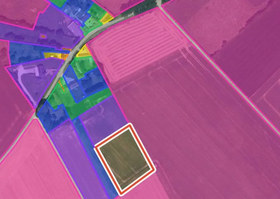
On this plan, the five sides of F 274 touch five parcels: five side boundaries, provided no side in fact runs along a lane open to traffic. The nearest building is about 84 m away according to the cadastre and 86 m in the report, which uses the outlines of IGN, the national mapping agency.
The narrow plot
A TerrainCheck example on flat ground, using the R111-17 formula: on a plot 12 m wide, 5 m walls need 3 m on each side, leaving 6 m of width. Building against one boundary, which the formula allows, leaves 9 m. Under a PLU, redo the sum with the rule of the zone.
Three possible routes, none guaranteed. Plot shape is one of the grounds for a minor adjustment (art. L152-3). In a subdivision or a plot split, the project is assessed as a whole against the PLU unless the rules say otherwise (art. R151-21); see the prior declaration for dividing land. Finally, a neighbouring house built on the boundary may justify an alternative rule, if the PLU provides one.
In the report: buildings around F 274
Before the preliminary contract (compromis): six checks on setbacks
- The plot’s zone and the date of the rules in force are noted.
- The siting rule for roads and side boundaries is copied word for word.
- The definitions page has been read: measuring point, height, overhangs, outbuildings.
- Each side of the plot is classed as road, public space or side boundary.
- The remaining buildable width is calculated, with a margin if the boundaries have not been surveyed.
- An information planning certificate has been applied for or obtained.
Next steps: read the rest of the PLU before buying and go through the checks before the compromis (the binding preliminary contract).
Common questions
How far from the neighbour’s boundary must a house be?
As far as the rules of the PLU zone require. With no PLU or equivalent document, article R111-17 requires half the difference in height, at least 3 m, unless the building stands on the boundary or an exemption is granted.
Can I build right on the boundary?
Under the national rules (RNU), yes: the R111-17 formula does not apply to a building that adjoins the boundary. Under a PLU, only if the zone’s rules allow it.
Does a private drive count as a road?
In the national glossary, yes if it is open to traffic, whatever its status. The PLU may refine that definition.
Is the cadastral map enough to measure a setback?
For a first estimate, yes. The map exists for tax purposes and does not fix boundaries; close to a boundary, only a survey by a géomètre-expert (chartered surveyor) settles them.
Keep reading
See the plot, its neighbours and nearby buildings before you measure
Pick the parcel on the map. The report draws its outline and dimensions, the published planning zone, the neighbouring buildings and their distance from the boundary, each with its source and date and explained in English. It does not replace the PLU rules or a boundary survey. Free check, PDF report for €29 (€39 in French and English).
