Pillar: Buying building land in France
Farmland prices in France: the official 2025 scale per hectare and the price per m²
In 2025 a hectare of arable land or meadow without buildings in metropolitan France, sold free of tenancy, averaged €6,460 according to the Safer group (the rural land agencies), about €0.65 per m²; with a tenant farmer in place, €5,350. For a specific parcel, overseas included, open the indicative scale published in the Journal officiel (the official gazette) of 19 August 2026: it gives a dominant price, a minimum and a maximum for each small farming region.
In brief
- By département (the French county), France excluding the overseas departments: averages from €2,540/ha (Jura) to €16,720/ha (Bouches-du-Rhône) for arable land and meadows of more than 70 ares (7,000 m²) sold free of tenancy, with no farm lease running (Agreste, the Ministry of Agriculture’s statistics service; 2023–2025 average). The overseas departments have separate series.
- Official scale: the Minister of Agriculture’s decision of 10 August 2026, published in the Journal officiel (the French official gazette) on 19 August 2026, gives the 2025 figures by small farming region: a dominant value, a minimum and a maximum in euros per hectare, before taxes and the costs of the deed.
- Per square metre: a hectare is 10,000 m², so divide by 10,000. In Ponthieu (Somme), €8,940/ha is about €0.89/m².
- Limits: the scale is indicative and covers agricultural land without buildings that stays in farming use; sales of under 70 ares of land free of tenancy are left out of the calculation.
- Actual sales: the tax administration’s open DVF files cover the last five years, except Alsace, Moselle and Mayotte; in data.gouv.fr’s geolocated version, group the rows by id_mutation, not by date and price.
On this page
The national benchmarks for 2025
The figures come from the Safer, the regional rural land agencies (sociétés d’aménagement foncier et d’établissement rural), to which every notaire (the public notary who handles French property sales) must give notice of planned sales under the Rural Code. Their federation publishes the prices jointly with Agreste, the statistics service of the Ministry of Agriculture.
For 2025, the Safer group’s national average, calculated for metropolitan France, is €6,460 per hectare for arable land and meadows without buildings sold free of tenancy (terres et prés libres non bâtis), up 0.9% in a year, and €5,350 for the same land sold with a lease in place (terres et prés loués non bâtis), up 2.5%. “Free” means farmed by its owner and not subject to a bail rural, the French farm lease, at the time of sale. “Leased” means farmed by a sitting tenant farmer under such a lease.
Depending on the main type of farming in the commune (the French municipality), land free of tenancy ranges from €4,740/ha in cattle-farming areas to €8,150/ha in field-crop areas.
Sources: Safer group: prices of arable land and meadows in 2025; Safer group: Le prix des terres 2025 (PDF). Accessed 12 November 2026.
By département: from €2,540 to €16,720 a hectare
By département, the reference is the Agreste publication “Valeur vénale des terres en 2025” (June 2026), for France excluding the overseas departments. Its “2025” price is an average of 2023, 2024 and 2025, in 2024 euros, for arable land and meadows of more than 70 ares (7,000 m²) sold free of tenancy.
The 91 départements with a published value run from €2,540/ha in Jura to €16,720/ha in Bouches-du-Rhône, a ratio of roughly 1 to 6.6. The spread stays wide inside a region: in Occitanie, from €4,330/ha in Lozère to €14,360/ha in Gard.
The Journal officiel scale: three figures per small farming region
Article L. 312-4 of the French Rural Code provides that a scale of the average market value of agricultural land is published every year by decision of the Minister of Agriculture. Under that article its figures are one of the elements a court weighs when it sets a land price; the decision that publishes the scale calls it indicative.
The latest decision, dated 10 August 2026 (Journal officiel of 19 August 2026), covers 2025. It has four tables: land free of tenancy, leased land, land in the overseas departments, and vineyards, the last in thousands of euros per hectare. Prices exclude taxes and the costs of the deed.
- Dominant value (dominante): the price most often paid, as observed or estimated. Agreste publishes the same figures under the heading “average price”, an average over three years.
- Minimum: 95% of prices are above this threshold.
- Maximum: 5% of prices are above this threshold.
How to read it: in Ponthieu, the dominant value for land free of tenancy is €8,940/ha, and nine out of ten prices recorded from 2023 to 2025 fall between €3,500 and €19,670/ha. For leased land: €7,650/ha, between €5,000 and €11,300/ha.
The scale groups communes into small farming regions (petites régions agricoles, PRA). Agreste publishes the PRA of every commune: Brailly-Cornehotte, the commune of our sample report, is listed there under Ponthieu.
Sources: Rural Code, article L. 312-4; Agreste: farmland values in 2025, method (PDF); Agreste: small farming regions, list of communes. Accessed 12 November 2026.
Free or leased land: a gap that changes with the département
Agreste defines leased land as arable land and meadows with a lease running at the time of the transaction, and publishes both series side by side.
| Département | Free of tenancy | Leased | Gap, approx. |
|---|---|---|---|
| Nord | €13,560/ha | €7,150/ha | −47% |
| Somme | €10,100/ha | €7,730/ha | −23% |
| Marne | €12,020/ha | €10,410/ha | −13% |
| Seine-Maritime | €11,600/ha | €10,610/ha | −9% |
| Côte-d’Or | €2,870/ha | €2,870/ha | 0% |
| Ardennes | €6,850/ha | €7,110/ha | +4% |
Average prices, 2025 value (2023–2025 average, 2024 euros): arable land and meadows of more than 70 ares sold free of tenancy, and leased arable land and meadows. Agreste, June 2026; gap calculated by TerrainCheck. Sources: Agreste: farmland values in 2025, tables. Accessed 12 November 2026.
The two series do not rest on the same sales: a 70-are threshold for land free of tenancy and, for leased land, a threshold set for each département, below 70 ares. Agreste gives a leased-land price for 58 départements; according to the Safer group, in the southern départements the market in leased land is too thin to publish reference prices.
Before you compare an asking price with the scale, ask in writing whether the land is free or leased, to whom and until when. The rights of the Safer and of the sitting tenant when land is sold are set out in buying farmland in France when you are not a farmer.
Sources: Agreste: farmland values in 2025, method (PDF); Safer group: Le prix des terres 2025 (PDF). Accessed 12 November 2026.
From hectares to square metres: the calculation, step by step
Under the French decree of 3 May 1961 on units of measurement, a hectare is ten thousand square metres and an are one hundred: a price per hectare divided by 10,000 gives a price per square metre.
- Price per m². Dominant value for land free of tenancy in Ponthieu: €8,940 ÷ 10,000 = €0.894, about €0.89/m².
- Price of a parcel. For 2.5 ha, i.e. 25,000 m²: 2.5 × 8,940 = €22,350.
- Range. At the scale’s minimum: 2.5 × 3,500 = €8,750. At its maximum: 2.5 × 19,670 = €49,175.
- The other way round. A listing at €15,000 for 12,000 m²: 15,000 ÷ 12,000 = €1.25/m², i.e. €12,500/ha. That is above the dominant value and inside the range.
Like the scale, these amounts exclude taxes and the costs of the deed. Check the area used as well: the area recorded in the cadastre, the French land register kept for tax purposes, is not a survey (see cadastral area vs real area).
Sources: Decree no. 61-501 of 3 May 1961, units of measurement. Accessed 12 November 2026.
Assessing an asking price in five steps
The times given are our own estimates, not official deadlines.
- Parcel reference and area: on cadastre.gouv.fr (see finding a cadastral reference). Cost: free. Time: a few minutes.
- Small farming region of the commune: in Agreste’s list of communes (an 8 MB XLS file). Cost: free. Time: ten minutes.
- Line of the scale: in the decision on Légifrance, the official legal database, or in Agreste’s tables. Note the dominant value, minimum and maximum, then convert the asking price. Cost: free. Time: a quarter of an hour.
- Sales of arable land and meadows nearby: in the geolocated DVF files on data.gouv.fr. Cost: free. Time: one to two hours; the files are large.
- A valuation of the parcel, if the stakes justify it: the Safer group refers you to the land adviser (conseiller foncier) of the Safer. Cost and time: ask for a quote.
Sources: Agreste: small farming regions, list of communes; Safer group: FAQ. Accessed 12 November 2026.
What moves the price of one parcel
The Safer group states that its prices are statistical averages by area, not valuations: only a valuation of the parcel itself takes in criteria the statistics do not hold (location, access, agronomic value, quality label, upkeep, how active the local market is).
The scale only applies to land that stays in farming: for the planning zone, see how to check whether land is buildable.
Sources: Safer group: price method; Agreste: farmland values in 2025, method (PDF). Accessed 12 November 2026.
Where to find actual sale prices
The Demandes de valeurs foncières (DVF) files of the tax administration (DGFiP), on data.gouv.fr, cover five years of property transactions, except in Alsace, Moselle and Mayotte, and are updated in April and October.
One sale can take up several rows, price repeated, with no sale identifier in the DGFiP file. Date, price and numéro de disposition are not enough: that number only tells apart the transactions within one deed. In the Somme in 2025, two sales of arable land of about 2 ha each, same day, same price, both numbered 1, each come to about €7,000/ha; merged, to about €3,500/ha.
Use data.gouv.fr’s geolocated version and group the rows by id_mutation, keeping rows outside the commune. data.gouv.fr starts a new identifier whenever the date or price changes from one row to the next; it is not stable between deliveries, and two neighbouring transactions with the same date and price can share one. So leave out groups with several disposition numbers, a type other than “Vente” (sale) or a price per hectare far out of line locally.
Keep sales whose rows are all T (arable land) or P (meadow) in the nature de culture column, with no building unit. Add up all their areas, even where a parcel appears twice with the same land type; if a parcel’s total differs from its cadastral area, drop the sale. Then divide the declared value by the total.
Sources: data.gouv.fr: geolocated DVF; DGFiP: guide to the DVF files (PDF). Accessed 12 November 2026.
In the report: the crops declared around the parcel
Before you make an offer
- Small farming region of the commune identified.
- Line of the scale noted: dominant value, minimum, maximum, from the “free” or the “leased” table.
- Asking price converted into €/ha and €/m², then compared with the range.
- Tenancy confirmed in writing: lease, tenant farmer, end date.
- Parcel under 70 ares, with a building or meant for another use: scale read as an order of magnitude.
- Sales of arable land and meadows nearby noted from DVF, grouped by id_mutation.
If the land is meant for building, see the order of checks before the compromis, the preliminary sale contract.
Common questions
What does farmland cost per square metre in France?
About €0.65/m² on average in metropolitan France in 2025 (€6,460/ha, Safer group, land without buildings sold free of tenancy). By département, overseas excluded: about €0.25 to €1.67/m² (€2,540 to €16,720/ha, Agreste, 2023–2025 average).
Does the Journal officiel scale bind the seller?
The decision calls it indicative. Under article L. 312-4 of the French Rural Code, its figures are one element a court takes into account when it sets a land price.
Does the scale apply to a 2,000 m² plot?
Prices for land free of tenancy are computed from sales of at least 70 ares, i.e. 7,000 m², of land without buildings that stays in farming use. A 2,000 m² parcel is outside that scope: the scale then gives no more than an order of magnitude.
Keep reading
What surrounds a farm parcel
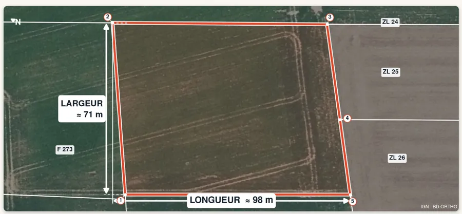
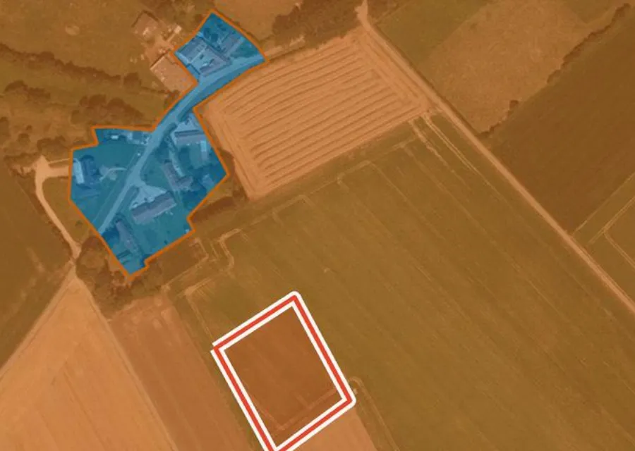
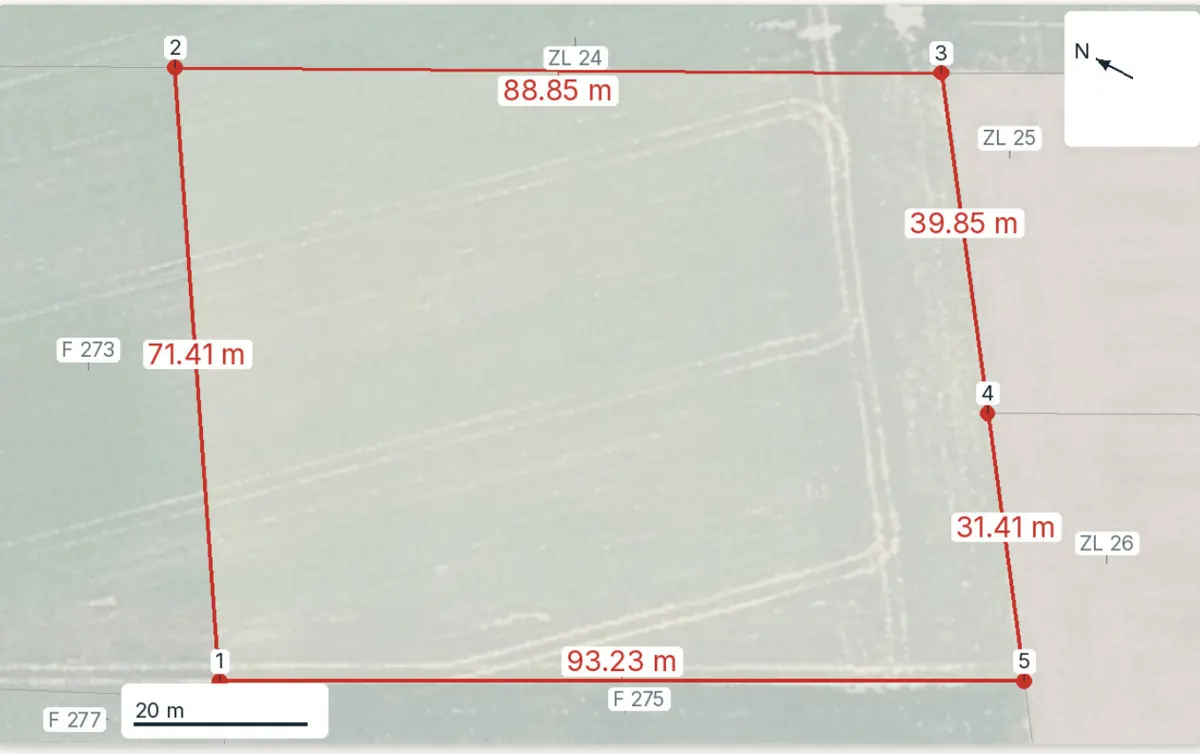
Pick the parcel on the map. The report shows the crops declared around it, its planning zone, natural hazards, dimensions and cadastral area, each with its source and date and explained in English. It does not value the parcel and does not name the owner. Free preview, PDF report for €29 (€39 in French and English).
