Pillar: Buying building land in France
Géorisques: how to read the hazard report for a French plot and what it leaves out
A Géorisques report gives, for information only, one level per hazard at the address and another for the commune: a label such as “Existant” points to a map or a plan that you still have to open, and the report is not the risk statement the seller owes. Start with a parcel search on georisques.gouv.fr.
In brief
- On georisques.gouv.fr, enter the address or the cadastral parcel (prefix, section, number), click “Accéder à mes risques” (see my risks), then “Télécharger le rapport de risque”. The report is free and comes as a dated PDF, in French.
- Each hazard gets two labels: at the address and in the commune (the French municipality). According to the Géorisques help page, “Existant” (existing) flags regulatory zoning that includes the address; yet the report also shows it for maps with no legal force, such as groundwater flooding in our example. So the label alone does not tell you whether a rule applies.
- The report is not the seller’s risk statement (ERP): it lists more hazards, including expert inventories with no legal force. Where the property lies in a hazard area listed by law, the ERP must be less than 6 months old and attached to the preliminary contract or, failing that, to the deed.
- Its limits: it only names Seveso sites and plants handling dangerous substances, and a clay or earthquake level replaces neither a soil study nor a site visit.
On this page
Getting the report for an address or a parcel
Géorisques is the French state’s public hazard website, run by the Ministry for Ecological Transition with the BRGM, the national geological survey. For a building plot, search by parcel: bare land may have no street address, and a point placed on a village street can land on the house next door.
- Find the cadastral reference. It appears in the listing, in the preliminary contract or on the online cadastral map; a reference such as 000-AB-1234 combines prefix, section and number. Where to find it and how it is built.
- Search on Géorisques. On the home page, choose “recherchez via une parcelle cadastrale”: commune or postcode, then prefix, section and number from drop-down lists. Free, no account needed.
- Read the tiles, then download the PDF. “Accéder à mes risques” shows one tile per hazard; “Télécharger le rapport de risque” produces the document. Ours, for a point in Brailly-Cornehotte, ran to 9 pages and was stamped “Édité le 12/11/2026”.
- Open the interactive map to see the outlines. Click “Couches” (layers), the eye icon to switch on a whole theme, then a coloured area to open its record. This is where you see whether a zone boundary crosses the plot.
- Keep the PDF with its date. Levels change as inventories, zoning and decrees are updated. Run the report again before the preliminary contract and before completion.
Reading the two columns: “à mon adresse” and “sur ma commune”
The summary page (page 2 of ours) lines up the hazards found, each with two labels. The left one is about the point you searched, the right one about the whole commune. A plot can show “Pas de risque connu” (no known risk) at the address and “Concerné” (affected) for the commune: a site is recorded in the commune, but not at that spot.
| Label | What Géorisques says it means | What to do with it |
|---|---|---|
| Existant | On the help page: a document with regulatory zoning shows the natural hazard in the commune and the zone includes the address. In the report, the label also appears for data with no legal force (groundwater flooding in ours). | Identify the source on the detail page. For a risk prevention plan or a public easement, read the zone and its rules: any duty comes from that document, not from the label. |
| Inconnu | A document without zoning (a natural disaster decree, for example) shows the hazard in the commune; the level at the address cannot be determined. | Ask the mairie (town hall) where it happened; ask the seller and the neighbours. |
| Pas de risque connu | Regulatory zoning exists in the commune but does not include the address, or the hazard is absent from the whole commune. | Check on the map how far the nearest zone is. |
| Concerné / Non concerné | For industrial hazards: a point hazard is recorded at the address (polluted site, classified installation, pipeline), or not. | Open the record of the site or plant. |
| Faible, Modéré, Important | Low, moderate, high: levels specific to one hazard (earthquake, radon, clay). | Read the detail page: it gives the numeric level (1/5, 2/3…) and the duties attached to it. |
The report’s labels, from the Géorisques help page updated on 19 December 2024. They are for information and can change as knowledge improves. Sources: Géorisques: what the risk levels in the report mean; Géorisques: why the report and the ERRIAL list different risks. Accessed 12 November 2026.
Section by section: what the detail pages say
After the summary, each hazard has its own page: a short text about the phenomenon, then “Informations détaillées” for the address. That part is what matters to a buyer.
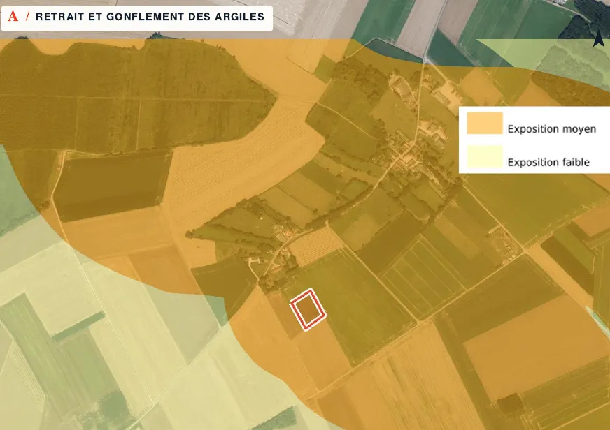
- Clay shrink-swell. A level out of 3 (2/3 in our example, shown as “Modéré”) and a note that building rules apply. In a medium or high zone a soil study comes into play: see the clay map and what it means for building.
- Earthquake. A zone from 1 to 5. The report states that from level 2, rules apply to building work; our point is in zone 1.
- Radon. A potential from 1 to 3 for the commune. Level 3 brings recommendations and a duty to inform the buyer.
- Groundwater flooding. An exposure class and a reliability note. Ours read “zones potentially prone to cellar flooding”, medium reliability: an order of magnitude, not a measurement on the plot. It is shown as “Existant” even though this map has no legal force.
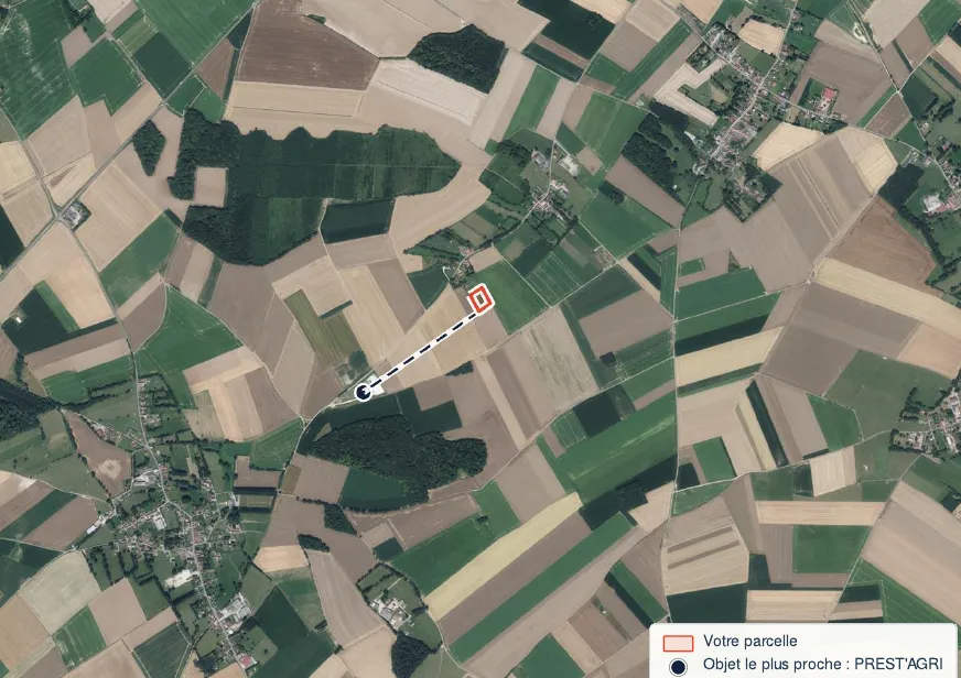
- Soil pollution and classified sites. The report only names Seveso sites and those under headings 4xxx (dangerous substances). A pig unit or a quarry next door can be missing: how to look up classified installations around a plot.
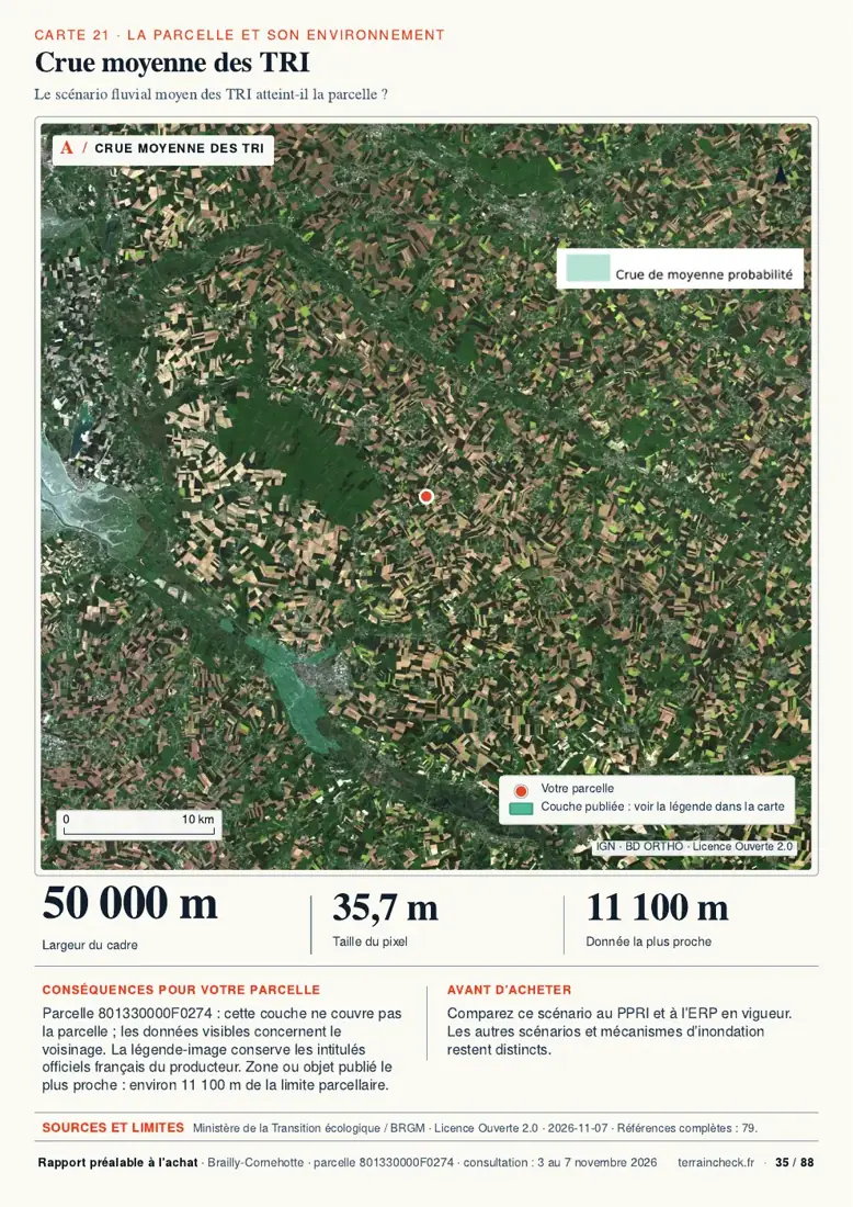
- Flooding. If a prevention plan covers the area, the report says so. Reading the PPRI (flood risk prevention plan) and its rules is covered in our flood-risk guide.
The commune’s natural disaster decrees (arrêtés de catastrophe naturelle, or CatNat) appear in the detail pages, with their reference number, the start date of the event and the date of publication in the Journal officiel, the official gazette.
Géorisques report, ERRIAL, risk statement: three different things
The report you download is open to anyone. The état des risques (ERP, risk statement) is a sale document: the seller fills it in, with the ERRIAL tool on Géorisques or by another means, and hands it to the buyer. If anything in it is unclear, ask the notaire, the public lawyer who handles the sale.
| Document | Who produces it | What it contains | Weight in the purchase |
|---|---|---|---|
| Géorisques risk report | You, online | Regulatory data plus expert inventories (BRGM), some with no legal force | Information only; no duty attached |
| ERRIAL | The seller, online | Regulated hazards affecting the property. The tool shows them at its own thresholds: flooding if the property is inside regulatory zoning, earthquake from 2/5, radon from 2/3, clay always, a polluted or potentially polluted site within 500 m, noise at levels A to D | Prepares the ERP; its display thresholds are not the cases where an ERP is compulsory |
| Risk statement (ERP) | The seller, via ERRIAL or any complete equivalent | Zones concerned, extracts of the prevention plans, natural disaster decrees that led to an insurance payout for the property | Compulsory in the areas listed under this table; handed over at the first visit if there is one, attached to the preliminary contract or deed, dated and signed |
The thresholds in the ERRIAL row are those at which the tool displays a hazard, according to the Géorisques help page. They do not define the duty to supply an ERP, which is set by article L125-5 of the Environment Code. A hazard marked “Existant” in the report can be missing from the ERRIAL when it comes from non-regulatory data. Sources: Géorisques: why the report and the ERRIAL list different risks; Géorisques: an “Existant” risk missing from the ERRIAL (trigger thresholds); Service-Public: property survey, risk statement (checked 28/09/2026); Environment Code, art. L125-5. Accessed 12 November 2026.
For a sale, the ERP is required for land, buildable or not, as soon as it lies in one of the areas listed by law: an approved natural, technological or mining risk prevention plan (or the study area of one that has been ordered), seismic zone 2 to 5, radon potential 3, coastal erosion zone, or an area where brush clearance is compulsory. It must be less than 6 months old and updated if its content is no longer accurate at signature.
Two gaps: ERRIAL shows radon from 2/3, whereas only level 3 is on that list; and it flags a polluted site within 500 m, a test that is not on the list published by Service-Public.
What the report does not tell you
Géorisques says so on page one: the report is “délivré à titre informatif” (for information) and gives “une vision simplifiée” (a simplified view). The levels come from published maps and inventories, not from a visit to your plot.
- A point is not a parcel: on a large plot, a zone boundary can run through the middle. The interactive map shows it; the summary does not.
- “Pas de risque connu” means no recorded regulatory zoning includes the address, or the hazard is absent from the commune. Something never mapped, such as old backfill, will not appear.
- The report says nothing about the ground under your foundations; only a geotechnical study does.
In our report: the hazards published for the parcel
Before the preliminary contract: the Géorisques checklist
- Géorisques report downloaded by parcel, with its issue date.
- Interactive map checked: zone boundaries against the outline of the plot.
- Any “Existant” or “Inconnu” label: matching document or decree identified.
- Medium or high clay exposure: geotechnical study requested from the seller.
- Classified installations searched in the full database, not only in the report.
- Seller’s ERP less than 6 months old, compared with the report, attached to the contract.
Read next: the order of checks before the compromis (the preliminary sale contract) and the planning certificate, which lists the easements tied to hazards.
Keep reading
Underground cavities and old quarries under a plot in France: how to check before buying
Flood risk when buying land in France: Géorisques, PPRI and the risk statement
Clay shrink-swell hazard in France: reading the exposure map and what it means for building
Classified sites (ICPE) near a plot in France, farms included: where to find them and what they mean
Hazards read on the outline of your parcel
Select the parcel on the map: the report covers clay, flooding, seismic zone, radon, groundwater and classified sites over its outline, with the distance to the nearest zone and the source and date of each item, explained in English. Free preview, PDF report for €29 (€39 in French and English).
