Pillar: Buying building land in France
Underground cavities and old quarries under a plot in France: how to check before buying
In mainland France, known underground cavities can be looked up free of charge on Géorisques (the BRGM’s national Cavités database), one commune (municipality) at a time; for Paris and départements (counties) 78, 91, 92, 93, 94 and 95 you ask the Inspection générale des carrières or the service interdépartemental des cavités instead. First step before the compromis (preliminary contract): open the records for the commune, then ask the town hall in writing whether a cavity has been reported.
In brief
- In its 2023 edition of key figures on natural hazards, the SDES, the environment ministry’s statistics office, counted 173,800 cavities on record (quarries, chalk pits, cellars, civil and military works, natural caves), from the national Cavités database kept by the BRGM, the French geological survey (2022 data), in a scope that leaves out Paris, the inner-ring départements around it, Yvelines, Martinique, French Guiana and Mayotte. It is not a live count: Géorisques also states that “over 500,000 cavities” are on record, mines excluded. A cavity missing from the database may still be in the ground.
- Anyone who knows of a cavity, or a sign of one, whose collapse could harm people or property must tell the mayor (article L563-6 of the Environment Code). Ask at the mairie (town hall) what has been reported.
- The risk statement (état des risques) the seller hands over: the list of zones in article L125-5 does not mention cavities. They come in through a natural-hazard or mining prevention plan, prescribed or approved, that covers the land.
- To find out what lies under the plot, a survey firm works in stages: records, a survey if the cavity can be entered, geophysics, boreholes. The price is set by quotation.
On this page
What kind of void can lie under a plot
Géorisques, the government hazards website, separates natural cavities, dissolved by water in limestone, chalk or gypsum, from man-made ones. In gypsum a cavity can change on a scale of decades. Mines are outside this inventory: they come under the Mining Code. An underground quarry still being worked is regulated as a classified installation (ICPE).
| Type | Size, depth | Main areas |
|---|---|---|
| Underground quarry | Up to several tens of hectares; usually 5 to 50 m deep | Île-de-France (about 4,700 ha undermined), Nord (2,000 ha), Gironde (2,000 ha), Normandy |
| Marnière (chalk pit dug from a shaft) | A shaft with galleries | Normandy: about 120,000 according to state services |
| Cellar, cave dwelling | Close to the surface, often one or two rooms | Loire Valley (several thousand), built-up areas |
| Military works (saps, galleries) | Galleries and underground rooms | Hauts-de-France: several thousand First World War saps |
| Natural cavity (karst) | From a narrow passage to a chamber tens of metres high | Jura, Alps, Pyrenees, Causses; gypsum around Paris |
The main types of cavity and where they are found, according to Géorisques. A marnière was dug to extract chalk to spread on fields. Sources: Géorisques: expert file on underground cavities; SDES: Key figures on natural hazards, 2023 edition, underground cavities. Accessed 13 November 2026.
At the surface, subsidence forms a shallow bowl, slowly and without breaking the ground. A fontis is a sudden crater, from under a metre to a few tens of metres across, when the roof of the cavity fails and the void works its way up. A filled-in marnière shaft can also reopen as its fill slips into the empty galleries. Deaths are very rare, but undermined land can turn out to be unbuildable without strengthening works.
Where to look before you sign
The search comes down to four free steps. The texts cited set no deadline for the town hall or the prefecture to reply, so ask in writing from your first visit.
- Géorisques, underground cavities section. On the data page (in French), pick the département and the commune (the municipality), then open the records of cavities near the plot: type, place name, how the opening was located. Free. Time: 15 to 30 minutes (TerrainCheck estimate).
- Paris and six Île-de-France départements. For 75, 92, 93 and 94, ask the Inspection générale des carrières; for 78, 91 and 95, the service interdépartemental des cavités. Géorisques does not show these areas.
- The town hall. Ask whether a cavity or a sign of one has been reported to the mayor, whether the commune has mapped its cavities and whether a risk prevention plan covers the plot. Free.
- The geology. The BRGM’s InfoTerre website has been shut since 21 October 2026: only its map viewer and search remain, without the records or reports. Free.
What the law and the risk statement say
Article L563-6 of the Environment Code sets three rules. Communes, or the groups of communes responsible for planning, map cavities and marnières that could make the ground collapse where needed, so not every commune has a map. Anyone who knows of a cavity or marnière dangerous to people or property, or of a sign that one exists, informs the mayor, who passes the information on without delay to the prefect and to the head of the département council.
Spreading plainly false, lying or deliberately misleading information about a cavity is punishable by a fine of €30,000. The prefect publishes a list of communes where a cavity has been reported or is presumed on real and serious grounds.
The risk statement follows article L125-5, whose list of zones does not mention cavities: they come in through a natural-hazard or mining prevention plan that covers them. A natural risk prevention plan (PPRN), the prefect’s responsibility, is a public-interest easement that sets building constraints zone by zone. For a built property, the seller must also list natural disaster claims paid out while they owned it, or that they were told about in an earlier risk statement.
Sources: Légifrance: Environment Code, article L563-6 (in force); Légifrance: Environment Code, article L125-5 (in force); Géorisques: expert file on underground cavities. Accessed 13 November 2026.
Having a cavity investigated: stages, cost, time
When there is a doubt (a cavity nearby, chalk or gypsum ground, a visible hollow, an old well or shaft), Géorisques sets out four successive phases, taken more or less far depending on what is at stake and on the type and size of the cavities.
- Desk study: a geologist’s opinion on the ground, then a search of inventories, archives and aerial photographs, sometimes asking local people.
- Survey of the cavity, if it is known and can be entered: by a géomètre-expert (chartered surveyor), by measurement on site or by a caver.
- Geophysics (microgravity, seismic, electrical and electromagnetic methods) by a qualified firm; the method depends on the expected size, depth and infill.
- Boreholes on the anomalies, destructive or cored, sometimes with a camera lowered into the void.
There is no official price list: each phase is quoted, and the price depends on the area studied, the method, the number of boreholes and access to the land. No timescale is set by the texts; ask the firm for a written schedule with its quotation. This work goes alongside the G1 or G2 geotechnical study for the house, which has its own rules.
Sources: Géorisques: expert file on underground cavities. Accessed 13 November 2026.
Building permit and insurance
A permit may be refused, or granted with special conditions, if the project would harm public safety because of its location (article R111-2 of the Planning Code). This article also applies in communes with a local plan (PLU). Inside a PPRN zone, the plan’s rules apply on top. Géorisques lists the possible treatments: monitoring, strengthening, removing the voids, and passive protection such as foundation piles.
On insurance, the natural disaster cover included in a French property damage policy extends to subsidence caused by underground cavities and marnières (article L125-1 of the Insurance Code). The cover does not apply to every problem linked to a cavity. It covers direct material damage that could not otherwise be insured and whose decisive cause was the abnormal intensity of a natural agent, where the usual precautions could not prevent it or could not be taken; an interministerial order must record a natural disaster for the commune, the period and the type of damage; and for a man-made cavity, damage caused by past or current mining is excluded. The cover applies to the property insured under the policy, and the insurer assesses the claim against these conditions.
Sources: Légifrance: Planning Code, article R111-2; Légifrance: Planning Code, article R111-1; Légifrance: Insurance Code, article L125-1 (in force). Accessed 13 November 2026.
If a cavity turns up after the purchase
- Keep people away: fence off the hole, do not go in, keep vehicles and children clear. Straight away.
- Tell the mayor in writing, with photos and the location (article L563-6). Free; no reply deadline in the text.
- Notify your insurer if an insured building is affected, as soon as you become aware of the damage; for a natural disaster claim, it must reach the insurer no later than 30 days after the recognition order is published (Service-Public). Free.
- Have the investigation done (phases above) before any filling: a plug placed on a shaft can give way again.
The natural hazard prevention fund can, under conditions, help pay for investigating and filling cavities that seriously threaten human life, or for buying an exposed property by agreement (article L561-3). Any claim against the seller is a matter for the notaire or a lawyer.
Sources: Légifrance: Environment Code, article L563-6 (in force); Légifrance: Insurance Code, article L125-1 (in force); Légifrance: Environment Code, article L561-3 (in force). Accessed 13 November 2026.
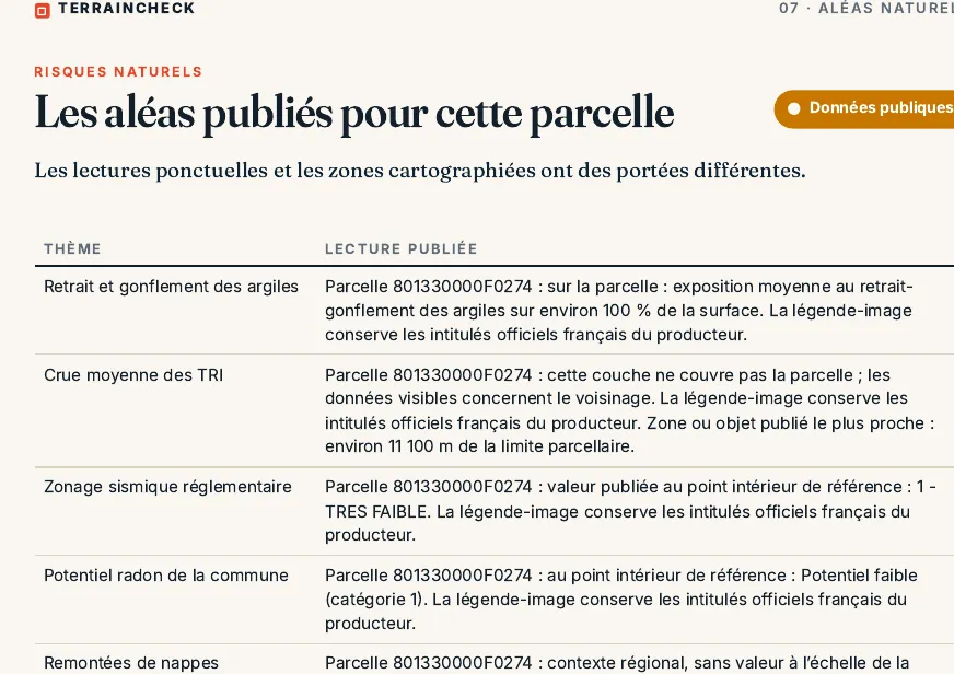
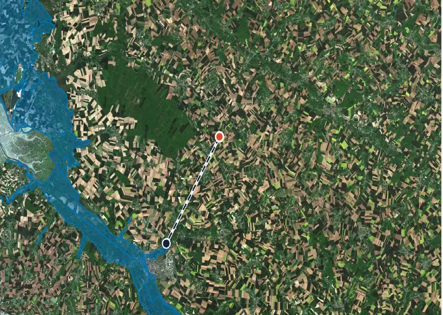
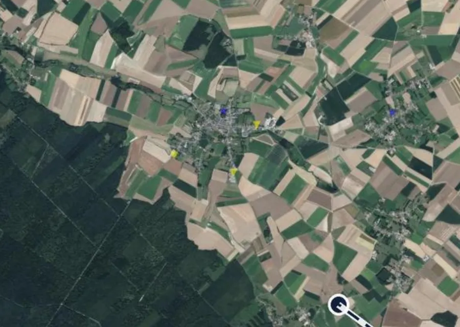
In the report: cavities around F 274
Before the compromis: seven checks
- Géorisques records for the commune and the neighbouring communes read and saved.
- In 75, 78, 91, 92, 93, 94 or 95: a reply from the Inspection générale des carrières or the service interdépartemental des cavités.
- Written question to the town hall: cavity or sign reported, cavity map, prevention plan.
- Risk statement read: PPRN or mining plan zone mentioned or not.
- Viewing: hollow, hole, old shaft, cracks in nearby walls noted and photographed.
- Chalk, gypsum or limestone underground: desk study quoted.
- Notaire told about the doubt before the compromis is drafted.
Read next: what to look at on a viewing and the order of checks before the compromis.
Common questions
How can I tell whether there is a marnière under the plot?
Check the Géorisques cavity records for the commune, ask the town hall whether a cavity or a sign of one has been reported, and look at the geological map. No database is complete: if in doubt, commission a desk study and then, if needed, geophysics and boreholes, all by quotation.
Does the seller have to report a cavity they know about?
Article L563-6 of the Environment Code requires anyone who knows of a cavity, or a sign of one, dangerous to people or property to inform the mayor. What the seller had to tell you, and any claim, are questions for the notaire.
Does insurance cover a cavity collapse?
The natural disaster cover in French property damage policies can include subsidence caused by underground cavities and marnières, under the conditions of article L125-1 of the Insurance Code: direct material damage caused by a natural agent of abnormal intensity, and an interministerial order recognising the disaster. Damage caused by mining is excluded.
Why does Géorisques show nothing for Paris?
For départements 75, 78, 91, 92, 93, 94 and 95, cavity data are not on Géorisques. They are held by the Inspection générale des carrières (75, 92, 93, 94) or the service interdépartemental des cavités (78, 91, 95).
Keep reading
Géorisques: how to read the hazard report for a French plot and what it leaves out
France’s risk statement (ERP) for land: what the seller must give you, the six-month rule and what it leaves out
Soil studies in France (G1, G2, G5): when they are required, who pays and what they contain
See the published cavities around a parcel
Pick the parcel on the map. The report plots the national cavity inventory around it, with the distance to the nearest, then sets out the PLU zone, other hazards, clay soils and recent sales nearby, each with its source and date and explained in English. It is not a soil survey. Free check, PDF report for €29 (€39 in French and English).
