Pillar: Buying building land in France
Document d’arpentage in France: what it is, who draws it up and how new parcels get their numbers
If you buy part of a plot in France, the new boundary must first be recorded in a document d’arpentage (DA): a survey document drawn up by an approved surveyor at the parties’ expense and checked by the cadastre office before the deed is drafted. The rule comes from a decree of 30 April 1955 and applies in communes under the conservation cadastrale system, which keeps the land tax map up to date. When it checks the DA, the cadastre office gives the new parcels their numbers; they come into force once the deed is registered. First step: ask a géomètre-expert (chartered land surveyor) for a quote.
In brief
- Who draws it up: when part of a parcel is sold, given away or shared out, in practice a géomètre-expert (chartered land surveyor registered with the professional Order). Other surveyors approved by the tax administration (DGFiP) are limited to divisions or mergers with no deed to follow.
- What it contains: form no. 6463-N-SD (the parcels before and after) and a map extract with the new boundary in red, signed by the owners, on paper or digitally.
- Timescales in the tax guidance: the map extract is supplied free to the surveyor within five clear days of the cadastre office receiving the order; the cadastre office checks the document and numbers the new parcels within five clear days of receiving the complete file. The surveyor’s own work has no deadline in these texts.
- What it does not do: it records the parties’ agreement on the new line, but it is not a bornage (formal boundary survey). A bornage, agreed with the neighbours or ordered by a court, is what fixes the boundary for good.
- Price: no fee is set in the regulations; the parties pay, on the surveyor’s quote.
On this page
What a document d’arpentage records
The French cadastre (the land tax map) divides every commune (municipality) into numbered parcels. In communes covered by the conservation cadastrale system, which keeps the cadastre up to date after every change, article 25 of the decree of 30 April 1955 requires that any change in a property boundary, “in particular following a division, a subdivision or a partition”, is recorded in a document d’arpentage (DA, a cadastral survey document) drawn up at the parties’ expense and certified by them.
The DA goes to the cadastre office before the deed is drafted, so that the office can check it and number the new parcels. It is a procès-verbal de délimitation (dimensioned plan), required where the map has been redrawn or the changed part has been surveyed or formally bounded, or otherwise a simple sketch.
When it is needed
- A sale, gift or partition that covers only part of a parcel: the deed creates a new parcel.
- Registration of a bornage or survey report.
- A division or merger of parcels requested by the owner with no deed, for instance before putting a plot on the market.
It is not needed to register a mortgage or an easement, rights that do not create a parcel. Plot subdivisions (lotissements), compulsory purchase and land consolidation follow their own cadastral procedures.
Why the notaire insists on it
A deed that divides land must describe the property as it stood before the division and each new parcel (article 7 of the decree of 4 January 1955). The text leaves out two cases: a lotissement carried out under the subdivision rules, and communes whose cadastre has not been renewed. Without a number for the part you are buying, there is no deed fit for registration: the notaire (the public official who draws up and registers the deed) waits for the checked DA and attaches the cadastre’s map extract to the deed sent to the land registry (service de la publicité foncière).
Who may draw up a document d’arpentage
Article 30 of the 1955 decree reserves the DA to approved persons. The DGFiP guidance (BOFiP, the official tax doctrine) sets out two groups.
- Approved automatically: géomètres-experts on the Order’s register, and surveyors from other EU or EEA countries who have filed a declaration with the Order to work in France.
- Approved on application: qualified, experienced survey technicians, former cadastre staff, retired géomètres-experts. Their DA cannot go with a notarial or administrative deed: only a division or merger with no deed to follow, or recording an existing survey or bornage on the map without moving a boundary.
So if the DA goes with the sale of part of a plot, it is work for a géomètre-expert (the rules add a few EU professionals and public-sector staff). The Act of 7 May 1946 reserves to them the work that fixes the limits of land, including division and boundary plans.
The steps, from quote to registration
- Quote and instructions. Choose a géomètre-expert and accept the quote. Cost: their fees. Time: no deadline in the texts cited; ask for a delivery date in writing.
- Cadastre papers. The surveyor orders form no. 6463-N-SD and a map extract (form no. 6461-N-SD) from the cadastre office, or downloads the map for a digital DA. Cost: free. Time: at most five clear days from receipt of the order by the cadastre office.
- Fieldwork and signatures. The surveyor measures, works out the areas and has the owners or their representative sign the form and the map extract. Time: depends on the site and the parties.
- Check and numbering. The file goes to the cadastre office, which checks it, accepts or rejects it, and numbers the new parcels. Time: five clear days from receipt of the complete file, according to the guidance.
- Deed and registration. The notaire names the new parcels in the deed, asks for all divisions in the DA to be registered and attaches the checked map extract. Once the land registry has registered the deed, the cadastre activates the new parcels.
Where the deed states that the matter is urgent, a provisional sketch may be used, provided the full plan is filed within two months of the deed; otherwise the cadastre draws it up itself and recovers the cost.
How the cadastre numbers the new parcels
On the DA, the surveyor gives the future parcels provisional labels. The cadastre’s checker assigns the real numbers and writes them on the map extract, which they sign and return to the surveyor. That extract is the one the notaire attaches to the deed.
The original parcel becomes the mother parcel, the new ones its daughter parcels. The new numbers only come into force when the cadastre validates the change, which happens once the deed has been registered: the daughters then become active and the mother is cancelled. Buildings are placed automatically on the daughter with the lowest number: after dividing a plot with a house on it, check on an ownership extract (relevé de propriété) that the house is attached to the right parcel.
With no deed, the cadastre registers the division itself through report no. 6493-N, and the surveyor tells the owners their new numbers.
Survey document, bornage, division plan: four different papers
The DA serves the cadastre and the land registry first. For the DGFiP, setting a boundary is “essentially a private matter” for the parties to settle. Where your line with the neighbour lies is what a bornage tells you.
| Document | Drawn up by | Purpose | Fixes the line? |
|---|---|---|---|
| Document d’arpentage | Approved surveyor; a géomètre-expert if a deed follows | Update the cadastral map and number the new parcels | No: it records the signatories’ agreement |
| Procès-verbal de bornage | Géomètre-expert, with the neighbours; a court if they disagree | Fix the line with the neighbour and set boundary markers | Yes, for good |
| Plan de division or plan d’arpentage (division or survey plan) | Géomètre-expert | Draw and measure the division (1946 Act); a copy attached to the DA lets the cadastre record a surveyed area | Not on its own |
| Déclaration préalable de division | The owner, at the mairie (town hall) | Planning consent for the division, where the rules require it | No: a planning matter |
Four documents you meet when land is divided. A DA can record an existing bornage on the map, but does not replace it. Sources: BOFiP, BOI-CAD-MAJ-10: survey documents (documents d’arpentage); BOFiP, BOI-CAD-MAJ-10-10: general rules, who may draw them up; Service-Public: boundary surveys (bornage); Act no. 46-942 of 7 May 1946 creating the Order of géomètres-experts, art. 1. Accessed 12 November 2026.
Markers put in the ground without a joint boundary survey with the neighbours are not a bornage, and the cadastre does not show them on the map. More on boundary surveys and their cost: bornage, cost and who pays. On planning consent: prior declaration for a land division.
How many survey documents a year
According to the DGFiP files, about 152,000 survey documents were validated in 2025, against about 193,000 in 2023, the highest figure for 2015–2025. Almost all are now digital: about 98% in 2025, against about 85% in 2015.
The date counted is the validation date at the cadastre, which follows registration of the deed, so a year’s figure does not track that year’s sales exactly.
What a document d’arpentage costs
Neither the 1955 decree nor the tax guidance sets a fee: the DA is drawn up “at the expense and on the initiative of the parties”. The form and the map extract are supplied to the surveyor free of charge. The price is therefore the géomètre-expert’s quote.
The quote depends on what has to be measured: a sketch takes less work than a dimensioned plan, a prior bornage is a separate job, and the number of lots counts. Ask for a quote that lists bornage, DA and plans for the mairie separately.
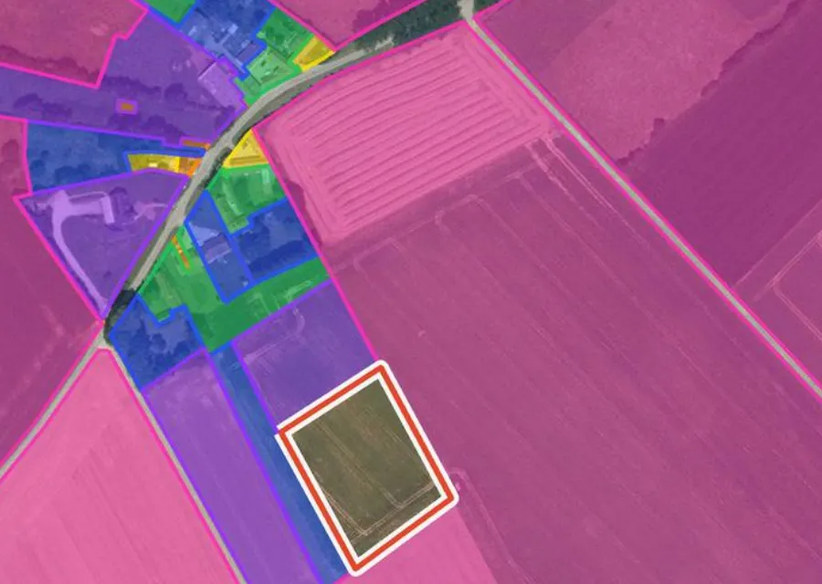
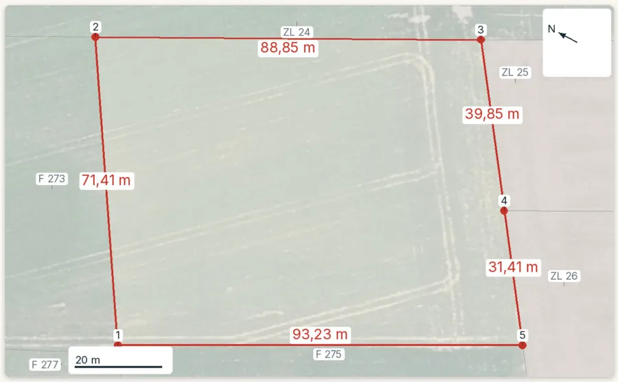
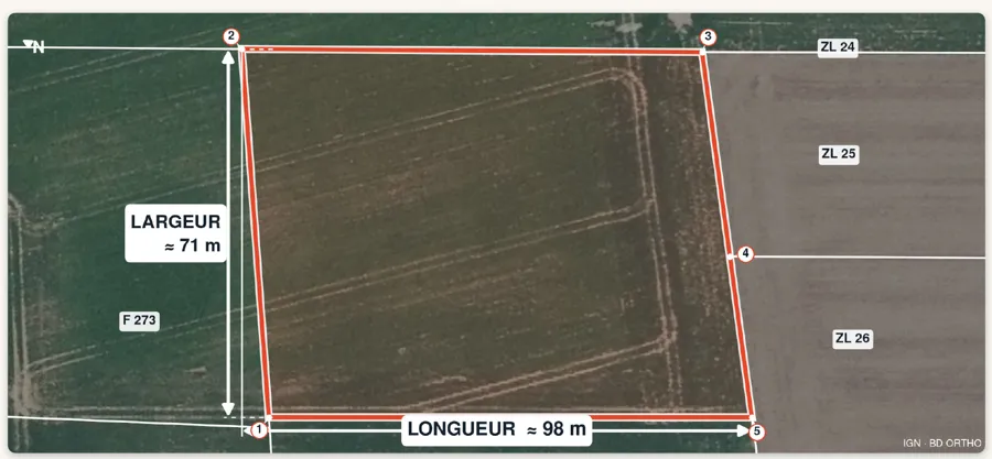
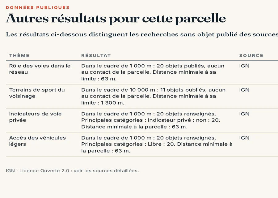
In the report: the sides of parcel F 274
Before you sign for part of a plot
- The compromis shows the part being sold on a plan, with its approximate area and the géomètre-expert’s name.
- The surveyor’s quote says whether it covers a bornage, the DA and any plans for the mairie.
- Filing the DA with the cadastre is scheduled before the date of the deed.
- The new numbers appear on the map extract checked by the cadastre, and the deed uses them.
- Planning questions (prior declaration, access, utilities) are dealt with separately.
To locate the original parcel: reading a cadastral reference. On the gap between the cadastral area and the real one: cadastral area vs real area.
Common questions
Can I buy part of a plot without a document d’arpentage?
Not under the general system: the deed must describe each new parcel, and the boundary change is recorded in a survey document filed with the cadastre before the deed is drafted. Plot subdivisions (lotissements) have their own procedure.
Does a document d’arpentage expire?
No. According to the tax guidance it has no expiry date as long as it matches the situation recorded at the cadastre. The cadastre office keeps every DA permanently and must give a copy to anyone who asks, so for an old DA start there. The “no duplicate” rule concerns the original: if that is lost, a new DA is drawn up.
Is a document d’arpentage the same as a bornage?
No. It records the signatories’ agreement so the map can be updated. A bornage report, signed with the neighbours or resulting from a court ruling, fixes the boundary for good.
Keep reading
Land boundary survey (bornage) in France: when it is required, how the price is set and who pays
Dividing a plot in France: prior declaration, development permit or nothing, depending on the case
Cadastral area vs real area of a plot in France: why the figures differ and what the law says
Certificate of alignment in France: will part of your plot go to the public road?
Looking at splitting a plot? Start with the whole parcel
Pick the parcel on the map. The report gives its outline, sides and cadastral area, then the PLU zone (local planning rules), natural hazards, clay soils and recent sales nearby, each with its source and date and explained in English. It does not replace the surveyor or the survey document. Free check, PDF report for €29 (€39 in French and English).
