Pillar: Buying building land in France
Estimating the value of a building plot in France from DVF sales data, step by step
In France, outside Bas-Rhin, Haut-Rhin, Moselle and Mayotte, you can benchmark a building plot’s price with the DVF sales data published free of charge on data.gouv.fr: divide each comparable sale’s price by its total area, then take the median for the commune (municipality). In Villers-Bocage (Somme), 43 sales from July 2021 to April 2026 give about €126/m²: a benchmark, not a valuation of your plot.
In brief
- The method: download the geolocated version of the DVF files, group the rows by transaction identifier (id_mutation), keep sales of building land alone, then work out the median and quartiles of the price per m². In Villers-Bocage, the middle half of the 43 sales lies between about €114 and €134/m².
- What the files cover: sales, auction sales, compulsory purchases and exchanges entered in the land register (fichier immobilier) over the last five years, except in Moselle, Bas-Rhin and Haut-Rhin, where transactions go into a separate register, the livre foncier, and in Mayotte. The 12 October 2026 delivery runs from 1 July 2021 to 30 June 2026; updates come in April and October. The data is under the Licence Ouverte 2.0 (France’s open government licence), with its own terms of use.
- Filter: transaction type “Vente” or “Vente terrain à bâtir”, no house, outbuilding or premises in the transaction, and land type code “AB” (building land) only. In Villers-Bocage, 195 transactions come down to 43 sales.
- Main trap: the valeur foncière is the price of the whole transaction, repeated on every row. Divide it by the land area of all the transaction’s rows added up (where a parcel appears on two rows, check the sum against its cadastral area); row by row, the median in our example would jump from about €126 to about €168/m².
- What the price includes: any VAT and estate agent’s fees paid by the seller, but not the fees of the notaire (the public notary who handles the sale), agent’s fees paid by the buyer or furniture. The file says nothing about utility connections or what the plot allows you to build.
On this page
What the DVF files contain
The DVF files (Demandes de valeurs foncières) exist because of article L112 A of the French Tax Procedures Code, created by a law of 10 August 2018: the tax administration makes the property values declared in transactions of the last five years freely available. Article R*112 A-1 covers sales, auction sales, compulsory purchases and exchanges entered in the fichier immobilier. For each transaction it lists the date and type, the price, the address, the cadastral references and a description, including the land area and, for unbuilt land, its land type.
The data is free and updated twice a year (articles R*112 A-1 and R*112 A-2). The French tax administration (DGFiP) publishes in April and October; the October release covers transactions entered by a land registry office (service de la publicité foncière) before 30 June. Each update replaces all the files and can add sales to earlier years, so the latest year is always incomplete.
Bas-Rhin, Haut-Rhin and Moselle, in north-eastern France, are missing: transactions there go into the livre foncier, a separate land register that the DGFiP database does not include. Mayotte is missing as well. For these four départements (French counties), DVF shows no sales at all.
| Column in the file | What it holds | What to watch |
|---|---|---|
| Nature mutation | Sale, off-plan sale, sale of building land, auction sale, compulsory purchase or exchange | Keep “Vente” and “Vente terrain à bâtir” |
| Valeur foncière | Amount or valuation declared for the whole transaction | Repeated on every row of the transaction |
| Code type local | 1 house, 2 flat, 3 separate outbuilding, 4 industrial, commercial or similar premises | Filled in: the sale includes a building |
| Nature culture | Code for unbuilt land: AB building land, T arable land, P meadows, J gardens, S sols, among others | AB is a cadastral class, not a right to build |
| Surface terrain | Cadastral area, the last area declared and known at the date of sale | One row per parcel and per land type |
Useful columns for a plot, based on the DGFiP guide to the DVF files and its questions and answers. Sources: DGFiP: guide to the DVF files (PDF); DGFiP: DVF questions and answers (PDF). Accessed 12 November 2026.
Sources: Tax Procedures Code (LPF), art. L112 A; Tax Procedures Code (LPF), art. R*112 A-1; Tax Procedures Code (LPF), art. R*112 A-2; data.gouv.fr: Demandes de valeurs foncières, recorded sales (DGFiP); DGFiP: guide to the DVF files (PDF); DGFiP: DVF questions and answers (PDF). Accessed 12 November 2026.
Where to look up the sales
The data.gouv.fr explorer, still a beta, plots sales on a map and searches by cadastral parcel. Its property-type filters stop at flats, houses and commercial premises, and on 12 November 2026 it still showed an April 2026 update. For land, work from the files.
- Download the geolocated files. Where: the “Demandes de valeurs foncières géolocalisées” page on data.gouv.fr, a reprocessed version of the DGFiP files: one compressed CSV per year (the 2025 file is about 116 MB and holds nearly 3.8 million rows) or a single file for July 2021 to June 2026. Its id_mutation column is there to group the rows of one transaction. Cost: nothing. Time: however long the download takes on your connection.
- Pick out the commune. Note the id_mutation values of the rows whose “code_commune” is the commune’s code (80798 for Villers-Bocage), then keep every row of those transactions, even rows in a neighbouring commune. A file this size needs a tool built for large CSV files rather than scrolling by hand. To find a parcel’s codes, see the cadastral reference. Cost: nothing. Time: about an hour the first time (TerrainCheck estimate).
- Group the rows by id_mutation. The raw DGFiP file has no sale identifier, and date, price and disposition number are not enough: that number tells apart the transactions within one deed, and in the Somme in 2025 two transactions in arable land that data.gouv.fr keeps apart share all three. data.gouv.fr rebuilds id_mutation from the order of the rows in the DGFiP file, and it changes from one delivery to the next: check that every row in a group has the same date, price and transaction type, and leave the sale out if not. Within a transaction, count each parcel and land type once. Then apply the filters in the next section. Cost: nothing. Time: about half an hour for a commune the size of Villers-Bocage (TerrainCheck estimate).
- Work out a price per m² for each sale, then the median and quartiles of the list. Cost: nothing. If the commune has few sales, add neighbouring communes: the file only goes back five years.
Sources: data.gouv.fr: DVF explorer; data.gouv.fr: Demandes de valeurs foncières, recorded sales (DGFiP); data.gouv.fr: geolocated DVF files; data.gouv.fr: code that produces the geolocated files (how id_mutation is built); DGFiP: guide to the DVF files (PDF). Accessed 12 November 2026.
Worked example: Villers-Bocage, one filter at a time
We applied the method to Villers-Bocage, a commune in the Somme, using the geolocated files of the October 2026 delivery (published on 20 October 2026 from the DGFiP files of 12 October), downloaded on 12 November 2026. The chart shows what is left after each filter.
The 5 exchanges go first. Of the 190 sales, 93 include a house, flat, outbuilding or premises, so their price also pays for a building. Of the 97 land-only sales, 54 include at least one land type other than AB: arable land in 29 of them, meadows in 21 and sols in 10, and one sale can include several. That leaves 43 sales of building land, all lying wholly within the commune.
Those 43 sales take up 75 rows of the file: 21 single-parcel sales with one row each, and 22 sales of two or more parcels with 54 rows between them. One sale of €75,000, for instance, covers two parcels of 292 and 293 m²: 75,000 ÷ 585 gives about €128/m², whereas 75,000 ÷ 292 would give about €257. Applied to all 75 rows, dividing row by row pushes the median from about €126 to about €168/m².
What the 43 sales show
The median is about €126/m², and the middle half of the sales lies between about €114 and €134/m² (first and third quartiles). The sales run from July 2021 to April 2026, with a median plot size of 516 m².
Read the extremes separately. Four sales of 3,000 to 11,247 m² went through at about €20 to €23/m². Two exceed €200/m², one at about €537/m² for 459 m², a price the file does not explain. The median hardly moves with such cases; the mean of the 43 sales is about €130/m².
Suppose a 600 m² plot is advertised for €90,000 (a hypothetical figure): that works out at €150/m², above the commune’s third quartile. That does not prove it is overpriced: it may be serviced, better connected or allow more building than the plots that sold. It does tell you what to ask the seller.
To place the commune within its département and region, the official averages are in our guide to building land prices by region.
What DVF does not tell you
A median of past sales is not a valuation of your plot. For a figure you need to show a third party (an estate, a division between heirs, a dispute), go to a notaire or a property valuer and ask for a quote.
If you publish your own figures, stick to aggregates. Article R*112 A-3 of the Tax Procedures Code requires the terms of use to forbid any reuse that would allow people to be re-identified, and the indexing of this information by search engines. That is why this guide gives no address or cadastral reference for the sales.
Sources: DGFiP: guide to the DVF files (PDF); DGFiP: DVF questions and answers (PDF); Tax Procedures Code (LPF), art. R*112 A-3; DGFiP: terms of use of the DVF data (PDF). Accessed 12 November 2026.
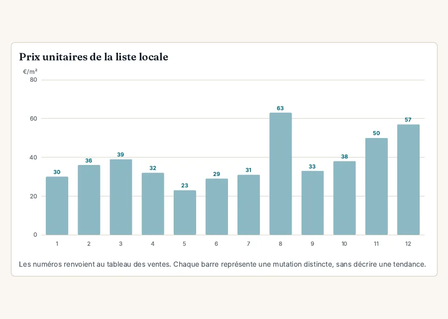
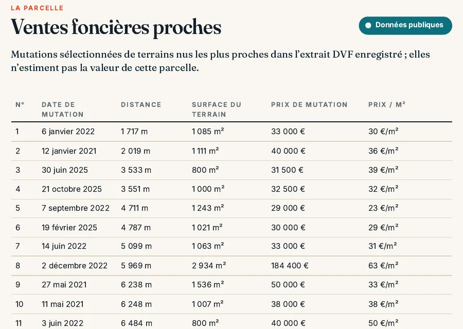
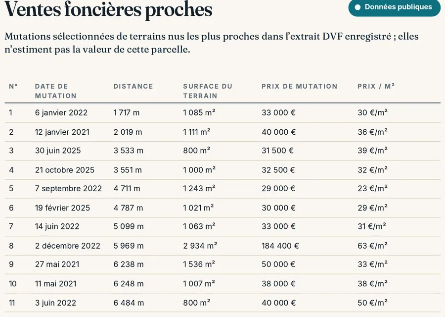
In the report: the nearest land sales
Before you make an offer
- Département outside Bas-Rhin, Haut-Rhin, Moselle and Mayotte; date of the latest DVF delivery noted.
- Rows grouped by id_mutation (geolocated files), exchanges and sales with buildings removed, land type AB only.
- Price per m² worked out on the total area of each transaction, then the median and quartiles.
- Asking price converted to €/m² and placed against the quartiles.
- Servicing, zoning and access of the plot compared with those of the sales you kept.
Read next: notary fees when buying land, which the declared value leaves out.
Common questions
Does DVF cover Alsace and Moselle?
No. The tax administration (DGFiP) does not hold the transactions for Bas-Rhin, Haut-Rhin and Moselle, which go into the separate livre foncier register, nor those for Mayotte.
Why is a recent sale missing?
A transaction only enters DVF once the land registry office (service de la publicité foncière) has entered it. The October release covers entries made before 30 June; the rest come with later updates.
Does the DVF price include the notaire’s fees?
No. The declared value leaves out the notaire’s fees, agent’s fees paid by the buyer and furniture; it includes any VAT and agent’s fees paid by the seller.
Keep reading
Building land prices in France per m²: 2024 averages by region and by département
Notary fees when buying land in France: 2026 rates by département, the fee scale and worked examples
France’s development tax (taxe d’aménagement): how it is calculated, when it is due and who is exempt
Serviced or unserviced plot in France: what “viabilisé” promises and how to check it
Capital gains tax on selling building land in France: calculation, allowances and exemptions
Land sales around a parcel, already sorted
Pick the parcel on the map. The report lists the nearest bare-land sales from DVF with distance, area and price per m², then the planning zone, natural hazards and cadastral area, explained in English. It does not value the plot. Free preview, PDF report for €29 (€39 in French and English).
