Pillar: Buying building land in France
Find a French cadastral parcel from an address, a locality name or a listing with no reference
In France an address does not identify a parcel: the national address base, free on adresse.data.gouv.fr, places a point, often on a front door, and lists linked parcels only where that is known. Start from the point, find the parcel on the cadastral map, then have the seller confirm the reference in writing: about 30 minutes of checking (TerrainCheck estimate).
In brief
- Look at the type of result the search returns: a house number gives the point of that address; a street, a lieu-dit (named locality) or a commune (municipality) gives only a rough one. In Brailly-Cornehotte, the point for the commune lies about 1.7 km from parcel F 274.
- The national address file can list the parcels linked to an address where this is known: in the Somme, 39.9% of addresses have none and 8.2% have several (file of 13 November 2026). The documentation calls the field experimental.
- Bare land does not necessarily have a house number. Without one, the address in the listing may belong to a neighbouring property or only locate the street, the lieu-dit or the commune: neither the address nor the parcel under its point tells you on its own which land is for sale.
- A parcel reference covers the whole parcel. If only part is for sale, the new boundary goes through a document d’arpentage (survey plan) before the deed, in communes under the cadastral maintenance regime.
On this page
An address is a point, not a parcel
In France, addresses are the business of the commune. The municipal council names the streets and localities, the mayor sets house numbering by order “in all communes where the operation is necessary”, and communes publish the data, which feed the Base adresse nationale (BAN, the national address base), free to consult on adresse.data.gouv.fr (in French).
The BAN locates each address with a point. The cadastre divides the ground into parcels: a parcel is “all the land in one piece, belonging to the same owner and lying in the same lieu-dit”. The two systems overlap but are not the same thing. A point on the front door of a house tells you nothing about the field behind it if that field is a different parcel.
The word lieu-dit is a trap of its own. In the address base a lieu-dit can stand in for a street name; in the cadastre it is the area within which a parcel is defined. A listing that says “lieu-dit Les Hayes” gives you a neighbourhood, not a point and not a parcel.
In the Somme file, four addresses in ten have no linked parcel and 8.2% have several, so the link helps without settling the question. The BAN documentation says as much: the list is given “if the information is known” and is data “being made reliable”. And under the Base Adresse Locale format it refers to, a commune’s certification of an address expressly excludes the list of parcels served.
The point itself usually sits on an entrance, a dwelling or a building. 6.2% of points are derived from the road segment and only 2.6% target a parcel. For land with no building and no number, the point you get may therefore belong to a neighbouring property or only mark a general area: only by comparing the cadastral map with the listing and the land itself can you tell.
Reading the result of an address search
The state’s address search engine (the Géoplateforme geocoding service, which replaces the former API Adresse) returns one of four result types: house number (housenumber), street (street), locality (locality) or commune (municipality). Each comes with a score from 0 to 1 “indicating the relevance of the result”. A high score says nothing about the parcel: typing “Brailly-Cornehotte” scores 0.93 and returns a point about 1.7 km from F 274.
| Result | Where the point falls | Example around F 274 | What it gives you |
|---|---|---|---|
| House number | The address point (entrance, building…) | 15 rue des Peupliers: approx. 110 m from F 274 | That number’s parcel, not necessarily the one for sale |
| Street | A point on the street | “Rue des Peupliers”: approx. 380 m. Typing “lieu-dit Le Moulin” also returns a street, “Rue Jean Moulin”, score 0.57 | The area to search on the map; check that the name and type found match what you typed |
| Locality | A point in the lieu-dit | No example: the BAN holds no lieu-dit for Brailly-Cornehotte | The area of the lieu-dit, to locate on the cadastral map |
| Commune | A point in the commune | “Brailly-Cornehotte”: approx. 1.7 km | Nothing about the parcel |
Result types of the geocoding service; examples recorded on 13 November 2026, distances to the edge of F 274 calculated by TerrainCheck. The Somme lieux-dits file of 13 November 2026 has no entry for the commune (INSEE code 80133). Sources: IGN, Géoplateforme: geocoding service description (result types, score); adresse.data.gouv.fr: Géoplateforme geocoding service; IGN, API Carto cadastre (Parcellaire Express), parcels around F 274, read on 13 November 2026; National address base, file lieux-dits-80-beta.csv.gz (Somme), version of 13 November 2026. Accessed 13 November 2026.
A postcode is not enough either. In the Somme file, postcode 80150 is shared by 26 communes. On cadastre.gouv.fr, the official cadastral map service, a parcel search will not run until you name the commune.
Worked example: a listing “rue des Peupliers” in Brailly-Cornehotte
Take parcel F 274, the bare plot in our sample report, and imagine a listing that places it “rue des Peupliers, Brailly-Cornehotte”. The address base has no address linked to F 274. The nearest numbers, 15, 15 a and 15 b rue des Peupliers, lie about 110 m from its edge and are linked to five other parcels.
Type “15 rue des Peupliers”, click the parcel under the point, and you get F 280, not F 274. Type only the street name and you land on parcel F 265, about 380 m away. Neither mistake shows on screen. Only comparing with the aerial photo, the shape of the land you walked and the seller’s written reference brings it out.
From address to parcel, step by step
- Search for the address in the listing on the BAN map. Note the result type and the exact name it picked. Cost: nothing, no account. Time: 5 minutes (TerrainCheck estimate).
- Show the parcels under the point (button “Afficher les parcelles cadastrales”) and write down section and number. If the point is a house and the listing is for bare land, look around it. Time: 10 minutes (TerrainCheck estimate).
- Compare with the land you visited on the aerial photo (IGN backgrounds on the same map): shape, hedges, tracks, nearby buildings. Step-by-step help for the public map sites is in searching for a parcel on cadastre.gouv.fr and Géoportail. Cost: nothing.
- Ask for the reference in writing (commune, section, number) from the seller, the estate agent or the notaire (the public official who handles the sale), and check it against your result. Time: however long they take to answer; the texts cited set no deadline.
- If in doubt, go to the mairie (town hall). The cadastral map can be consulted there, and the commune manages addresses: it knows whether the plot has a number or should get one (see the certificate of numbering). Cost: A3 or A4 extracts of the map are free; requests can also go by post. Time: none set by the texts cited.
| Source | Where | What it shows | Its limit |
|---|---|---|---|
| National address base | adresse.data.gouv.fr | The address point, its type, sometimes linked parcels | Link missing or multiple, not certified |
| Cadastral map | cadastre.gouv.fr, mairie | Section, number, parcel outline | Kept for tax; does not fix boundaries |
| Aerial photo | IGN backgrounds, Géoportail | Visible shape and land use | A hedge is not a boundary |
| Seller, agent, notaire | In writing | The reference of the land being sold | Check it on the map |
| Mairie | In person or by post | The map to consult, the commune’s addressing | No set deadline |
Five sources to cross-check; none is enough on its own. Sources: National address base documentation: the BAN files (CSV schema); Base Adresse Locale format 1.3 (AITF), the specification the BAN documentation refers to; Service-Public: how to consult the cadastre; adresse.data.gouv.fr: map of the national address base. Accessed 13 November 2026.
When the plot is only part of a parcel
A listing may offer 1,000 m² cut from a larger parcel. The reference you find then covers the whole parcel, and the part for sale has no number yet. Decree 55-471 (art. 25) provides that, “in communes subject to the cadastral maintenance regime”, any change in a property boundary, division included, is recorded in a document d’arpentage (survey plan) submitted to the cadastre “before the deed is drawn up”; the new parcels are numbered at that stage.
Ask the seller for a plan of the part being sold and the name of the surveyor. The seller’s side is covered in selling part of your plot, the survey plan in the document d’arpentage. In Moselle, Bas-Rhin and Haut-Rhin, deeds are published in the Livre foncier, a separate land register: see Alsace-Moselle and the Livre foncier.
Sources: Decree no. 55-471 of 30 April 1955 on the renewal and maintenance of the cadastre, art. 25; Service-Public: getting information on a property; Service-Public: how to consult the cadastre; cadastre.gouv.fr: help on searching by parcel. Accessed 13 November 2026.
In the report: the outline of F 274 on the aerial photo
Before you commit: six checks
- Result type noted: house number, street, locality or commune.
- Name picked by the search is the one in the listing.
- Parcel under the point compared with the shape of the land you visited.
- Written reference (commune, section, number) from the seller or the notaire.
- Part of a parcel: plan of the part for sale and surveyor named.
- Same reference in the compromis, the planning certificate and the risk statement.
To read the reference you get: the French cadastral reference. Next: viewing the land and the order of checks before the compromis.
Common questions
Can I find the parcel from the postcode alone?
No. One postcode can cover several communes: in the Somme, 80150 covers 26. A parcel search on cadastre.gouv.fr needs the commune’s name or postcode, then the address or the reference.
Does the address point mark the edge of the land?
No. It usually sits on an entrance, a dwelling or a building. Neither the point nor the cadastral map, which is kept for tax purposes, fixes property boundaries; only a bornage by a géomètre-expert (chartered surveyor) does.
Can a plot with no address get one?
House numbering is set by the mayor, by order, in communes where it is needed. Ask at the mairie; the process is in our guide to the certificate of numbering.
Keep reading
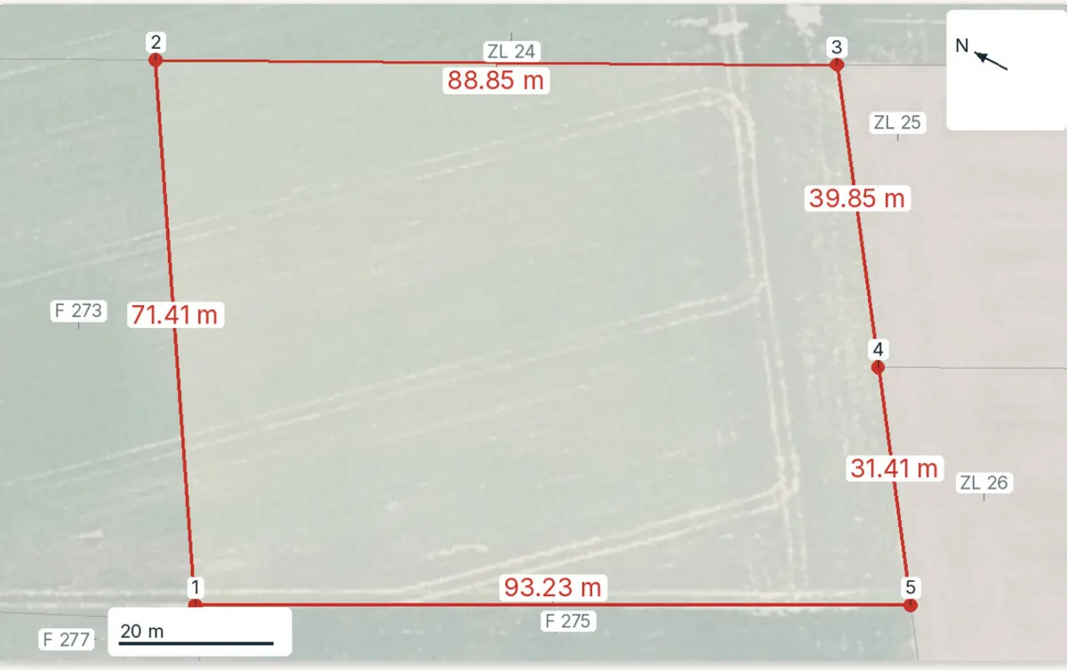
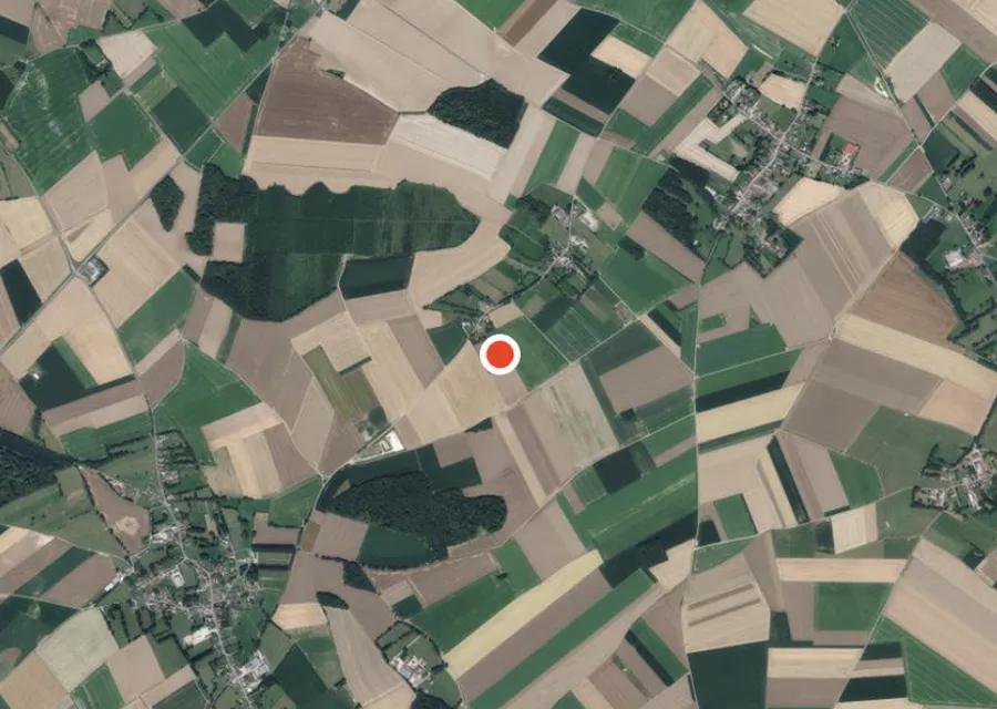
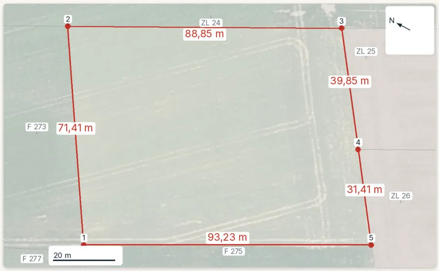
Found the parcel? See what the public records say about it
Pick the parcel on the map. The report draws its outline on the aerial photo, then sets out the PLU zone (local plan), natural hazards, clay soils, Natura 2000 and recent sales nearby, each with its source and date and explained in English. It does not confirm the owner or the boundaries. Free check, PDF report for €29 (€39 in French and English).
