Pillar: Buying building land in France
Plot split between two zones in France: what can you build where?
In France, a plot cut by a zone line of the local plan (PLU) or carte communale falls under two regimes: with a PLU, the rules of two zones; with a carte communale, a buildable sector and a sector limited to the exceptions of article L161-4, under the national planning rules (RNU). The house goes in the buildable part, and the part in zone A, N or a non-buildable sector allows only the exceptions provided for it. First step: open the plot on the Géoportail de l’urbanisme, then have the line confirmed at the town hall, which holds the authoritative document.
In brief
- A PLU (the local plan of a commune, the French municipality) draws its zones on a map and sets the rules inside each zone (article R151-17 of the planning code). A plot cut by a zone line follows the rules of each zone on its own part.
- In zone A (farmland) or N (natural areas), the code lists what may be allowed: buildings needed for farming (and forestry in N) and the cases in articles L151-11 to L151-13, including extensions or outbuildings of existing dwellings within the limits of the zone rules. Under a carte communale (a simpler local map), the exceptions are those of article L161-4.
- The Géoportail de l’urbanisme can be used without an account, but it says its data is for information only: only the documents held at the mairie (town hall), the inter-municipal body or the préfecture are authoritative.
- An operational planning certificate (certificat d’urbanisme opérationnel) is free, the town hall has 2 months to reply and it is valid for 18 months: describe the house sited in the buildable part.
On this page
One plot, two regimes by sector
Zoning is not assigned to the cadastral parcel as a whole. The rules of the PLU draw zones on its maps, and only the written rules and those maps carry the duty of strict compliance (art. R151-10). A project must also be consistent with the development guidelines (OAP, orientations d’aménagement et de programmation) where they exist (art. L152-1), so read them too, especially in zone AU. When a zone line crosses a plot, each square metre follows the zone it lies in.
Zone U may cover areas already built up and areas that existing public infrastructure can serve; zone A, areas protected for the potential of their farmland; zone N, areas protected for their sites, landscapes, forestry or natural character. In a commune with a carte communale, the map also separates the sectors where building is allowed from those where it is not, but it has no detailed zone rules like a PLU: applications are assessed under the national planning rules (RNU), and outside the buildable sector under the exceptions of article L161-4.
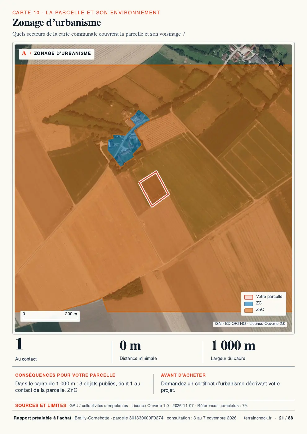
In Brailly-Cornehotte (Somme), the commune of our sample report, we overlaid the cadastre and the carte communale published on the Géoportail: 68 of the 781 parcels are cut by the line with more than 20% of their area on each side.
| What splits the plot | What the code says | Where to check |
|---|---|---|
| Zone U and zone A or N | In A or N: buildings needed for farming (and forestry in N); changes of use, extensions and outbuildings of dwellings, small designated sectors, under the conditions of arts L151-11 to L151-13 (R151-23, R151-25). | Written rules of both zones |
| Zone U and zone AU | In AU (future development): building as part of a single development scheme or as internal infrastructure is built, if nearby networks suffice; otherwise only after the PLU is amended or revised (R151-20). | Development guidelines (OAP) for the AU zone |
| Sectors of a carte communale | Outside the buildable sector: only the exceptions of art. L161-4 (extensions, outbuildings near an existing building, public facilities, farming…). | Carte communale map |
| Classified woodland (EBC) | Bans any change of use that would compromise the trees; a clearing application is automatically refused (L113-2). | Zoning map |
| Major road | Outside built-up areas: no building within 100 m of the centreline of a motorway, expressway or bypass, 75 m of another major through road, with exceptions (L111-6, L111-7) or PLU rules (L111-8). | Road classification, PLU |
The most common situations and the article that governs each. Sources: Planning code, art. R151-17 (zones of the rules); Planning code, art. R151-23 (building in zone A); Planning code, art. R151-25 (building in zone N); Planning code, art. R151-20 (AU zones); Planning code, art. L161-4 (carte communale sectors); Planning code, art. L113-2 (classified woodland); Planning code, art. L111-6 (strip along major roads); Planning code, art. L111-7 (exceptions). Accessed 13 November 2026.
Reading the line and getting it confirmed
- Open the plot on the Géoportail de l’urbanisme (French only). Map tab, enter the address, click the parcel: the panel lists the zones touching it and offers to download the documents that apply to the land. No account needed. Time: about fifteen minutes (TerrainCheck estimate). No parcel number yet? Find it first.
- Read the written rules of both zones, not just the zone name: setbacks from the road and neighbours, site coverage, height, outbuildings allowed in A or N. Cost: none. Time: one to two hours (TerrainCheck estimate).
- Have the line confirmed at the town hall. The Géoportail itself says its data is for information and only documents held at the town hall, the inter-municipal body or the préfecture are authoritative. Ask for the large-scale zoning map. Cost and time: none set by the texts cited.
- If the line runs close to where the house would go, ask a géomètre-expert (chartered land surveyor) to plot the zone line on a survey of the land. Cost: on quotation, depending on area and terrain. Time: as quoted.
- Apply for an operational planning certificate at the town hall, stating the nature of the project and the approximate siting and use of the house, placed in the buildable part. Free. Reply within 2 months of receipt of the application; if none comes, the tacit certificate only freezes the rules, taxes and administrative limits on ownership, and says nothing about whether your project is feasible. Details: information or operational planning certificate.
For 18 months after it is issued, a permit application is assessed under the rules in force on the date of the certificate, except rules on public safety or health (art. L410-1). It can be extended by a year if the rules, easements and taxes have not changed, on a request made at least 2 months before it expires.
Sources: Géoportail de l’urbanisme: FAQ; Service-Public: planning certificate (CU); Planning code, art. L410-1 (planning certificate). Accessed 13 November 2026.
Where the house, access and utilities can go
The area you can actually build on is the buildable part minus the setbacks its rules impose from the road and the neighbouring plots. On parcel F 339, about 2,060 m² lies in the buildable sector, on the north-west side. A house straddling the line would have to meet, for the part in A or N, the rules of that zone, which allow only exceptions.
If the buildable part lies at the back, behind a strip in zone N, access becomes the question: a drive or utility trenches across zone N are works that must comply with its rules (art. L152-1). On the networks themselves, see serviced or unserviced plot.
What the non-buildable part allows
What you can do on that part depends on its zoning. In zone A or N of a PLU, article L151-12 lets existing dwellings receive extensions or outbuildings, provided they harm neither farming nor the landscape, and only within the siting, height, footprint and density limits set by the zone rules.
The text refers to existing dwellings. Before the house is built, ask the town hall in writing whether a garage, shed or swimming pool would be accepted in the A or N part once the house is finished. Under a carte communale, article L161-4 allows outbuildings near an existing building, still subject to planning consent.
Sources: Planning code, art. L151-12 (extensions and outbuildings in A and N zones); Planning code, art. L161-4 (carte communale sectors); Planning code, art. L113-2 (classified woodland). Accessed 13 November 2026.
Price and contract: think in buildable square metres
Compare the price with building-land prices applied to the buildable part only. On F 339 about 70% of the area is buildable, so each buildable square metre costs about 1.4 times the price per square metre worked out on the whole plot. The A or N part compares with sales of farmland and gardens; for recorded sale prices, see estimating a price with DVF.
Service-Public, the government’s official information site, lists among the contents of a compromis de vente (the binding preliminary contract) for building land, a detailed description of the plot with its buildable floor area, a condition precedent on obtaining planning permission and the deadline for each condition. On a split plot, have the condition describe the house you intend to build and where it sits in the buildable part, matching the operational certificate.
If the seller is selling only the buildable part, the parcel has to be divided first: see prior declaration for land division.
Sources: Service-Public: preliminary contract for a building plot; Service-Public: planning certificate (CU). Accessed 13 November 2026.
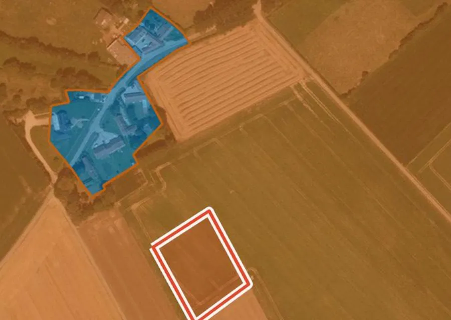
In the report: zoning of parcel F 274
Before the compromis: six checks
- Zones touching the plot noted from the Géoportail de l’urbanisme, with their rough share.
- Written rules of both zones read: setbacks, footprint, height, outbuildings in A or N.
- Line confirmed on the town hall’s zoning map.
- House, access and connections placed in the buildable part, with setbacks.
- Operational planning certificate applied for with that site plan.
- Price related to the buildable area; planning-permission condition describing the project.
The wider picture: is my land buildable?, reading the PLU before buying and the checks before the compromis.
Common questions
Can I put a swimming pool in the part zoned N?
The answer lies in the rules of zone N: article L151-12 lets them allow outbuildings of existing dwellings, within the siting, height, footprint and density limits they set. Ask the town hall in writing before you sign.
Is a tacit planning certificate enough?
Not here. If the town hall does not reply in time, the tacit certificate freezes the rules, taxes and limits on ownership, but does not say whether your house can sit in the buildable part. Ask for the written reply, which the town hall must still issue, even late.
Does the area in zone N count towards the permitted site coverage?
That depends on how the zone U rules are worded and how they define site coverage: ask the town hall to state it, ideally in the operational planning certificate.
Keep reading
A plot across two zones? Start with the zoning
Pick the parcel on the map. The report lists the planning zones and the share of the plot in each, then natural hazards, clay soils and recent sales nearby, each with its source and date and explained in English. It does not replace a planning certificate. Free check, PDF report for €29 (€39 in French and English).
